MyTopo
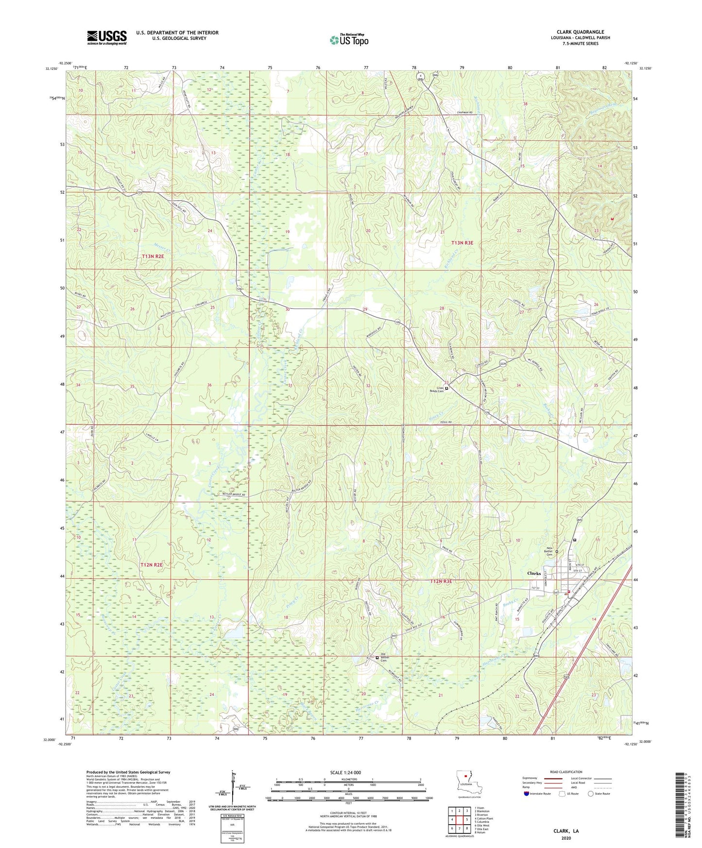
Clark Louisiana US Topo Map
Couldn't load pickup availability
2024 topographic map quadrangle Clark in the state of Louisiana. Scale: 1:24000. Based on the newly updated USGS 7.5' US Topo map series, this map is in the following counties: Caldwell. The map contains contour data, water features, and other items you are used to seeing on USGS maps, but also has updated roads and other features. This is the next generation of topographic maps. Printed on high-quality waterproof paper with UV fade-resistant inks.
Quads adjacent to this one:
West: Cotton Plant
Northwest: Vixen
North: Blankston
Northeast: Riverton
East: Columbia
Southeast: Holum
South: Olla East
Southwest: Olla West
This map covers the same area as the classic USGS quad with code o32092a2.
Contains the following named places: Banks Springs Gas Field, Beaucoup Creek, Bethel Church Gas Field, Black Bayou, Bushy Creek, Caldwell Parish Correctional Center, Clarks, Clarks Post Office, Clarks Volunteer Fire Department, Cooper, Cross Roads Baptist Church, Cross Roads Cemetery, East Columbia Volunteer Fire Department, Hurricane Creek, KARD-TV (West Monroe), Kelly School Gas Field, Messer Creek, Mount Pleasant Lookout Tower, New Bethel Cemetery, North Clarks Gas Field, Oak Grove School, Old Bethel Baptist Church, Old Bethel Cemetery, Old Bethel Christian Academy School, Parish Governing Authority District 3, Parish Governing Authority District 6, Piney Creek, Richland Creek, Village of Clarks, Ward Nine, Ward Seven, Ward Two, West Clarks Gas Field, ZIP Code: 71435