MyTopo
Pawnee Louisiana US Topo Map
Couldn't load pickup availability
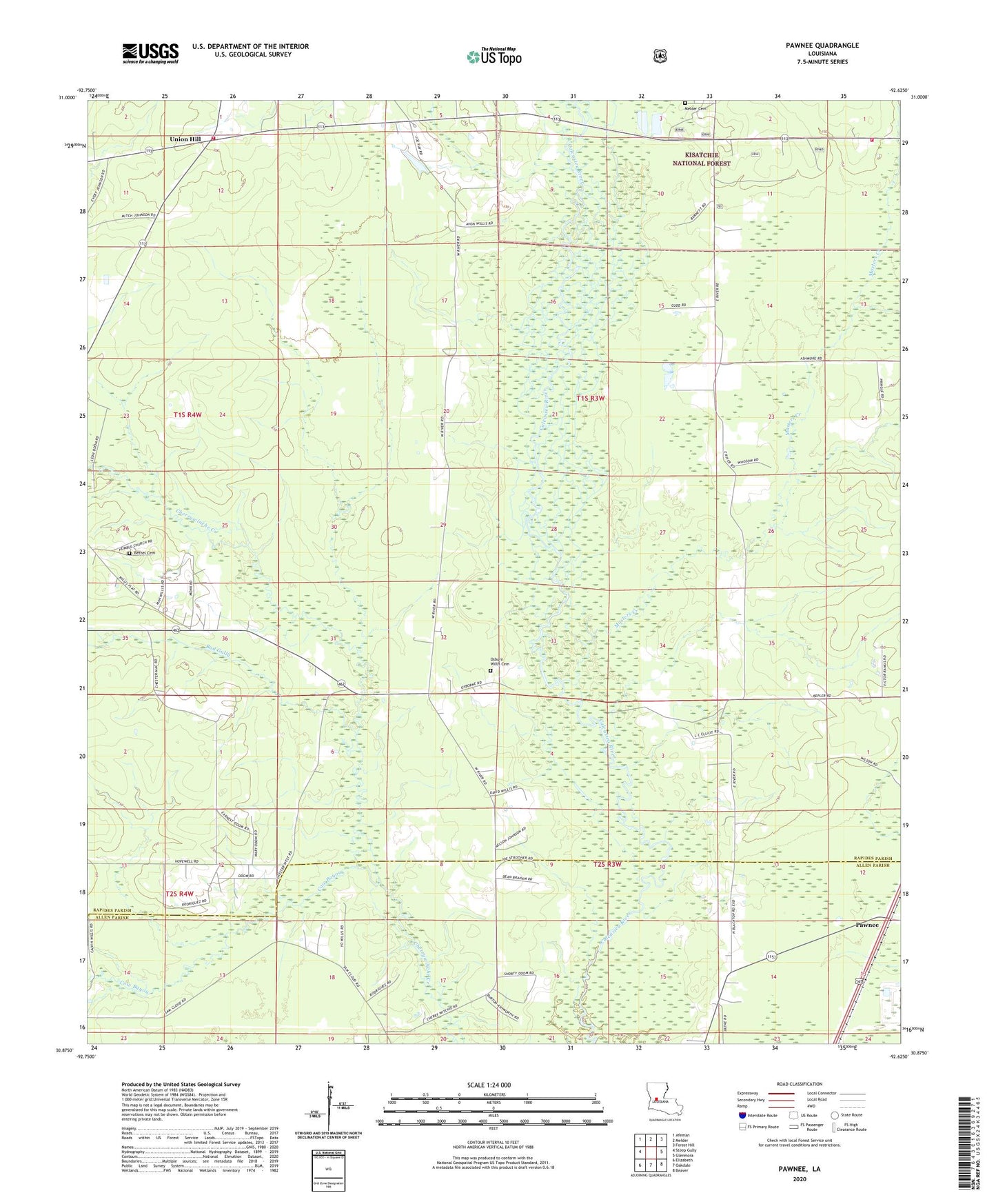
2020 topographic map quadrangle Pawnee in the state of Louisiana. Scale: 1:24000. Based on the newly updated USGS 7.5' US Topo map series, this map is in the following counties: Rapides, Allen. The map contains contour data, water features, and other items you are used to seeing on USGS maps, but also has updated roads and other features. This is the next generation of topographic maps. Printed on high-quality waterproof paper with UV fade-resistant inks.
Quads adjacent to this one:
West: Steep Gully
Northwest: Afeman
North: Melder
Northeast: Forest Hill
East: Glenmora
Southeast: Beaver
South: Oakdale
Southwest: Elizabeth
Contains the following named places: Bad Gully, Bethany Church, Bethel, Bethel Cemetery, Bethel Church, Calcasieu Church, Cow Bayou, Davis Crossing Church, Gospel Church, Hickory Grove School, Hope Well Church, Hopewell Baptist Church, Humble Church, Masters Creek, Melder Cemetery, Osburn, Osburn Willis Cemetery, Pawnee, Plainview Community Volunteer Fire Department, Prairie Branch, Spring Creek Volunteer Fire Department Station 1, Union Hill, Union Hill School, Walnut Grove School