MyTopo
Steep Gully Louisiana US Topo Map
Couldn't load pickup availability
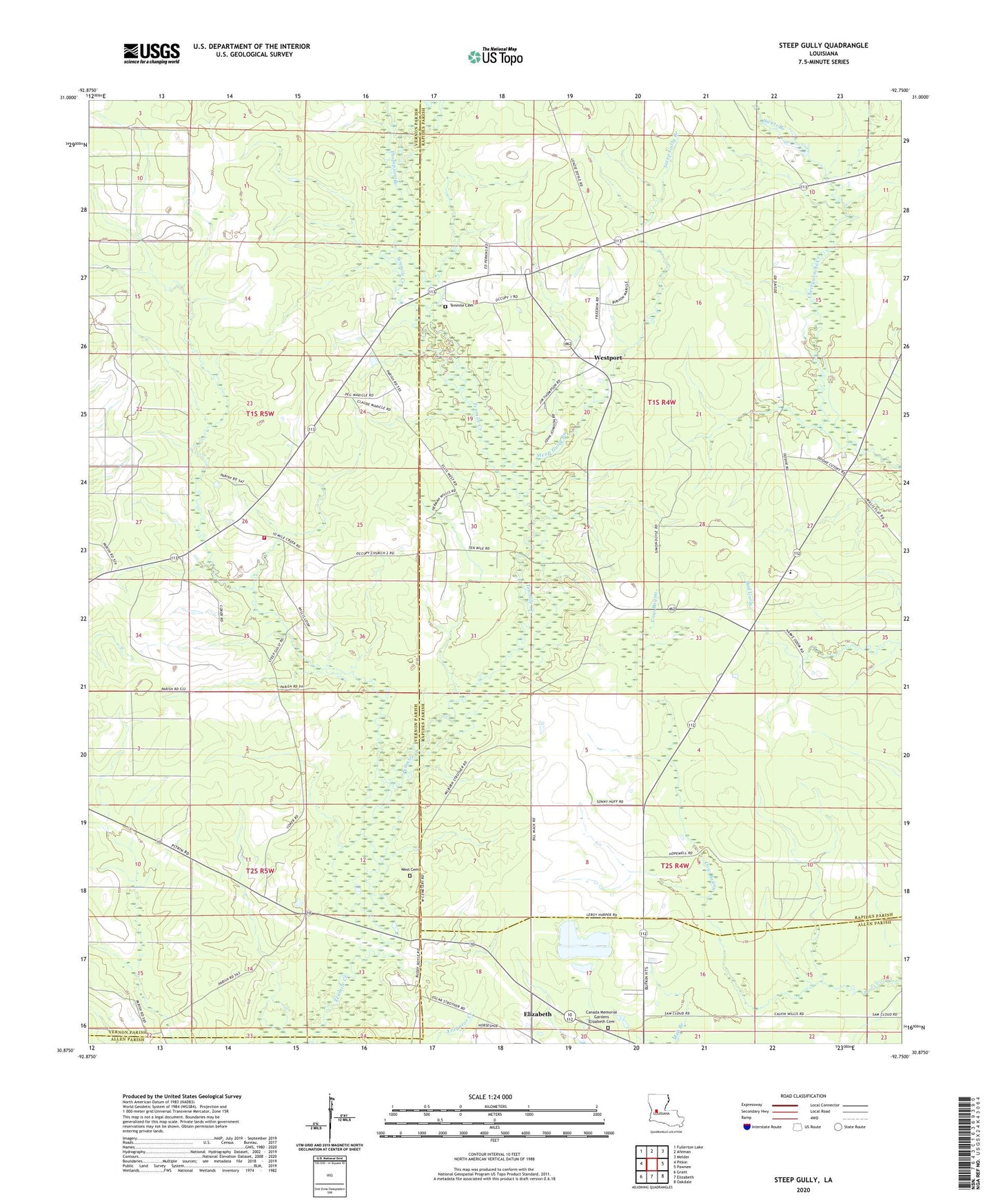
2024 topographic map quadrangle Steep Gully in the state of Louisiana. Scale: 1:24000. Based on the newly updated USGS 7.5' US Topo map series, this map is in the following counties: Vernon, Rapides, Allen. The map contains contour data, water features, and other items you are used to seeing on USGS maps, but also has updated roads and other features. This is the next generation of topographic maps. Printed on high-quality waterproof paper with UV fade-resistant inks.
Quads adjacent to this one:
West: Pitkin
Northwest: Fullerton Lake
North: Afeman
Northeast: Melder
East: Pawnee
Southeast: Oakdale
South: Elizabeth
Southwest: Grant
This map covers the same area as the classic USGS quad with code o30092h7.
Contains the following named places: Canada Memorial Gardens Elizabeth Cemetery, Community Volunteer Fire Department, Freedom Baptist Church, Freedom Church, Friendship Baptist Church, Hickory Log Gully, Humble Baptist Church, Louisiana Noname 61 Dam, Mainview School, Occupy Church Number 1, Occupy Church Number 2, Occupy Number One Cemetery, Occupy School, Ocupi Church, Pine Grove Church, Plainview High School, Plainview Lookout Tower, Refuge School, Shady Grove Baptist Church, Shady Grove Church, Steep Gully, Steep Gully Branch, Swetz Branch, Thompson Branch, West Cemetery, Westport