MyTopo
Elizabeth Louisiana US Topo Map
Couldn't load pickup availability
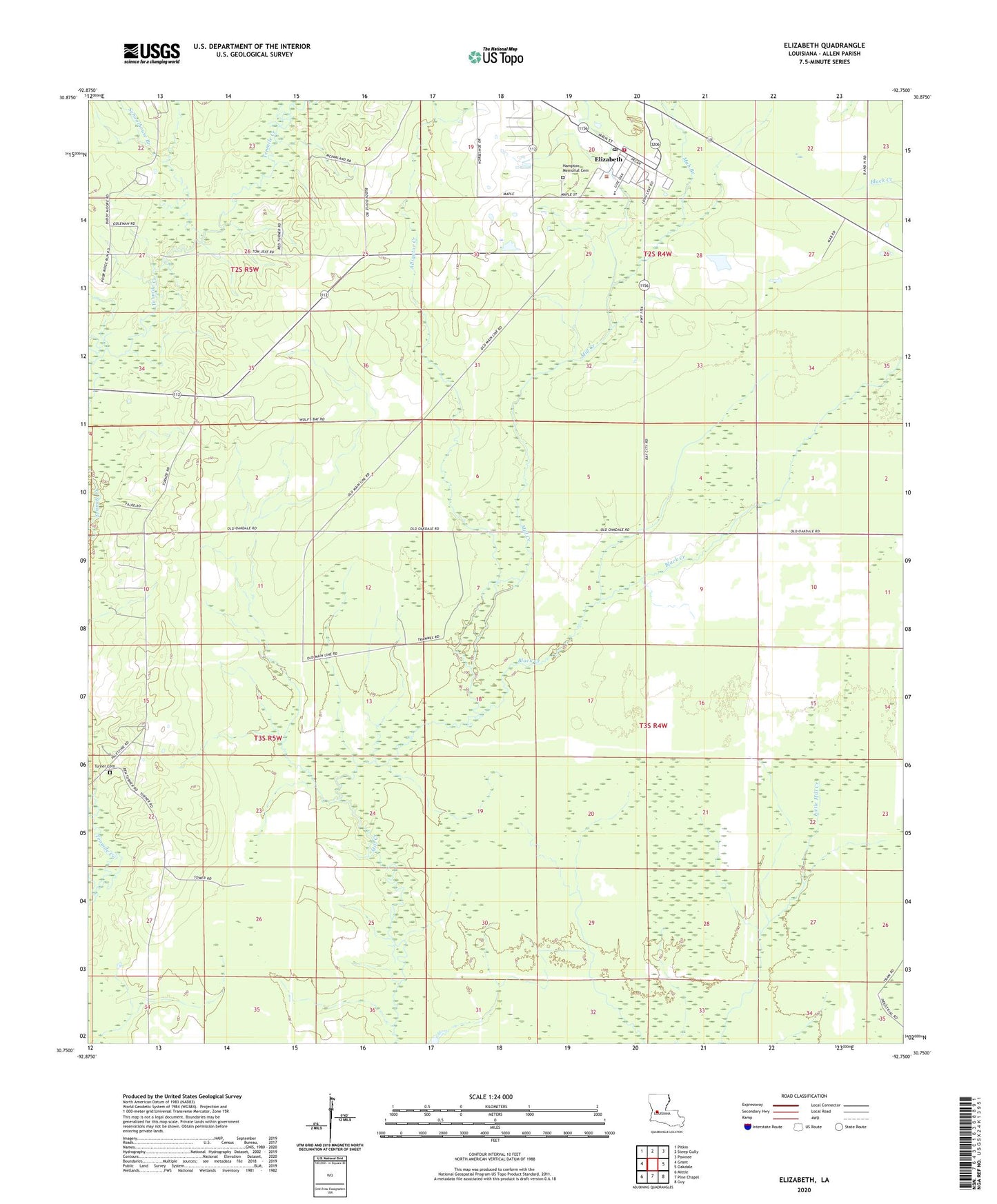
2024 topographic map quadrangle Elizabeth in the state of Louisiana. Scale: 1:24000. Based on the newly updated USGS 7.5' US Topo map series, this map is in the following counties: Allen. The map contains contour data, water features, and other items you are used to seeing on USGS maps, but also has updated roads and other features. This is the next generation of topographic maps. Printed on high-quality waterproof paper with UV fade-resistant inks.
Quads adjacent to this one:
West: Grant
Northwest: Pitkin
North: Steep Gully
Northeast: Pawnee
East: Oakdale
Southeast: Guy
South: Pine Chapel
Southwest: Mittie
This map covers the same area as the classic USGS quad with code o30092g7.
Contains the following named places: Alligator Creek, Black Creek, Carter Branch, Elizabeth, Elizabeth Baptist Church, Elizabeth Gas Field, Elizabeth High School, Elizabeth Lookout Tower, Elizabeth Volunteer Fire Department, Hampton Memorial Cemetery, Louisiana Noname 60 Dam, Mab, Mab Branch, Marionville, Schoolhouse Branch, Town of Elizabeth, Turner Church, ZIP Code: 70638