
MyTopo
Ponchatoula SE Louisiana US Topo Map
Couldn't load pickup availability
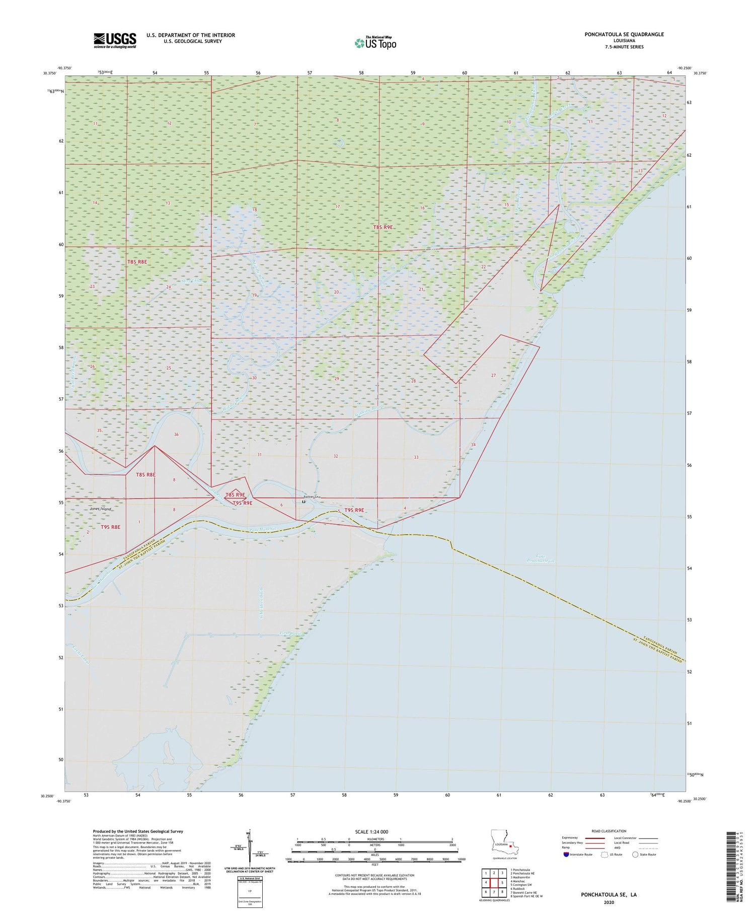
2024 topographic map quadrangle Ponchatoula SE in the state of Louisiana. Scale: 1:24000. Based on the newly updated USGS 7.5' US Topo map series, this map is in the following counties: Tangipahoa, St. John the Baptist. The map contains contour data, water features, and other items you are used to seeing on USGS maps, but also has updated roads and other features. This is the next generation of topographic maps. Printed on high-quality waterproof paper with UV fade-resistant inks.
Quads adjacent to this one:
West: Manchac
Northwest: Ponchatoula
North: Ponchatoula NE
Northeast: Madisonville
East: Covington SW
Southeast: Spanish Fort NE OE W
South: Bonnett Carre NE
Southwest: Ruddock
This map covers the same area as the classic USGS quad with code o30090c3.
Contains the following named places: Bedico Creek, Cecils Canal, First Canal, Fuller Canal, Manchac Wildlife Management Area, Mays Bayou, Middle Bayou, Mire Canal, North Pass, Parish Governing Authority District 9, Pass Manchac, Pass Manchac Lighthouse, Schleiders Ditch, Second Canal, Stinking Bayou, Tangipahoa River, ZIP Code: 70454


