MyTopo
Ponchatoula NE Louisiana US Topo Map
Couldn't load pickup availability
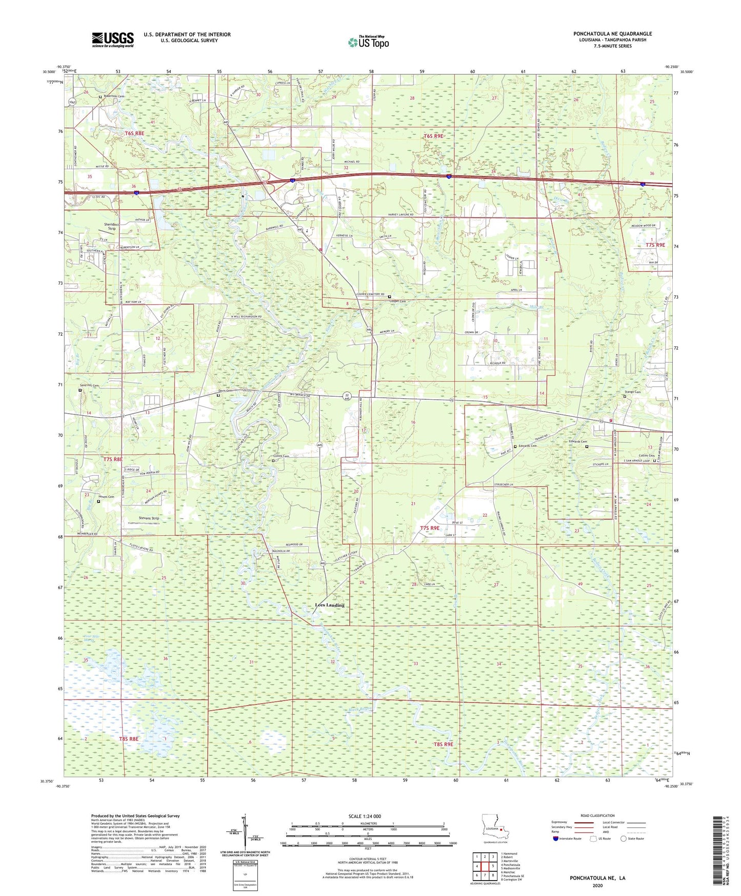
2024 topographic map quadrangle Ponchatoula NE in the state of Louisiana. Scale: 1:24000. Based on the newly updated USGS 7.5' US Topo map series, this map is in the following counties: Tangipahoa. The map contains contour data, water features, and other items you are used to seeing on USGS maps, but also has updated roads and other features. This is the next generation of topographic maps. Printed on high-quality waterproof paper with UV fade-resistant inks.
Quads adjacent to this one:
West: Ponchatoula
Northwest: Hammond
North: Robert
Northeast: Martinville
East: Madisonville
Southeast: Covington SW
South: Ponchatoula SE
Southwest: Manchac
This map covers the same area as the classic USGS quad with code o30090d3.
Contains the following named places: Bedico, Bedico Church, Bedico Park, Bethel Church of God, Big Branch, Black Bayou, Cedar Branch, Champ Cooper Elementary School, Church of God, Collins Cemetery, Cooper Cemetery, Cow Branch, Davis Cemetery, Dead Lake, Dixie Branch, Ear Lake, East Bedico Creek, Edwards Cemetery, Eighth Ward Volunteer Fire Department, Eighth Ward Volunteer Fire Department of Tangipahoa Parish Main Station, Good Hope Church, Holden Branch, Howe School, Howes Cemetery, Katie, Lees Landing, Lees Landing United Methodist Church, Mile Branch, Mitchell Lake Gas Field, Mitchells Lake, New Hope Church, Pentecostal Church, Pine Dale Church, P-Kaw-Shun Creek, Pole Bridge Branch, Rice Bayou, Robertson Cemetery, Sand Hill Cemetery, Sheridan's Strip, Sims Creek, Stango Cemetery, Stevens Strip, Wallace Landing, Ward Eight, Washley Creek, Wesley Chapel United Methodist Church