MyTopo
Saranac Louisiana US Topo Map
Couldn't load pickup availability
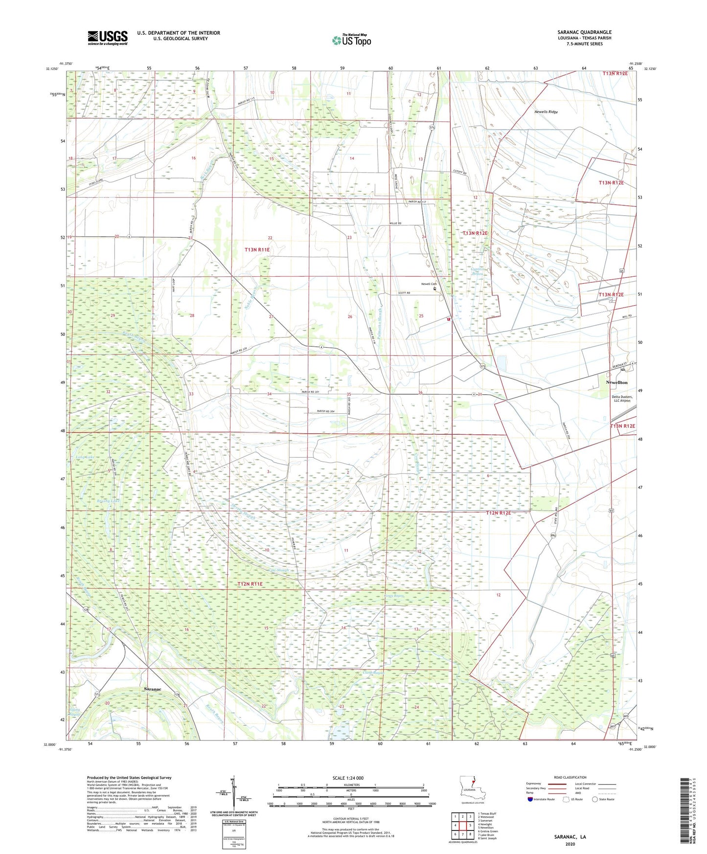
2020 topographic map quadrangle Saranac in the state of Louisiana. Scale: 1:24000. Based on the newly updated USGS 7.5' US Topo map series, this map is in the following counties: Tensas. The map contains contour data, water features, and other items you are used to seeing on USGS maps, but also has updated roads and other features. This is the next generation of topographic maps. Printed on high-quality waterproof paper with UV fade-resistant inks.
Quads adjacent to this one:
West: Newlight
Northwest: Tensas Bluff
North: Westwood
Northeast: Somerset
East: Newellton
Southeast: Saint Joseph
South: Lake Bruin
Southwest: Gretna Green
Contains the following named places: Beck Bayou, Bethany Baptist Church, Brushy Lake, Caney Bayou, Church of Christ, Church of God, Clark Bayou, Cow Slough, Dorthy Slough, Glade Bayou, Justina Gas Field, Long Lake, Molen Lake, Morning Star Church, Nable Bayou, Newell Cemetery, Palmetto Slough, Paradise Church, Saddletree Lake, Saranac, Tensas, Tensas Parish, Tensas Parish Fire District 1 Station 4, Young Bayou, ZIP Code: 71357