MyTopo
Somerset Louisiana US Topo Map
Couldn't load pickup availability
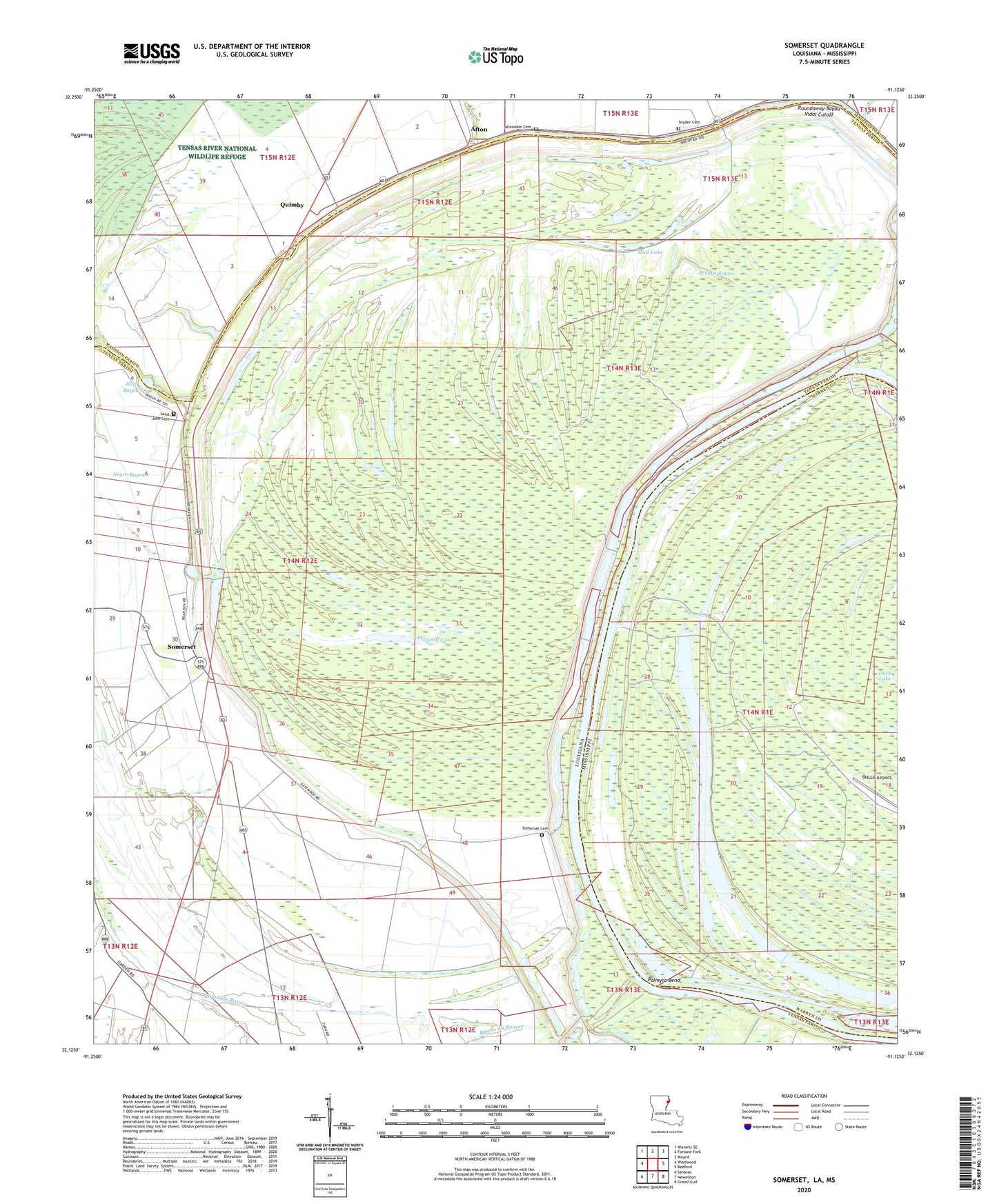
2024 topographic map quadrangle Somerset in the states of Louisiana, Mississippi. Scale: 1:24000. Based on the newly updated USGS 7.5' US Topo map series, this map is in the following counties: Tensas, Warren, Madison. The map contains contour data, water features, and other items you are used to seeing on USGS maps, but also has updated roads and other features. This is the next generation of topographic maps. Printed on high-quality waterproof paper with UV fade-resistant inks.
Quads adjacent to this one:
West: Westwood
Northwest: Waverly SE
North: Fortune Fork
Northeast: Mound
East: Bedford
Southeast: Grand Gulf
South: Newellton
Southwest: Saranac
Contains the following named places: Afton, Allendale Cemetery, Ashville, Ashwood Landing, Bayou du Rosset, Bridgie Bayou, Duck Lake, Grassy Lake, Hapaca Planatation, Hurricane, Hurricane Island, Ione Plantation, Lake Shallow, Middle Palmyra Island, Mill Lake, Mound Bayou, Mud Lake, Negro Bayou, New Carthage, Palmyra Bend, Palmyra Lake, Pasture Green Church, Quimby, Richland Plantation, Saint John Cemetery, Saint John Church, Saint Paul Church, Snyder Cemetery, Somerset, Somerset Cemetery, Somerset Landing, Somerset Plantation, Woodburn Plantation