MyTopo
Sikes Louisiana US Topo Map
Couldn't load pickup availability
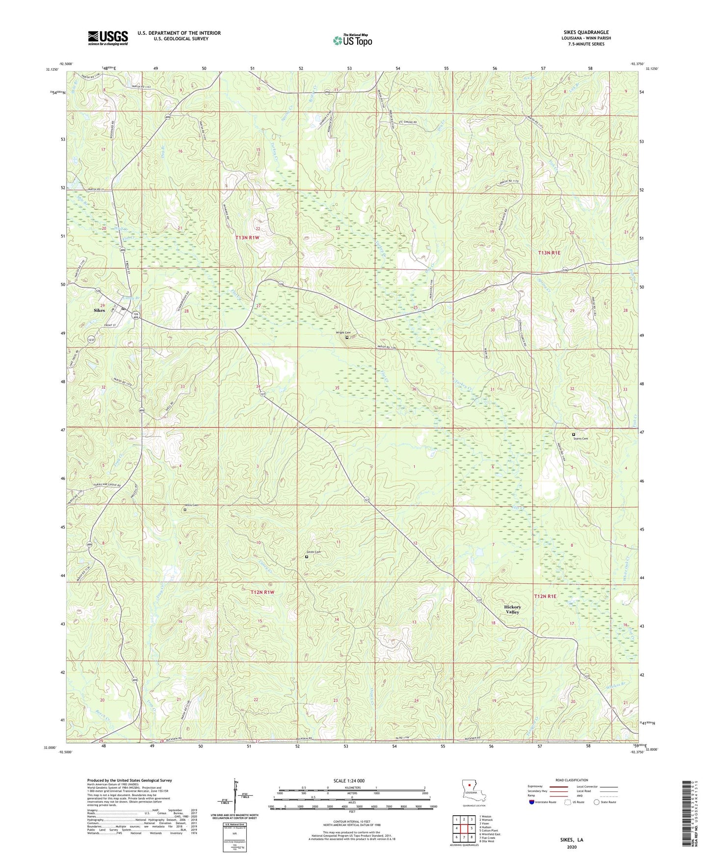
2020 topographic map quadrangle Sikes in the state of Louisiana. Scale: 1:24000. Based on the newly updated USGS 7.5' US Topo map series, this map is in the following counties: Winn. The map contains contour data, water features, and other items you are used to seeing on USGS maps, but also has updated roads and other features. This is the next generation of topographic maps. Printed on high-quality waterproof paper with UV fade-resistant inks.
Quads adjacent to this one:
West: Hudson
Northwest: Weston
North: Womack
Northeast: Vixen
East: Cotton Plant
Southeast: Olla West
South: Flat Creek
Southwest: Winnfield East
Contains the following named places: Bridge Creek, Brister School, Caney Branch, Dry Creek, Dug Branch, East Sikes Gas Field, Fellowship Church, Fish Creek, Hart Church, Hickory Ridge Church, Hickory Valley, Hill, Hurricane Grove Church, Little Creek, Mile Branch, Parish Governing Authority District 11, Parish Governing Authority District 6, Shady Grove Church, Sharon Church, Sikes, Sikes Lookout Tower, Sikes Post Office, Sikes Spur, Smith Cemetery, Spring Creek, Spring Creek Gas Field, Starns Cemetery, Tanyard Creek, Tanyard Creek Gas Field, Turkey Creek, Village of Sikes, Ward Three, West Hickory Valley Gas Field, Wheless Branch, White Oak Creek, Willis Cemetery, Wolf Creek, Wright Cemetery, ZIP Code: 71473