MyTopo
Winnfield East Louisiana US Topo Map
Couldn't load pickup availability
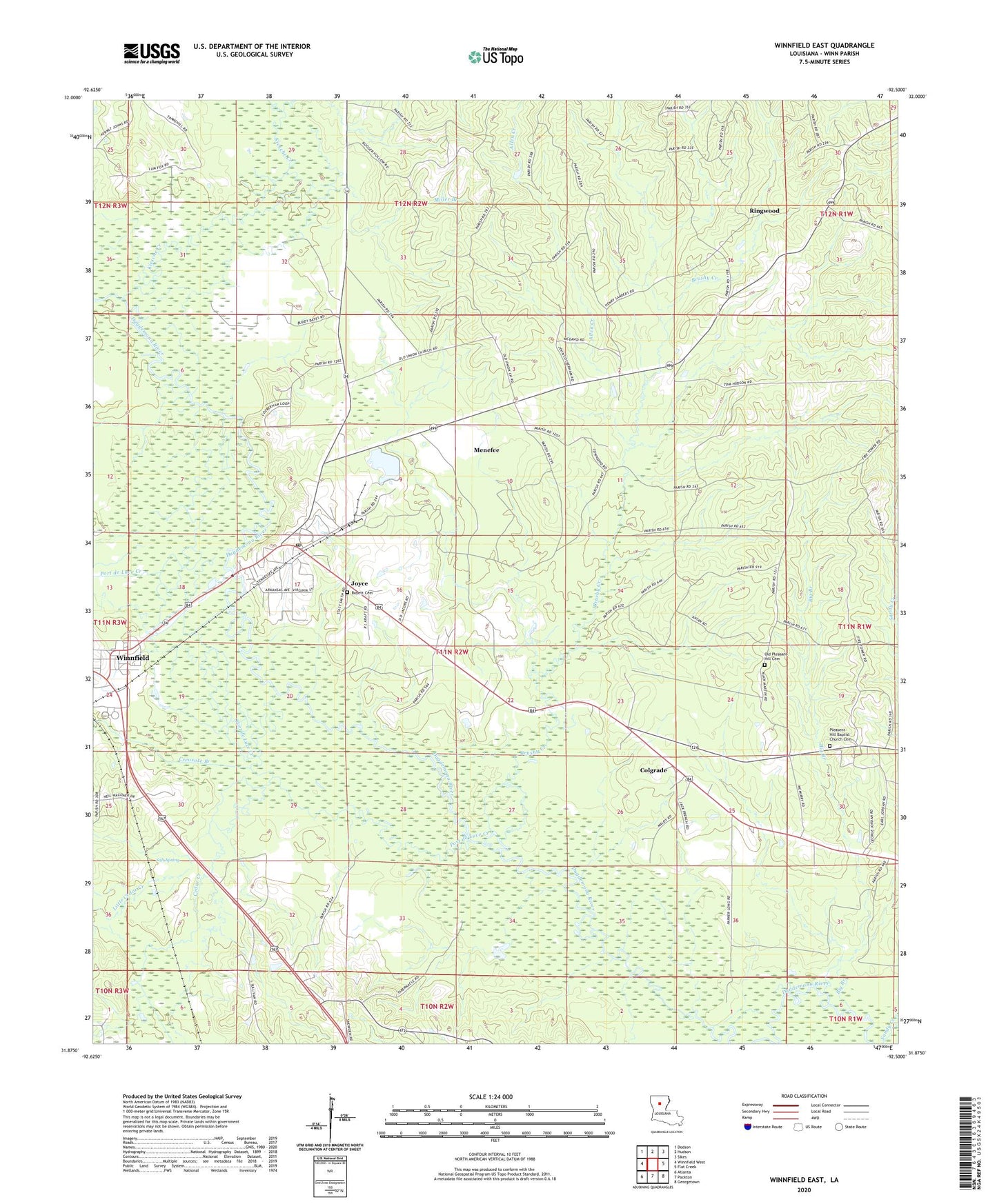
2024 topographic map quadrangle Winnfield East in the state of Louisiana. Scale: 1:24000. Based on the newly updated USGS 7.5' US Topo map series, this map is in the following counties: Winn. The map contains contour data, water features, and other items you are used to seeing on USGS maps, but also has updated roads and other features. This is the next generation of topographic maps. Printed on high-quality waterproof paper with UV fade-resistant inks.
Quads adjacent to this one:
West: Winnfield West
Northwest: Dodson
North: Hudson
Northeast: Sikes
East: Flat Creek
Southeast: Georgetown
South: Packton
Southwest: Atlanta
This map covers the same area as the classic USGS quad with code o31092h5.
Contains the following named places: Allen Creek, Big Branch, Boyett Cemetery, Brushy Creek, Cedar Creek, Cedar Creek Salt Lick, Colgrade, Colgrade Lookout Tower, Corinth Church, Corinth Tabernacle, Creosote Branch, Dry Creek, Joyce, Joyce Census Designated Place, Joyce Post Office, Kiesche Creek, Little Cedar Creek, Menefee, Miller Branch, Old Pleasant Hill Cemetery, Pleasent Hill Baptist Church Cemetery, Port de Luce Creek, Ringwood, Salt Spring, Sandy Creek, Tremont Pond Dam, Union Church, Ward Two, WINNFIELD KINDERGARTEN, Winnfield Mini Park