MyTopo
Simmesport Louisiana US Topo Map
Couldn't load pickup availability
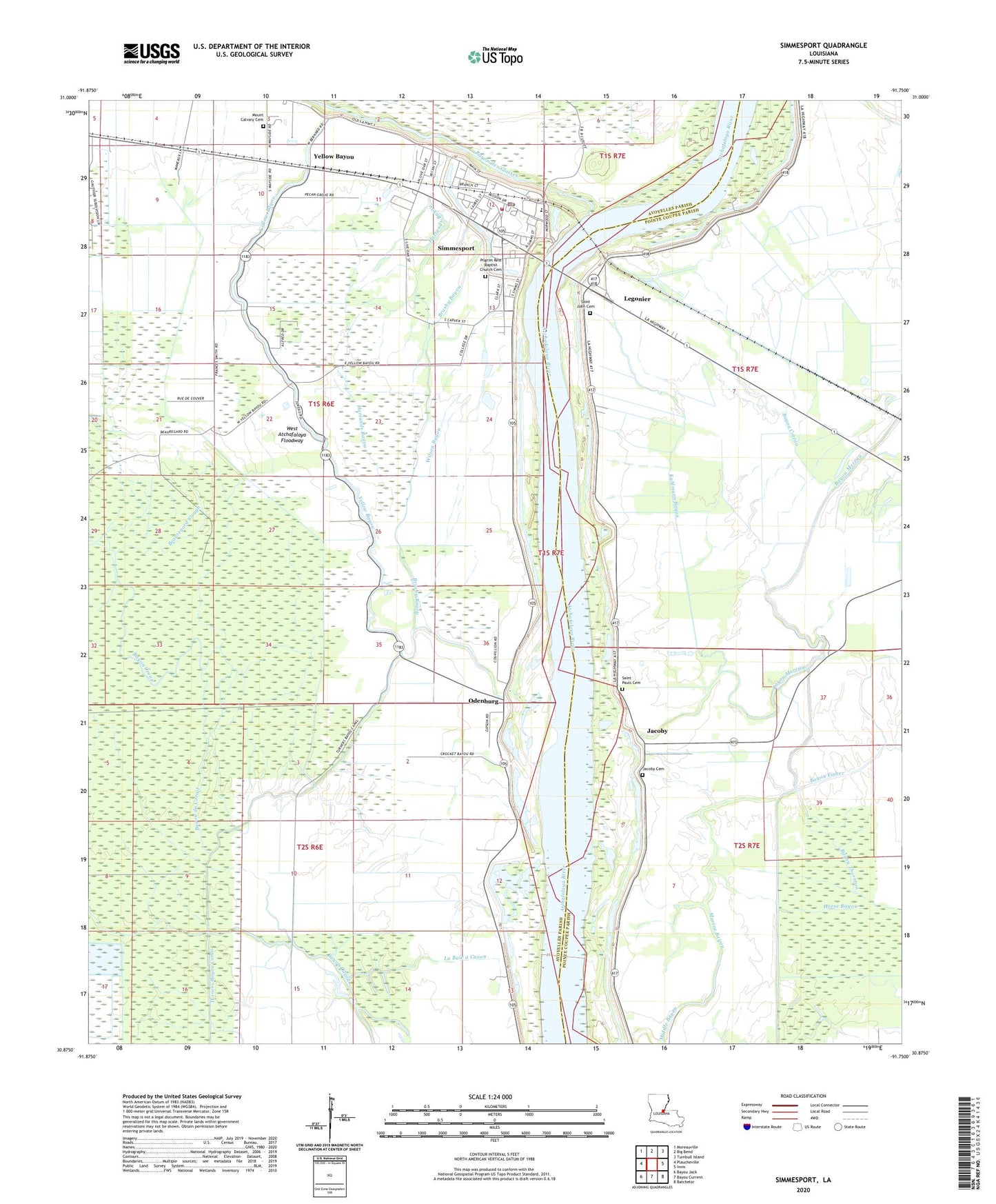
2020 topographic map quadrangle Simmesport in the state of Louisiana. Scale: 1:24000. Based on the newly updated USGS 7.5' US Topo map series, this map is in the following counties: Avoyelles, Pointe Coupee. The map contains contour data, water features, and other items you are used to seeing on USGS maps, but also has updated roads and other features. This is the next generation of topographic maps. Printed on high-quality waterproof paper with UV fade-resistant inks.
Quads adjacent to this one:
West: Plaucheville
Northwest: Moreauville
North: Big Bend
Northeast: Turnbull Island
East: Innis
Southeast: Batchelor
South: Bayou Current
Southwest: Bayou Jack
Contains the following named places: Atchafalaya Flying Company Airport, Bayou a Ferdinand, Bayou Cason, Bayou Coteau, Bayou Creux, Bayou des Glaises, Bayou du Corail, Bayou Moreau, Bayou Thornton, Beauregard Slough, Brushy Bayou, Cason, Deer Range Landing, Deer Range Plantation, Dunbar High School, Eden, Glynville, Greater Zion Travel Church, Harlands Bayou, Horse Bayou, Jacoby, Jacoby Cemetery, Jacoby Chapel, Jacoby Church, Jacoby Landing, Kuhlmann Bayou, La Baie a Cason, Legonier, Lower Deer Range Landing, Marine Bayou, McCrea School, Mount Calvary Cemetery, Mount Calvary Church, Odenburg, Parish Governing Authority District 9, Pilgrim Rest Baptist Church, Pilgrim Rest Baptist Church Cemetery, Pleasant Greens Church, Riverside Elementary School, Saint John Cemetery, Saint John Church, Saint Matthew Church, Saint Pauls Cemetery, Simmesport, Simmesport Police Department, Simmesport Post Office, Simmesport Volunteer Fire Department, State of Louisiana, Sunrise Church, Town of Simmesport, Tree of Life Church, Turners Bayou Canal, Ward Seven, Wayside, Williams Landing, Wilson Bayou, Yellow Bayou