MyTopo
Bayou Current Louisiana US Topo Map
Couldn't load pickup availability
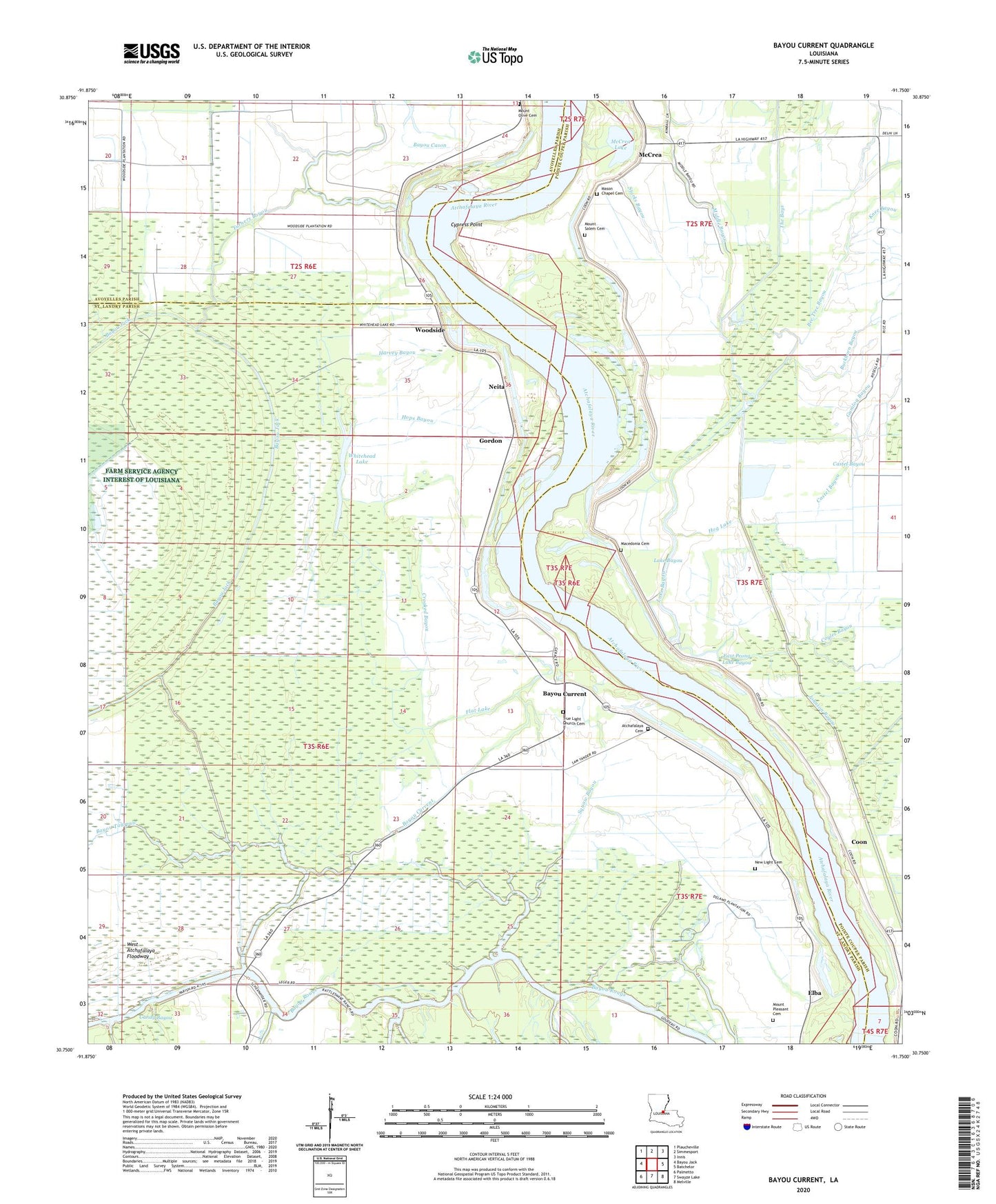
2024 topographic map quadrangle Bayou Current in the state of Louisiana. Scale: 1:24000. Based on the newly updated USGS 7.5' US Topo map series, this map is in the following counties: St. Landry, Pointe Coupee, Avoyelles. The map contains contour data, water features, and other items you are used to seeing on USGS maps, but also has updated roads and other features. This is the next generation of topographic maps. Printed on high-quality waterproof paper with UV fade-resistant inks.
Quads adjacent to this one:
West: Bayou Jack
Northwest: Plaucheville
North: Simmesport
Northeast: Innis
East: Batchelor
Southeast: Melville
South: Swayze Lake
Southwest: Palmetto
This map covers the same area as the classic USGS quad with code o30091g7.
Contains the following named places: Atchafalaya Cemetery, Atchafalaya Church, Barberton Landing, Bayou Current, Bayou Garwood, Bayou Tawpaw, Bee Tree Bayou, Buckhorn Bayou, Burlong Landing, Castel Bayou, Coon, Coyles Bayou, Crooked Bayou, Cypress Point, Davis Bayou, Delano, East Prong Lake Bayou, Elba, Elba Oil Field, Fairfield Landing, Flat Lake, Gordon, Greens Lake, Harvey Bayou, Hog Lake, Hops Bayou, Johnson Bayou, Knee Bayou, Lake Bayou, Lake Bayou School, Little Zion Church, Macedonia Cemetery, Mason Chapel, Mason Chapel Cemetery, McCrea, McCrea Lake, Middle Bayou, Morning Star Cemetery, Mount Olive Cemetery, Mount Olive Church, Mount Pleasant Cemetery, Mount Pleasant Church, Mount Salem Cemetery, Mount Salem Church, Neita, New Light Cemetery, New Light Church, New Zion Church, Pointe Coupee Church, Quinton Oil Field, Somers, Squaw Bayou, Starks Bayou, Suna, The Bays, True Light Church, Turners Bayou, Ward One, Webb, West Atchafalaya Floodway, Whitehead Lake, Woodside, Woodside School, ZIP Code: 71353