MyTopo
Simpson North Louisiana US Topo Map
Couldn't load pickup availability
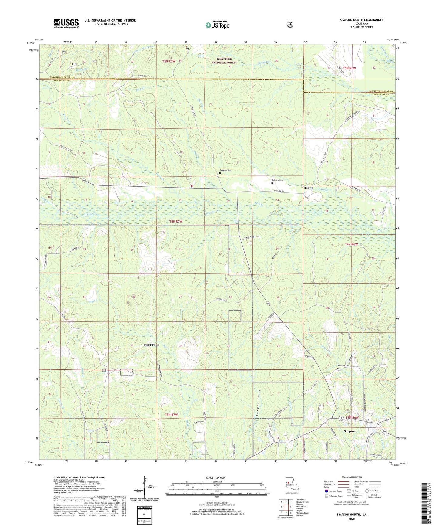
2020 topographic map quadrangle Simpson North in the state of Louisiana. Scale: 1:24000. Based on the newly updated USGS 7.5' US Topo map series, this map is in the following counties: Vernon, Natchitoches. The map contains contour data, water features, and other items you are used to seeing on USGS maps, but also has updated roads and other features. This is the next generation of topographic maps. Printed on high-quality waterproof paper with UV fade-resistant inks.
Quads adjacent to this one:
West: Kurthwood
Northwest: Kisatchie
North: Bayou Livrogne
Northeast: Gorum
East: Temple
Southeast: Lacamp
South: Simpson South
Southwest: Slagle
Contains the following named places: Alco Hutton Volunteer Fire Department, Allen Branch, Ballview Cemetery, Brush Creek, Buck Branch, Don Merchant Pond Dam, First Church of God, Hutton, Indian Branch, James Andre Pond Dam, Mary Smith Pond Dam, Parish Governing Authority District 6, Robinson Cemetery, Simpson Baptist Church, Simpson High School, Simpson Post Office, Simpson Volunteer Fire Department, Village of Simpson, Welcome Cemetery, ZIP Code: 71474