MyTopo
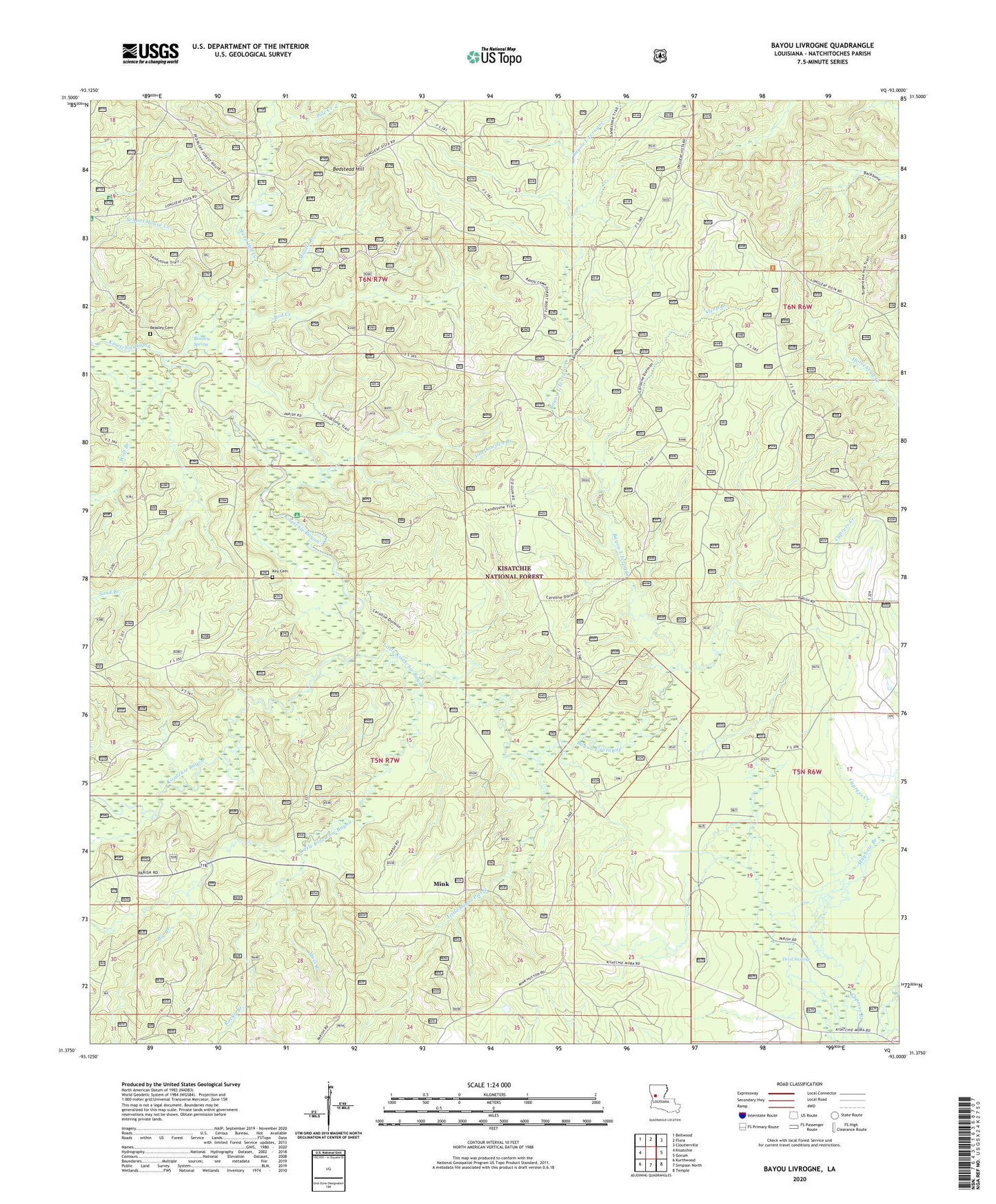
Bayou Livrogne Louisiana US Topo Map
Couldn't load pickup availability
Also explore the Bayou Livrogne Forest Service Topo of this same quad for updated USFS data
2024 topographic map quadrangle Bayou Livrogne in the state of Louisiana. Scale: 1:24000. Based on the newly updated USGS 7.5' US Topo map series, this map is in the following counties: Natchitoches. The map contains contour data, water features, and other items you are used to seeing on USGS maps, but also has updated roads and other features. This is the next generation of topographic maps. Printed on high-quality waterproof paper with UV fade-resistant inks.
Quads adjacent to this one:
West: Kisatchie
Northwest: Bellwood
North: Flora
Northeast: Cloutierville
East: Gorum
Southeast: Temple
South: Simpson North
Southwest: Kurthwood
This map covers the same area as the classic USGS quad with code o31093d1.
Contains the following named places: Bayou L'Ivrogne, Beasley Cemetery, Beasley Spring, Bedstead Hill, Big Branch, Cypress Creek, Devil Swamp, Jim Dowden Branch, Key Cemetery, Kisatchie Bayou Campground, Little Bayou Pierre, Little Kisatchie Bayou, Mayhaw Branch, Middle Branch, Mink, Moss Branch, New Hope School, Pole Creek, Red Creek, Red Dirt Lookout Tower, Red Dirt National Wildlife Management Area, Rocky Branch, Sand Branch, Steep Branch, Steep Hill Creek, Wolf Branch