MyTopo
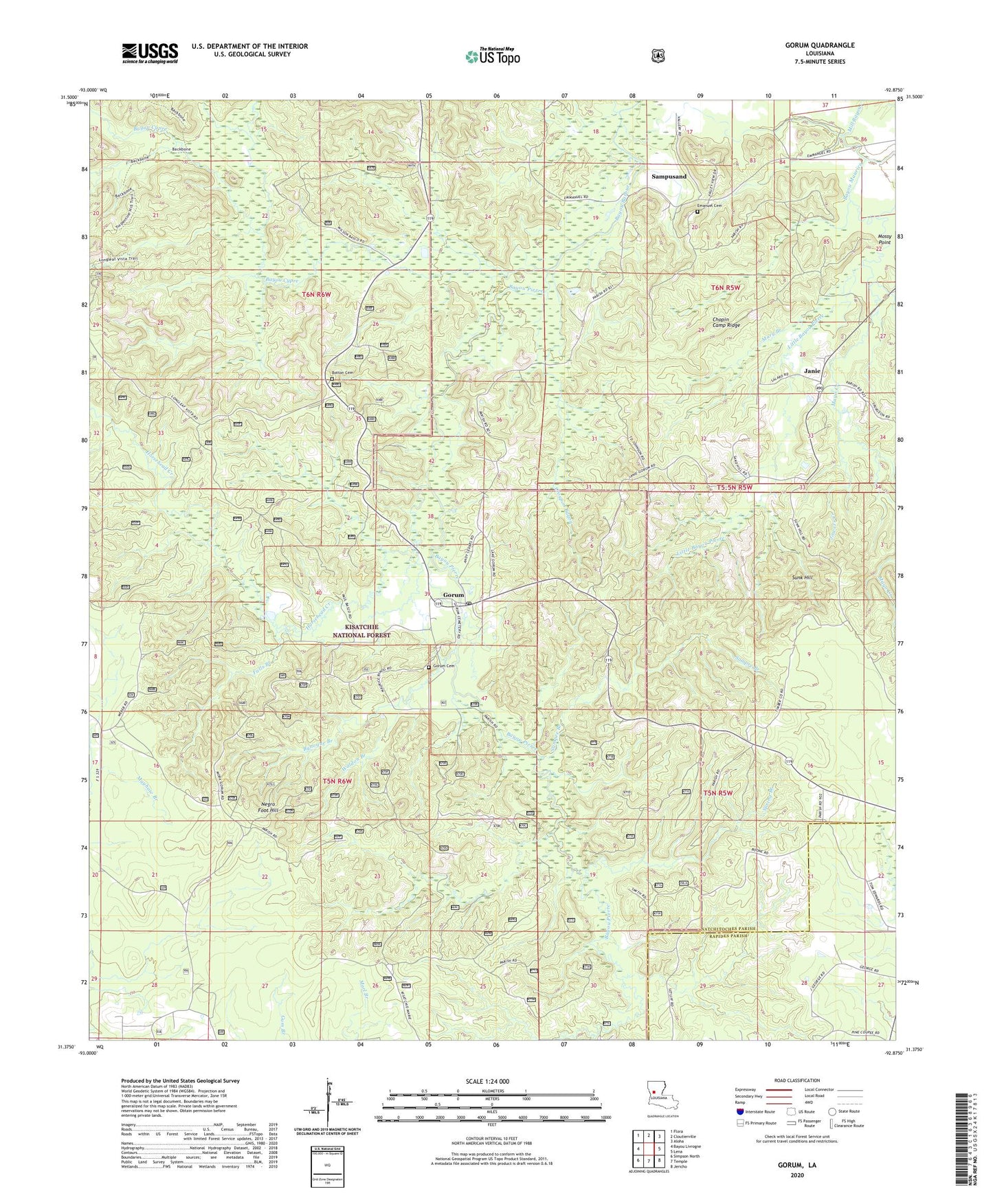
Gorum Louisiana US Topo Map
Couldn't load pickup availability
Also explore the Gorum Forest Service Topo of this same quad for updated USFS data
2024 topographic map quadrangle Gorum in the state of Louisiana. Scale: 1:24000. Based on the newly updated USGS 7.5' US Topo map series, this map is in the following counties: Natchitoches, Rapides. The map contains contour data, water features, and other items you are used to seeing on USGS maps, but also has updated roads and other features. This is the next generation of topographic maps. Printed on high-quality waterproof paper with UV fade-resistant inks.
Quads adjacent to this one:
West: Bayou Livrogne
Northwest: Flora
North: Cloutierville
Northeast: Aloha
East: Lena
Southeast: Jericho
South: Temple
Southwest: Simpson North
This map covers the same area as the classic USGS quad with code o31092d8.
Contains the following named places: Barbue Ford, Bay Spring, Bayou Cypre, Bayou Cypre Overlook, Bayou Maurice, Bayou Pierre, Bayou Pierre Overlook, Bolton Hill Overlook, Botton Cemetery, Bynogue Branch, Chopin Camp Ridge, Clear Lake, Croupon Bayou, Emanuel Church, Emmanuel Cemetery, Falls Branch, Gorum, Gorum Cemetery, Gorum Lookout Tower, Gorum Post Office, Hait Brake, Horsehead Creek, Janie, Johnston School, Jowers Creek, Kisatchie Hills Wilderness, Levy School, Little Bayou Pierre, Longleaf Trail Vista Picnic Area, Manuel School, Mary Branch, Mayo Creek, Mora Church, Mossy Point, Negro Foot Hill, Sampre Branch, Sampusand, Spring Branch, Sunk Hill, Waldon Branch, ZIP Codes: 71427, 71455