MyTopo
Dowden Creek Louisiana US Topo Map
Couldn't load pickup availability
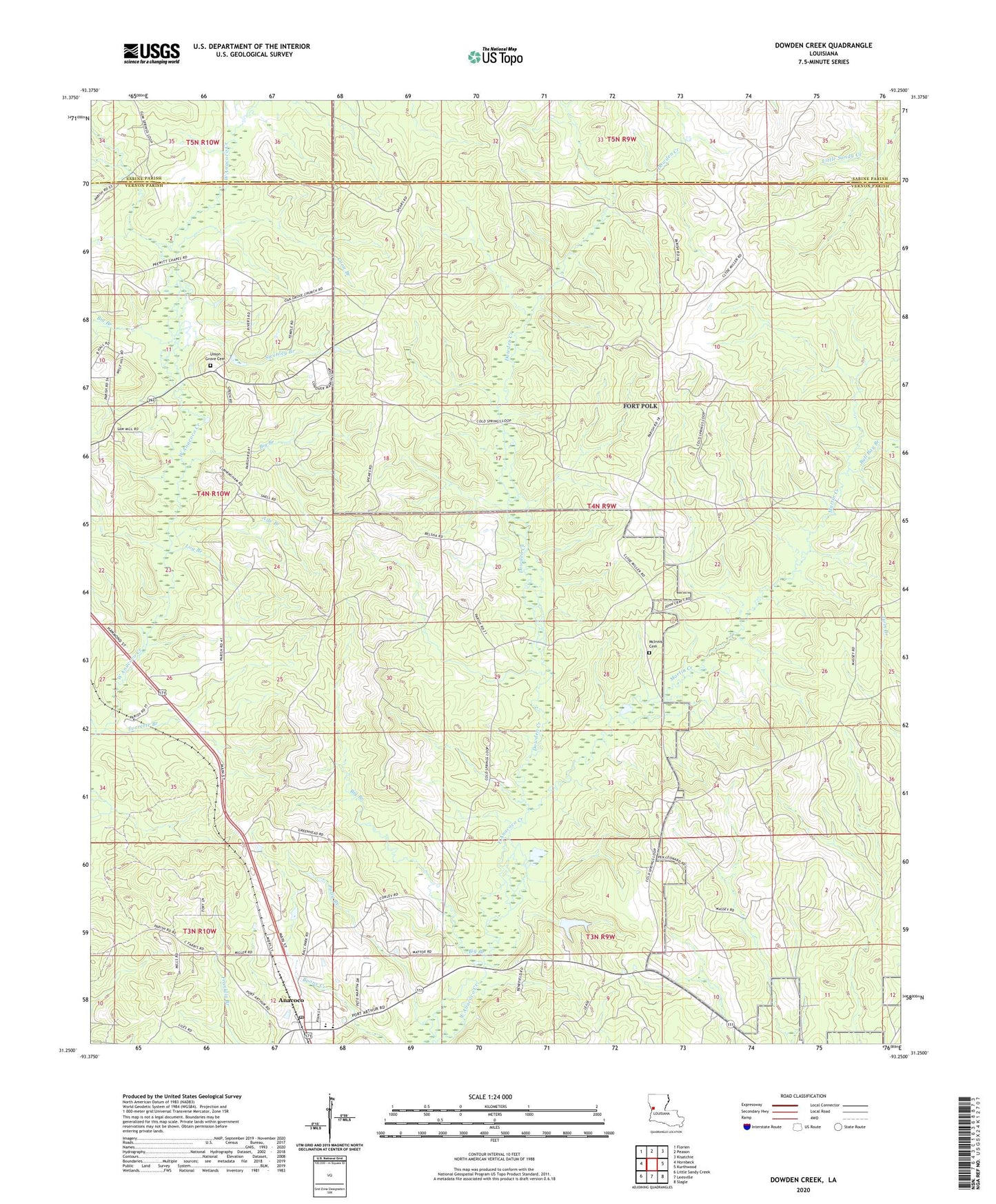
2024 topographic map quadrangle Dowden Creek in the state of Louisiana. Scale: 1:24000. Based on the newly updated USGS 7.5' US Topo map series, this map is in the following counties: Vernon, Sabine. The map contains contour data, water features, and other items you are used to seeing on USGS maps, but also has updated roads and other features. This is the next generation of topographic maps. Printed on high-quality waterproof paper with UV fade-resistant inks.
Quads adjacent to this one:
West: Hornbeck
Northwest: Florien
North: Peason
Northeast: Kisatchie
East: Kurthwood
Southeast: Slagle
South: Leesville
Southwest: Little Sandy Creek
This map covers the same area as the classic USGS quad with code o31093c3.
Contains the following named places: Ade Branch, Anacoco, Anacoco Elementary School, Anacoco High School, Big Branch, Bonnie Chapel, Brushy Creek, Bull Bay Branch, Cold Springs Baptist Church, Coon Branch, Dowden Creek, Everett, Everette Branch, Log Branch, Martin Creek, McInnis Cemetery, Mitchell Church, Orange Church, Peason Ridge Oil Field, Polly Branch, Pruitts Chapel, Swenley Branch, Union Grove Cemetery, Union Grove Church, Village of Anacoco