MyTopo
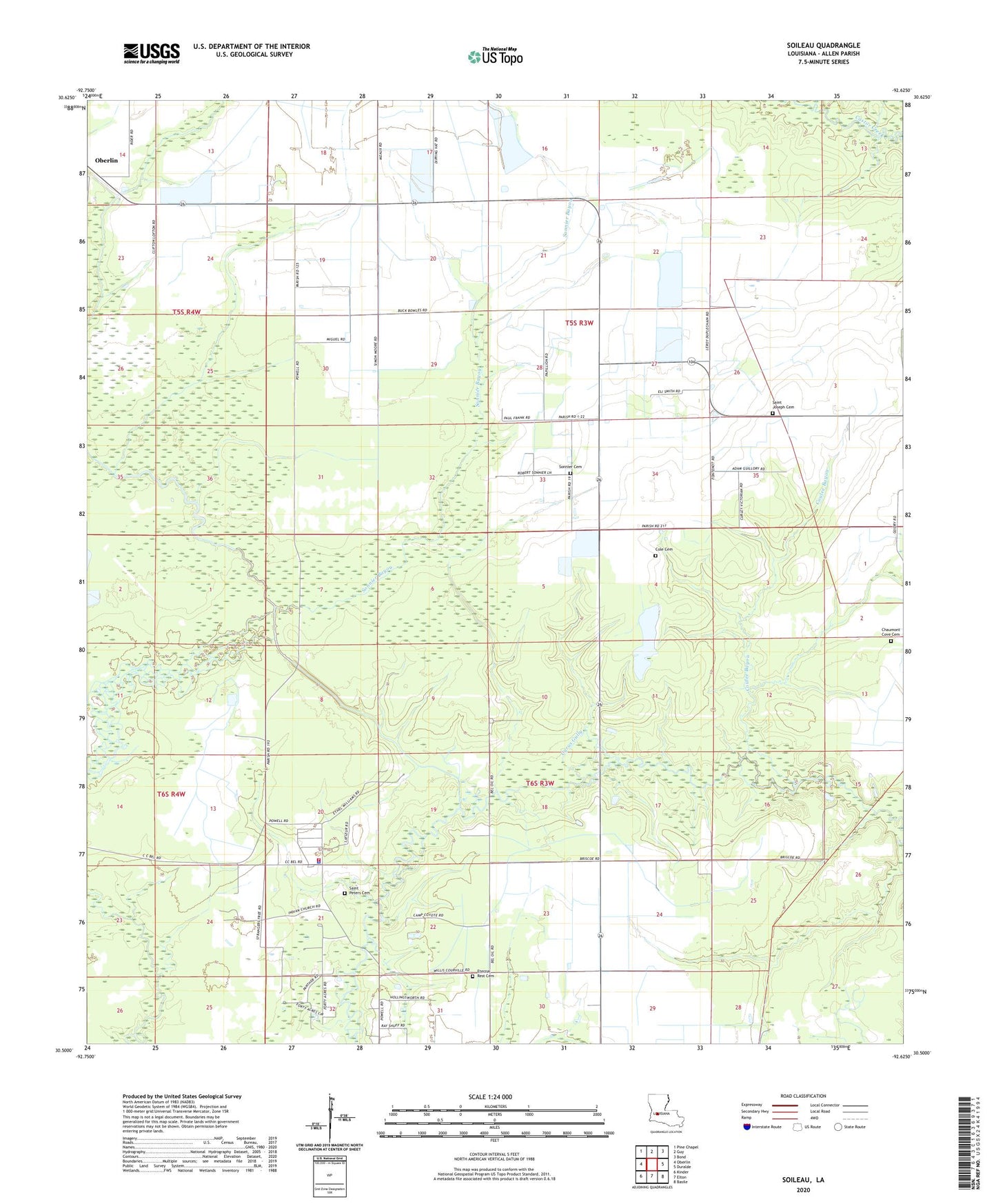
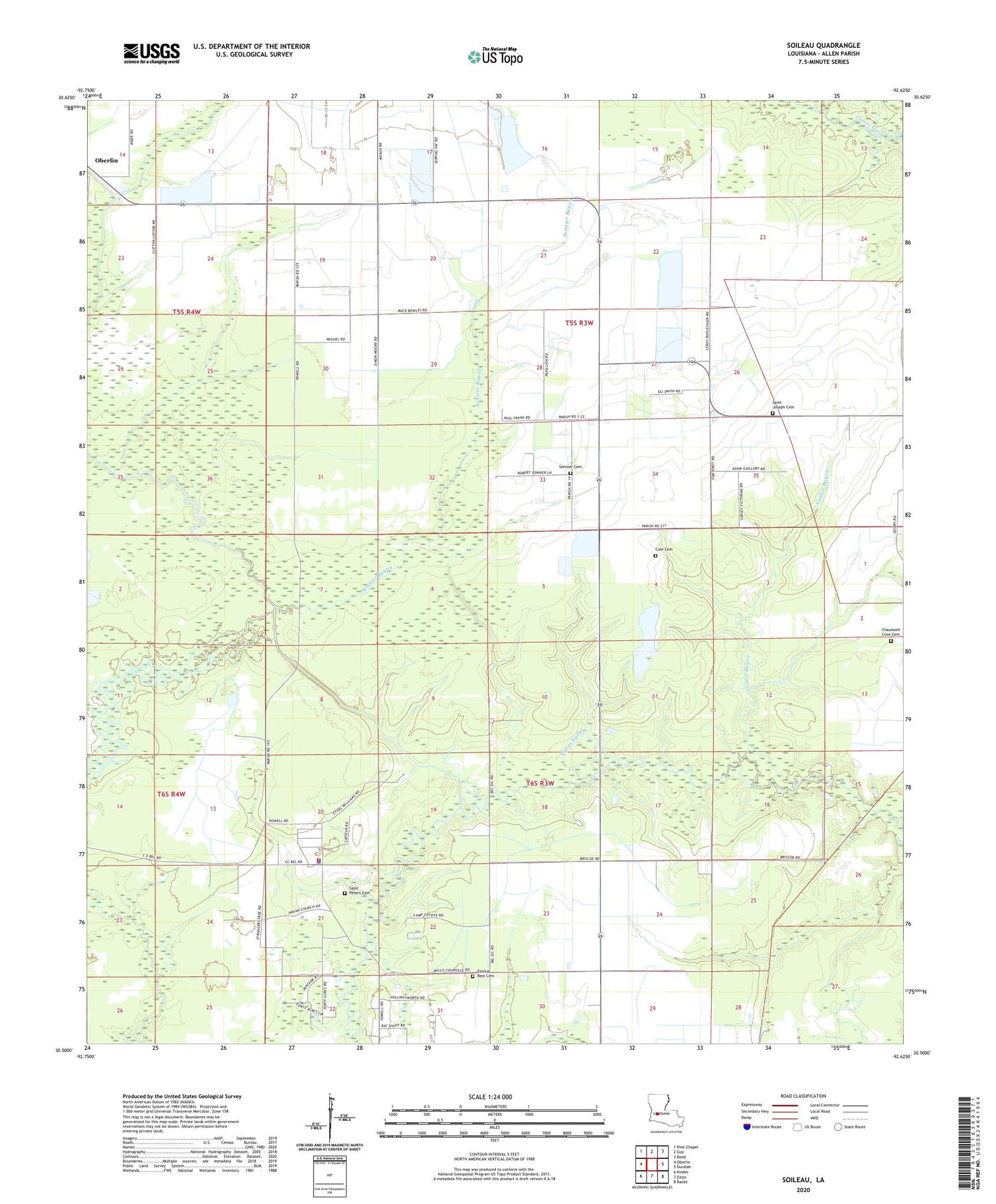
Soileau Louisiana US Topo Map
Couldn't load pickup availability
2020 topographic map quadrangle Soileau in the state of Louisiana. Scale: 1:24000. Based on the newly updated USGS 7.5' US Topo map series, this map is in the following counties: Allen. The map contains contour data, water features, and other items you are used to seeing on USGS maps, but also has updated roads and other features. This is the next generation of topographic maps. Printed on high-quality waterproof paper with UV fade-resistant inks.
Quads adjacent to this one:
West: Oberlin
Northwest: Pine Chapel
North: Guy
Northeast: Bond
East: Duralde
Southeast: Basile
South: Elton
Southwest: Kinder
Contains the following named places: Cole Cemetery, Coulee Bayou, Coushatta Tribal Fire Department, Cyrus Gully, Leeds School, Louisiana Noname 79 Dam, North Elton Gas Field, Parish Governing Authority District 5, Saint Peters Cemetery, Soileau, Soileau Church, Sonnier Bayou, Sonnier Cemetery, Southeast Oberlin Oil and Gas Field, Spring Gully, Ward One, Winn Gully