MyTopo
Elton Louisiana US Topo Map
Couldn't load pickup availability
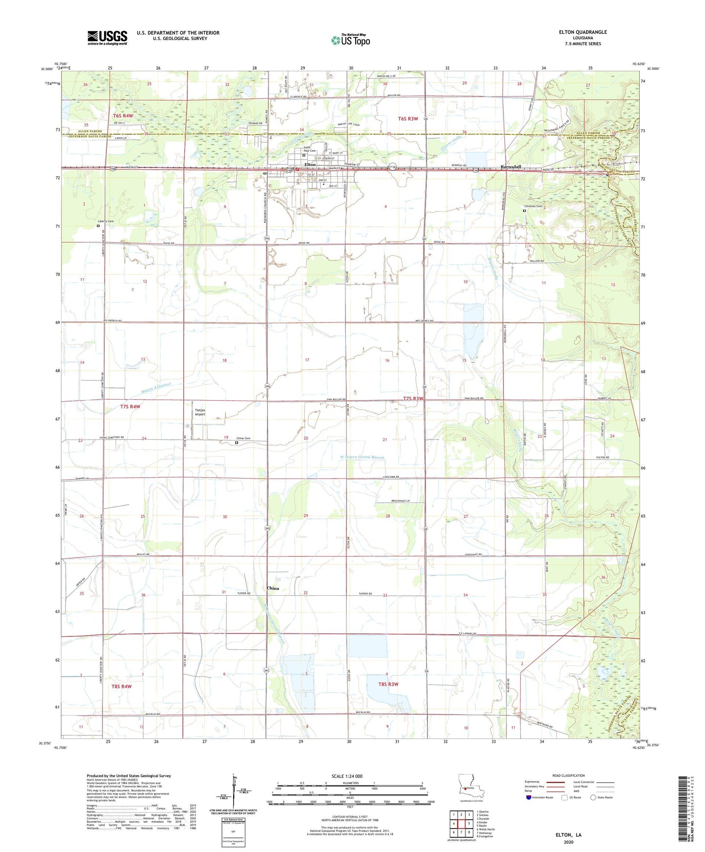
2024 topographic map quadrangle Elton in the state of Louisiana. Scale: 1:24000. Based on the newly updated USGS 7.5' US Topo map series, this map is in the following counties: Jefferson Davis, Allen, Acadia, Evangeline. The map contains contour data, water features, and other items you are used to seeing on USGS maps, but also has updated roads and other features. This is the next generation of topographic maps. Printed on high-quality waterproof paper with UV fade-resistant inks.
Quads adjacent to this one:
West: Kinder
Northwest: Oberlin
North: Soileau
Northeast: Duralde
East: Basile
Southeast: Evangeline
South: Hathaway
Southwest: Welsh North
This map covers the same area as the classic USGS quad with code o30092d6.
Contains the following named places: Barnsdall, China, China Cemetery, China Gas Field, Chretien Cemetery, Dry Slough, Elton, Elton Elementary School, Elton Fire Department, Elton High School, Elton Police Department, Elton Post Office, Faith Deliverance Temple, First Baptist Church of Elton, Golden Chain Baptist Church, Greens Gully, Jefferson Davis Parish Library Elton Branch, Jefferson Davis Parish Wastewater Treatment Plant, Liberty Cemetery, Mount Pilgrim Baptist Church, Parish Governing Authority District 9, Rogers Bayou Gas Field, Rogers Gully, Saint Ann Church, Saint Joseph Catholic Church, Saint Pauls Catholic Church, South Elton Oil and Gas Field, Southeast China Gas Field, Tietjes Airport, Town of Elton, United Pentecostal Church, Ward Four, West Tepetate Oil and Gas Field, ZIP Code: 70532