MyTopo
Kinder Louisiana US Topo Map
Couldn't load pickup availability
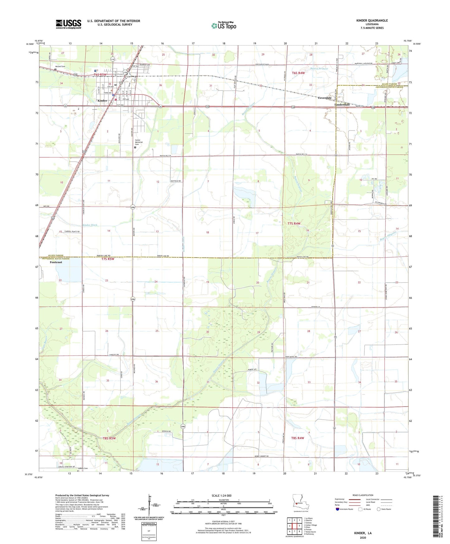
2024 topographic map quadrangle Kinder in the state of Louisiana. Scale: 1:24000. Based on the newly updated USGS 7.5' US Topo map series, this map is in the following counties: Jefferson Davis, Allen. The map contains contour data, water features, and other items you are used to seeing on USGS maps, but also has updated roads and other features. This is the next generation of topographic maps. Printed on high-quality waterproof paper with UV fade-resistant inks.
Quads adjacent to this one:
West: Indian Village
Northwest: Le Blanc
North: Oberlin
Northeast: Soileau
East: Elton
Southeast: Hathaway
South: Welsh North
Southwest: Fenton
This map covers the same area as the classic USGS quad with code o30092d7.
Contains the following named places: Allen Parish Hospital, Allen Parish Library Kinder Branch, Bayou Alligator, Christ Praise and Worship Center, Church Alive of Kinder, Coverdale, First Baptist Church, First United Methodist Church, Hannah Chapel African Methodist Episcopal Church, Kinder, Kinder Bible Church, Kinder Canal, Kinder Church of Christ, Kinder Ditch, Kinder Elementary School, Kinder Fire Department, Kinder High School, Kinder Middle School, Kinder Police Department, Kinder Post Office, Kinder Water Treatment Plant, Lauderdale, LeBleu Cemetery, Louisiana Noname 107 Dam, McGee Cemetery, New Hope Assembly Church, North Edna Oil Field, Parish Governing Authority District 6, Saint Philip Neri Church, Thompson Spur, Town of Kinder, Ward Two, West Edna Gas Field