MyTopo
Pine Chapel Louisiana US Topo Map
Couldn't load pickup availability
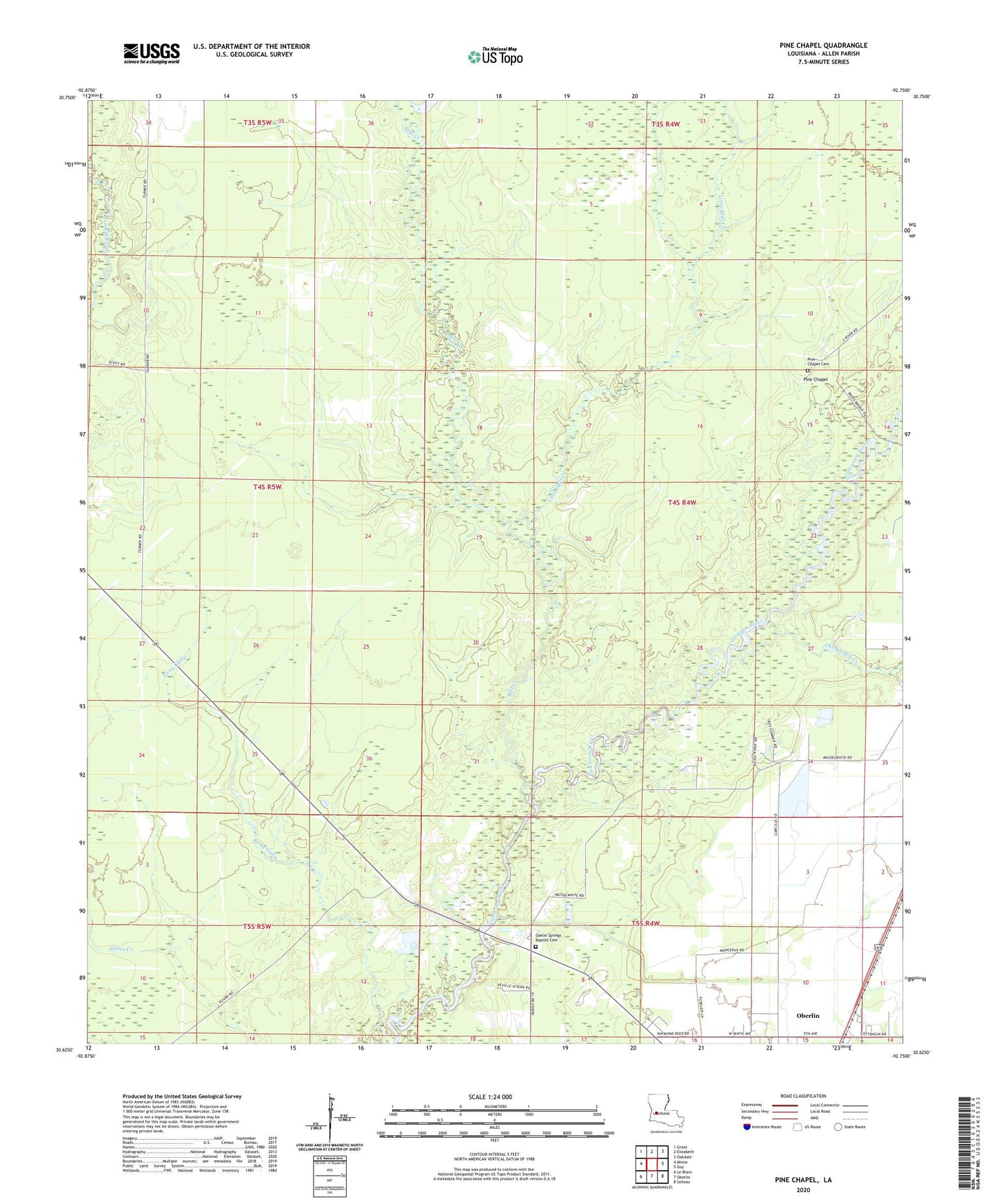
2024 topographic map quadrangle Pine Chapel in the state of Louisiana. Scale: 1:24000. Based on the newly updated USGS 7.5' US Topo map series, this map is in the following counties: Allen. The map contains contour data, water features, and other items you are used to seeing on USGS maps, but also has updated roads and other features. This is the next generation of topographic maps. Printed on high-quality waterproof paper with UV fade-resistant inks.
Quads adjacent to this one:
West: Mittie
Northwest: Grant
North: Elizabeth
Northeast: Oakdale
East: Guy
Southeast: Soileau
South: Oberlin
Southwest: Le Blanc
This map covers the same area as the classic USGS quad with code o30092f7.
Contains the following named places: Allen Parish, Chinquapin Creek, East Mittie Gas Field, Little Mill Creek, Mill Creek, Northwest Oberlin Gas Field, Oakland Springs Church, Oaklin Springs Baptist Cemetery, Oberlin Covenant Church, Oberlin Lookout Tower, Pine Chapel, Saint Frances Nursing and Rehabilitation Center