MyTopo
South Pass Louisiana US Topo Map
Couldn't load pickup availability
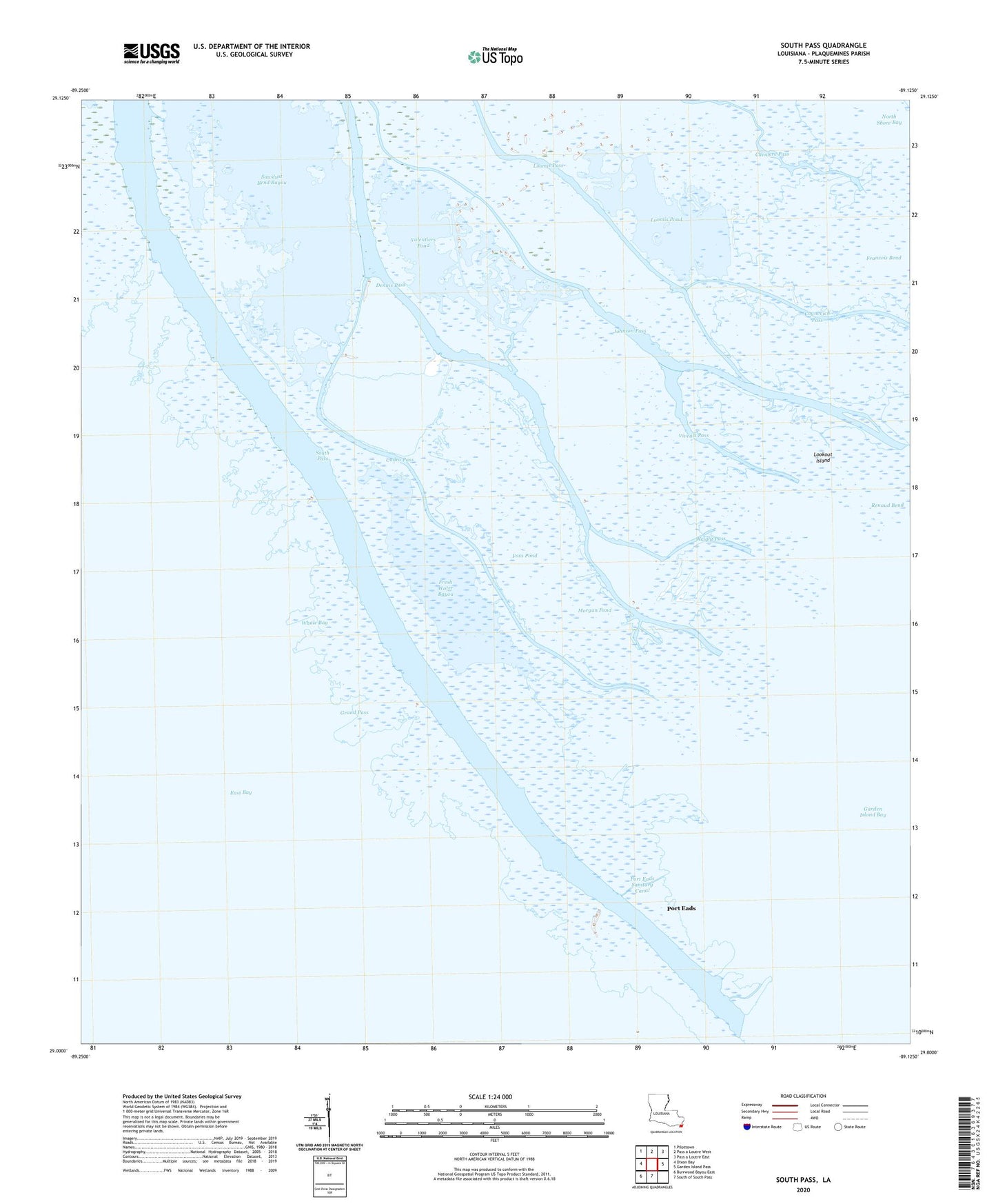
2020 topographic map quadrangle South Pass in the state of Louisiana. Scale: 1:24000. Based on the newly updated USGS 7.5' US Topo map series, this map is in the following counties: Plaquemines. The map contains contour data, water features, and other items you are used to seeing on USGS maps, but also has updated roads and other features. This is the next generation of topographic maps. Printed on high-quality waterproof paper with UV fade-resistant inks.
Quads adjacent to this one:
West: Dixon Bay
Northwest: Pilottown
North: Pass a Loutre West
Northeast: Pass a Loutre East
East: Garden Island Pass
South: South of South Pass
Southwest: Burrwood Bayou East
Contains the following named places: Balize Bay Gas Field, Block 21 Gas Field, Cadro Pass, Cognevich Pass, Dennis Pass, East Jetty, Foxs Pond, Francois Bend, Fresh Water Bayou, Garden Island Bay Oil and Gas Field, Garden Island Bay Seaplane Base, Grand Pass, Johnson Pass, Lookout Island, Loomis Pass, Loomis Pond, Morgan Pond, Pass a Loutre State Water Fowl Management Area, Port Eads, Port Eads Sanitary Canal, Renaud Bend, Sawdust Bend Bayou, South Pass, South Pass Light, Valentiers Pond, Viveals Pass, Whale Bay, Wright Pass