MyTopo
Spring Ridge Louisiana US Topo Map
Couldn't load pickup availability
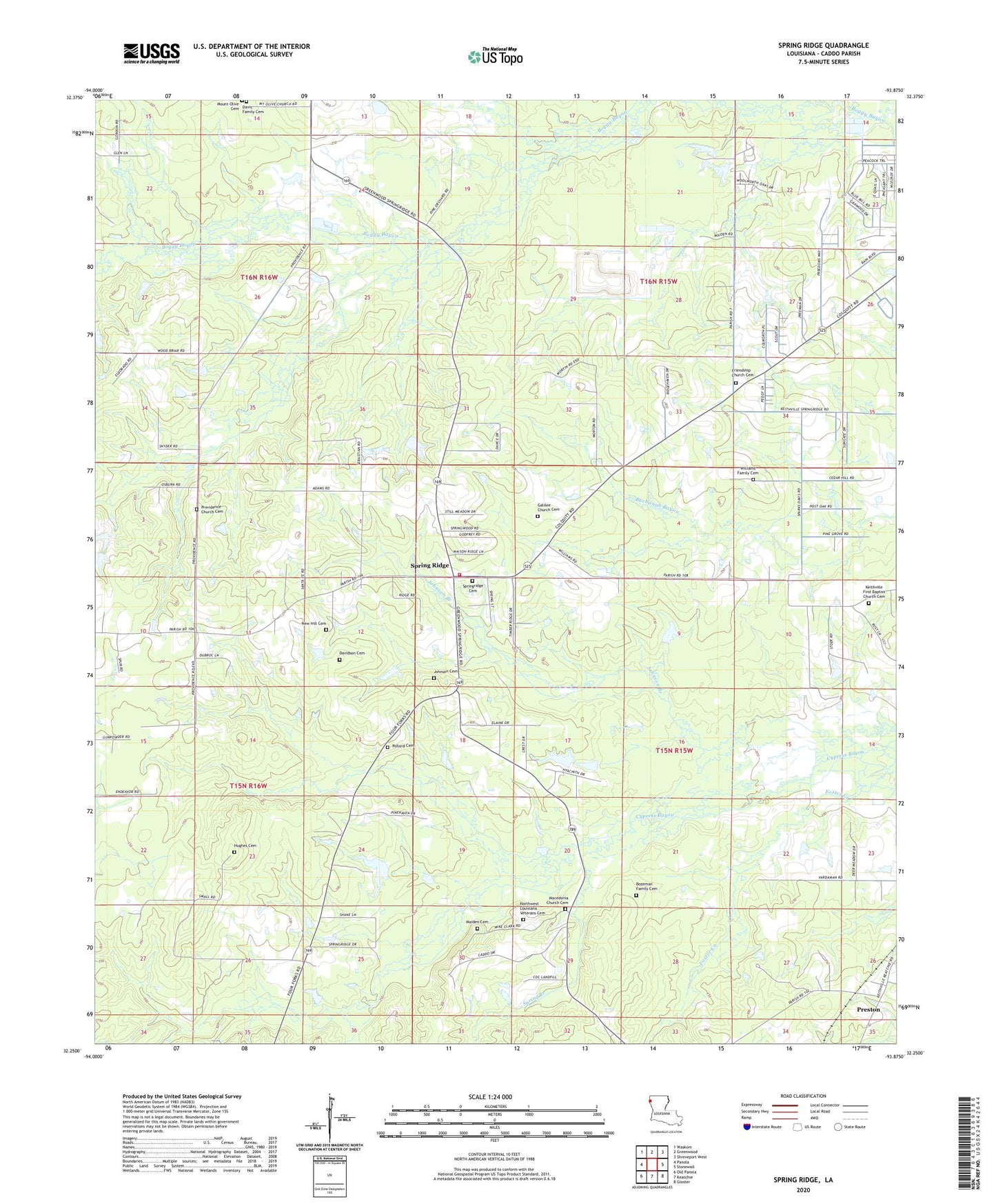
2020 topographic map quadrangle Spring Ridge in the state of Louisiana. Scale: 1:24000. Based on the newly updated USGS 7.5' US Topo map series, this map is in the following counties: Caddo. The map contains contour data, water features, and other items you are used to seeing on USGS maps, but also has updated roads and other features. This is the next generation of topographic maps. Printed on high-quality waterproof paper with UV fade-resistant inks.
Quads adjacent to this one:
West: Panola
Northwest: Waskom
North: Greenwood
Northeast: Shreveport West
East: Stonewall
Southeast: Gloster
South: Keatchie
Southwest: Old Panola
Contains the following named places: Caddo Parish Fire District 4 Central Station, Daisy Grove School, Davidson Cemetery, Forcht - Wade Correctional Center, Forcht Wade Correctional Center Special Services District Facility, Galilee Church, Hughes Cemetery, Johnson Cemetery, Johnson Gas Field, Maiden Cemetery, Metcalf Oil and Gas Field, Mount Olive Missionary Baptist Church, Mount Olive School, Mount Washington Church, New Hill Cemetery, Northwest Louisiana Veterans Cemetery, Parish Governing Authority District 11, Pollard Cemetery, Preston, Providence Church, Saint Johns Church, Spring Branch, Spring Ridge, Ward Six, White Hall School, ZIP Code: 71047