MyTopo
Waskom Texas US Topo Map
Couldn't load pickup availability
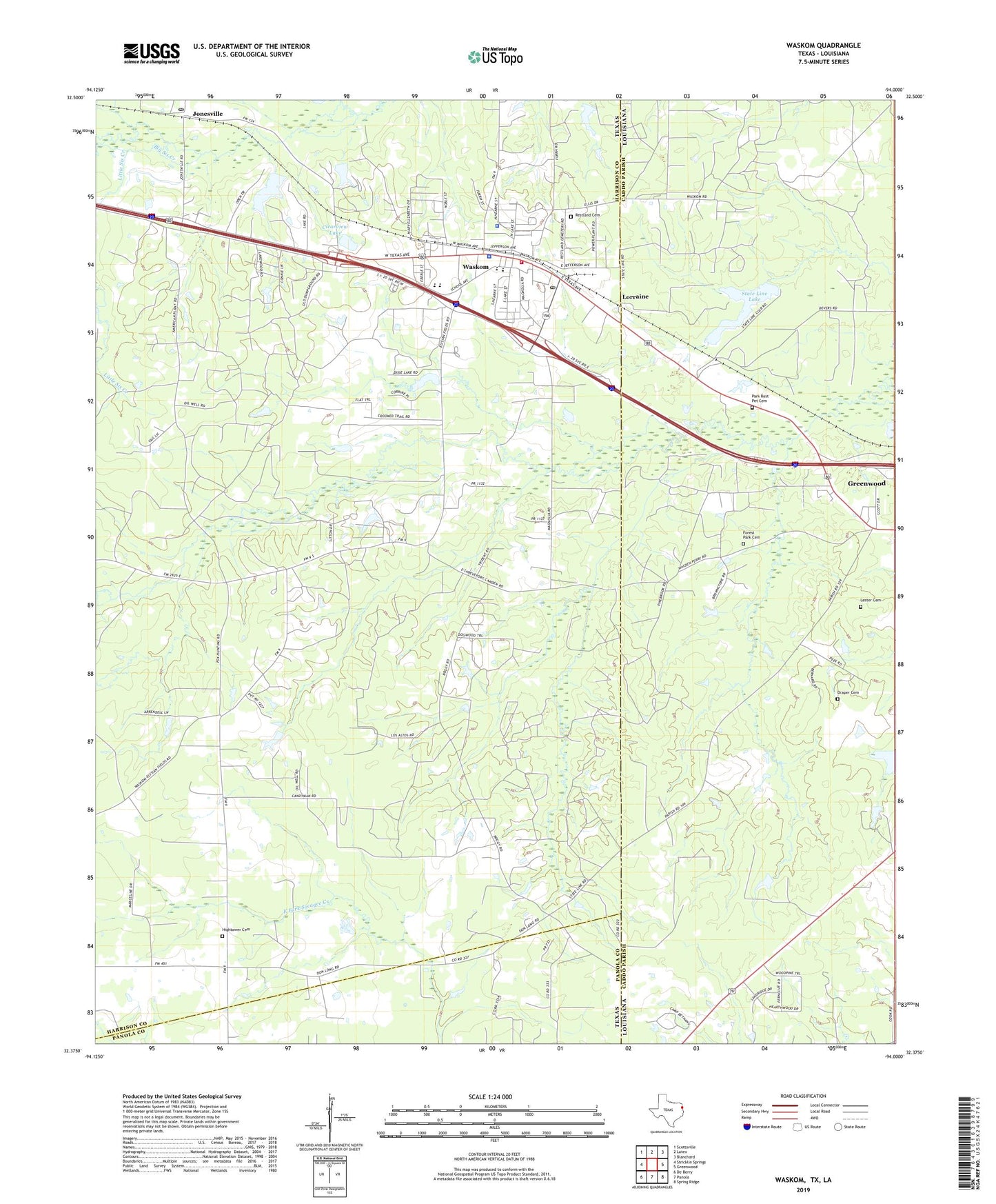
2022 topographic map quadrangle Waskom in the states of Texas, Louisiana. Scale: 1:24000. Based on the newly updated USGS 7.5' US Topo map series, this map is in the following counties: Harrison, Caddo, Panola. The map contains contour data, water features, and other items you are used to seeing on USGS maps, but also has updated roads and other features. This is the next generation of topographic maps. Printed on high-quality waterproof paper with UV fade-resistant inks.
Quads adjacent to this one:
West: Stricklin Springs
Northwest: Scottsville
North: Latex
Northeast: Blanchard
East: Greenwood
Southeast: Spring Ridge
South: Panola
Southwest: De Berry
This map covers the same area as the classic USGS quad with code o32094d1.
Contains the following named places: Abney High School, Big Sis Creek, City of Waskom, Clearview Lake, Clearview Lake Dam, Draper Cemetery, Forest Park - Whitworth Cemetery, Gainesville Church, Harrison County Constable's Office Precinct 1, Hightower Cemetery, Jonesville, Jonesville Post Office, Lester Cemetery, Lions Club Park, Little Sis Creek, Lorraine, New Boggy Bayou Church, New Hebron Church, Park Rest Pet Cemetery, Pleasant Hill School, Public Road School, Restland Cemetery, Spring Hill School, State Line Lake, Union Chapel, Wadley Regional Medical Center Heliport, Waskom, Waskom City Hall, Waskom Elementary School, Waskom Gas and Oil Field, Waskom Heliport, Waskom Police Department, Waskom Post Office, Waskom Volunteer Fire Department, ZIP Codes: 71033, 75692