MyTopo
Panola Texas US Topo Map
Couldn't load pickup availability
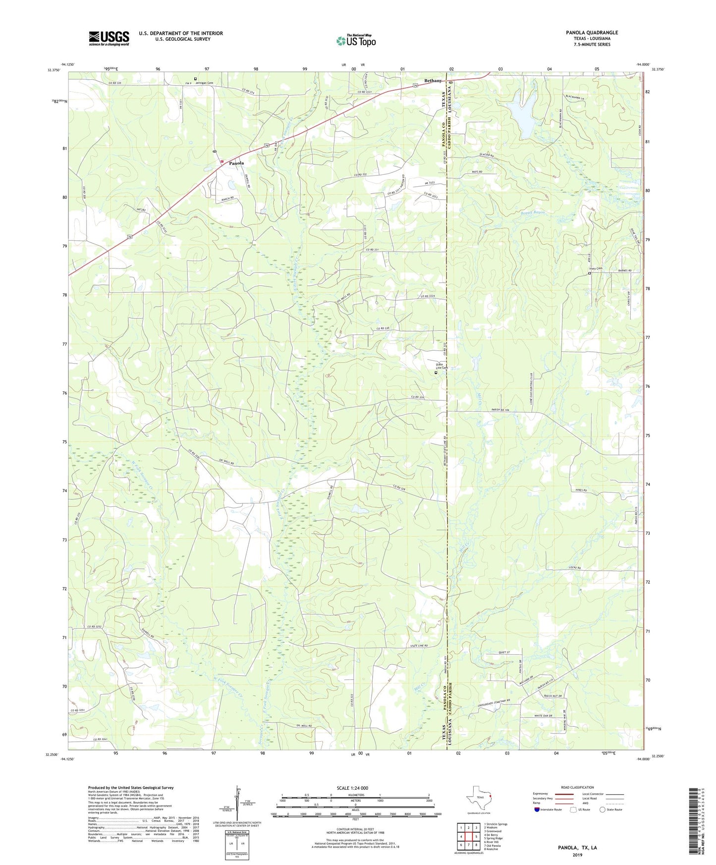
2022 topographic map quadrangle Panola in the states of Texas, Louisiana. Scale: 1:24000. Based on the newly updated USGS 7.5' US Topo map series, this map is in the following counties: Panola, Caddo. The map contains contour data, water features, and other items you are used to seeing on USGS maps, but also has updated roads and other features. This is the next generation of topographic maps. Printed on high-quality waterproof paper with UV fade-resistant inks.
Quads adjacent to this one:
West: De Berry
Northwest: Stricklin Springs
North: Waskom
Northeast: Greenwood
East: Spring Ridge
Southeast: Keatchie
South: Old Panola
Southwest: River Hill
This map covers the same area as the classic USGS quad with code o32094c1.
Contains the following named places: Antioch Church, Bethany, Bethany Oil and Gas Field, Bethany Post Office, Community Four Volunteer Fire Department, Cross Road School, De Berry School, Do Right Church, East Fork Socagee Creek, Ivy Cemetery, Jernigan Cemetery, Lakeland Farm Lake, Liberty School, Mission Church, Mount Zion Church, Panola, Panola Post Office, Pine Grove School, State Line Cemetery, Waco School, West Fork Socagee Creek, ZIP Code: 71007