MyTopo
Starks Louisiana US Topo Map
Couldn't load pickup availability
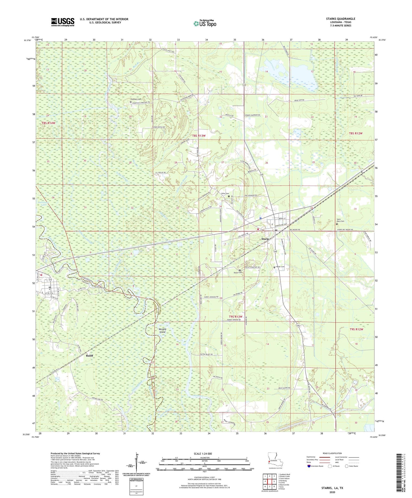
2020 topographic map quadrangle Starks in the states of Louisiana, Texas. Scale: 1:24000. Based on the newly updated USGS 7.5' US Topo map series, this map is in the following counties: Calcasieu, Newton. The map contains contour data, water features, and other items you are used to seeing on USGS maps, but also has updated roads and other features. This is the next generation of topographic maps. Printed on high-quality waterproof paper with UV fade-resistant inks.
Quads adjacent to this one:
West: Hartburg
Northwest: Sudduth Bluff
North: Shoats Creek
Northeast: Clark Hollow
East: Lunita
Southeast: Vinton
South: Echo
Southwest: Mauriceville
Contains the following named places: Alligator Lake, Alligator Park, Ashworth Slough, Bess Branch, Calcasieu Parish Library Starks Branch, Calvary Apostolic Church, Cutoff Bayou, Deweyville, Deweyville Post Office, Doyle Cemetery, First Baptist Church, First Pentecostal Church, Fountain Cemetery, Long Slough, Miller Cemetery, Northwest Starks Gas Field, Patterson Slough, Ruliff, Saint Mary Cemetery, Saint Mary Church, South Newton Emergency Services District 1, Starks, Starks Census Designated Place, Starks High School, Starks Lookout Tower, Starks Oil Field, Starks Post Office, Starks Ward 5 Volunteer Fire Department, Stevenson Lake, Ward Five, Wembly Island, ZIP Code: 70661