MyTopo
Sudduth Bluff Texas US Topo Map
Couldn't load pickup availability
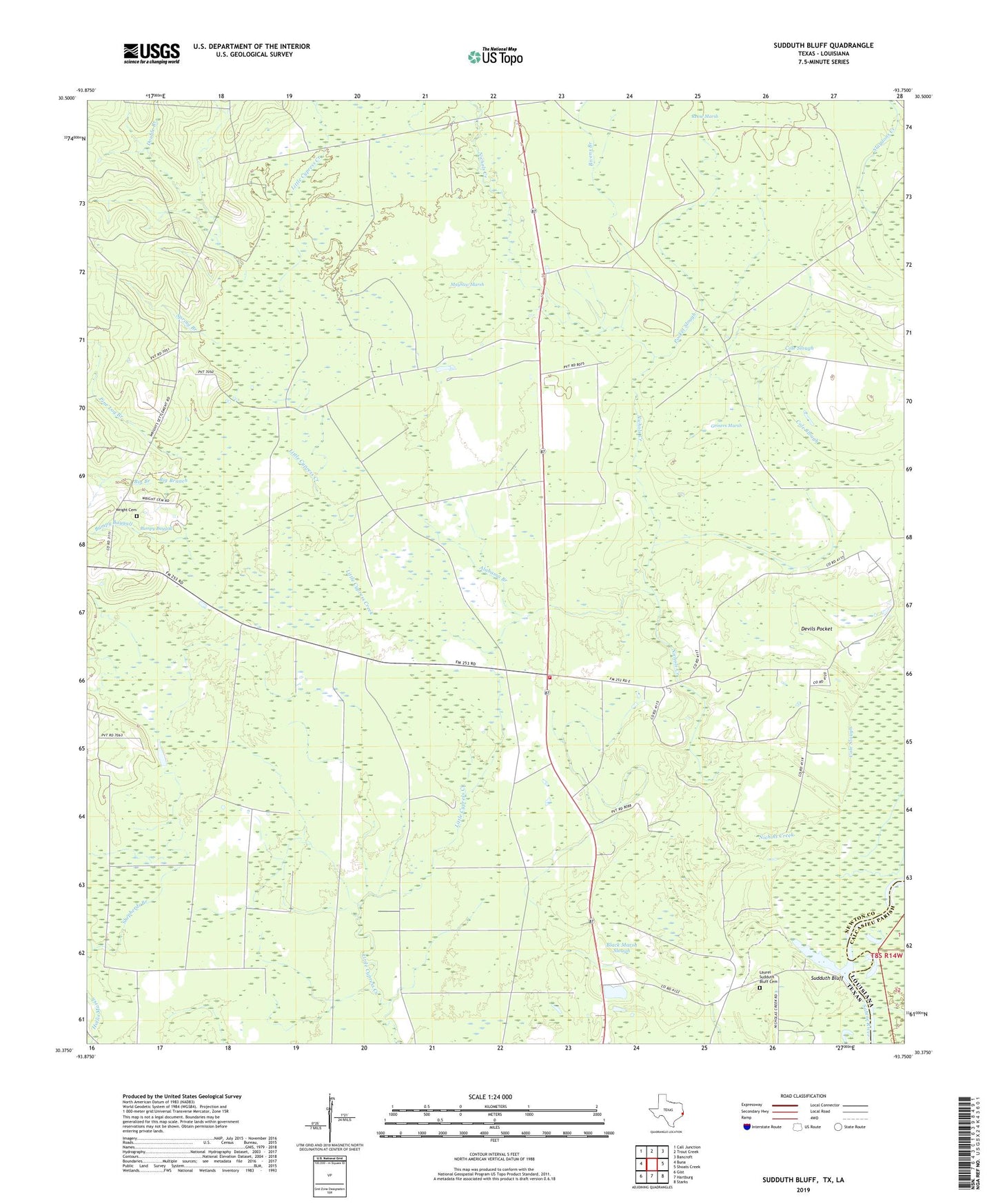
2022 topographic map quadrangle Sudduth Bluff in the states of Texas, Louisiana. Scale: 1:24000. Based on the newly updated USGS 7.5' US Topo map series, this map is in the following counties: Newton, Calcasieu. The map contains contour data, water features, and other items you are used to seeing on USGS maps, but also has updated roads and other features. This is the next generation of topographic maps. Printed on high-quality waterproof paper with UV fade-resistant inks.
Quads adjacent to this one:
West: Buna
Northwest: Call Junction
North: Trout Creek
Northeast: Bancroft
East: Shoats Creek
Southeast: Starks
South: Hartburg
Southwest: Gist
This map covers the same area as the classic USGS quad with code o30093d7.
Contains the following named places: Alabama Branch, Big Branch, Bivens Branch, Black Marsh Slough, Bumpy Baygall, Buna Lookout Tower, Cole Slough, Devil's Pocket Volunteer Fire Department, Double Branch, Griners Marsh, Laurel Sudduth Bluff Cemetery, Mayhaw Marsh, Nichols Creek, Nichols Creek Church, Nixs Ferry, Pine Log Branch, Pocket Slough, Shepherds Branch, Spring Branch, Sudduth Bluff, Wright Cemetery