MyTopo
Shoats Creek Louisiana US Topo Map
Couldn't load pickup availability
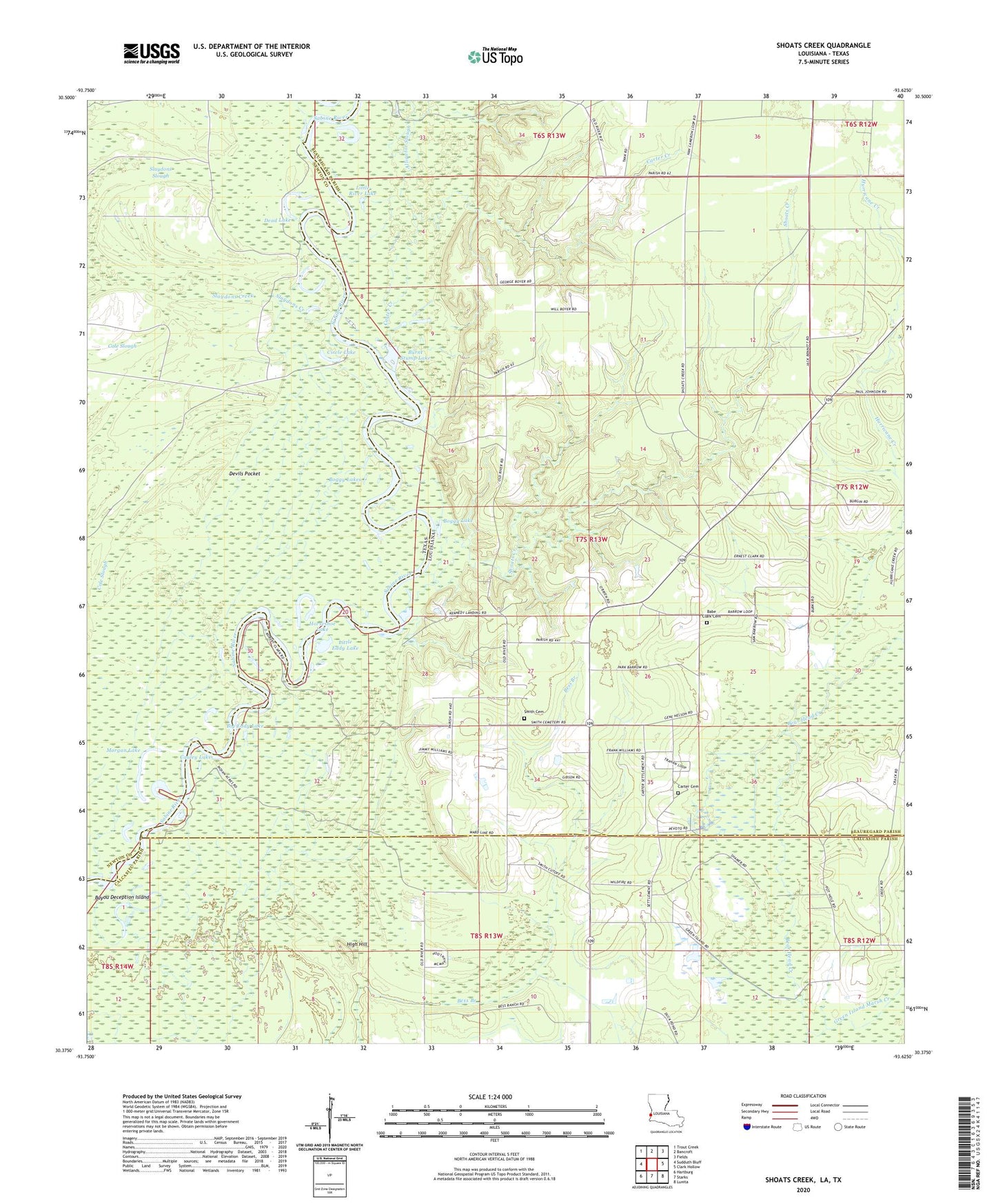
2024 topographic map quadrangle Shoats Creek in the states of Louisiana, Texas. Scale: 1:24000. Based on the newly updated USGS 7.5' US Topo map series, this map is in the following counties: Beauregard, Newton, Calcasieu. The map contains contour data, water features, and other items you are used to seeing on USGS maps, but also has updated roads and other features. This is the next generation of topographic maps. Printed on high-quality waterproof paper with UV fade-resistant inks.
Quads adjacent to this one:
West: Sudduth Bluff
Northwest: Trout Creek
North: Bancroft
Northeast: Fields
East: Clark Hollow
Southeast: Lunita
South: Starks
Southwest: Hartburg
Contains the following named places: Alligator Lake, Alligator Slough, Babe Clark Cemetery, Bayou Deception Island, Beckam Lake, Big Eddy Lake, Boggy Lake, Boggy Lakes, Burnt Stump Lake, Carter Cemetery, Carter Creek, Cauley Lake, Circle Lake, Clark Cemetery, Clear Lake, Dead Lake, Devils Pocket, Duetts Eddy Lake, Gambrell Baptist Church, Green Island Marsh Creek, High Hill, Horseshoe Lake, Hurricane Creek, Little Eddy Lake, Little River Lake, Morgan Lake, Nicks Ferry, Nicks Landing, North Starks Oil Field, Shoats Creek, Slaydons Creek, Slaydons Slough, Smith Cemetery, South Bancroft Gas Field