MyTopo
Sugrue Louisiana US Topo Map
Couldn't load pickup availability
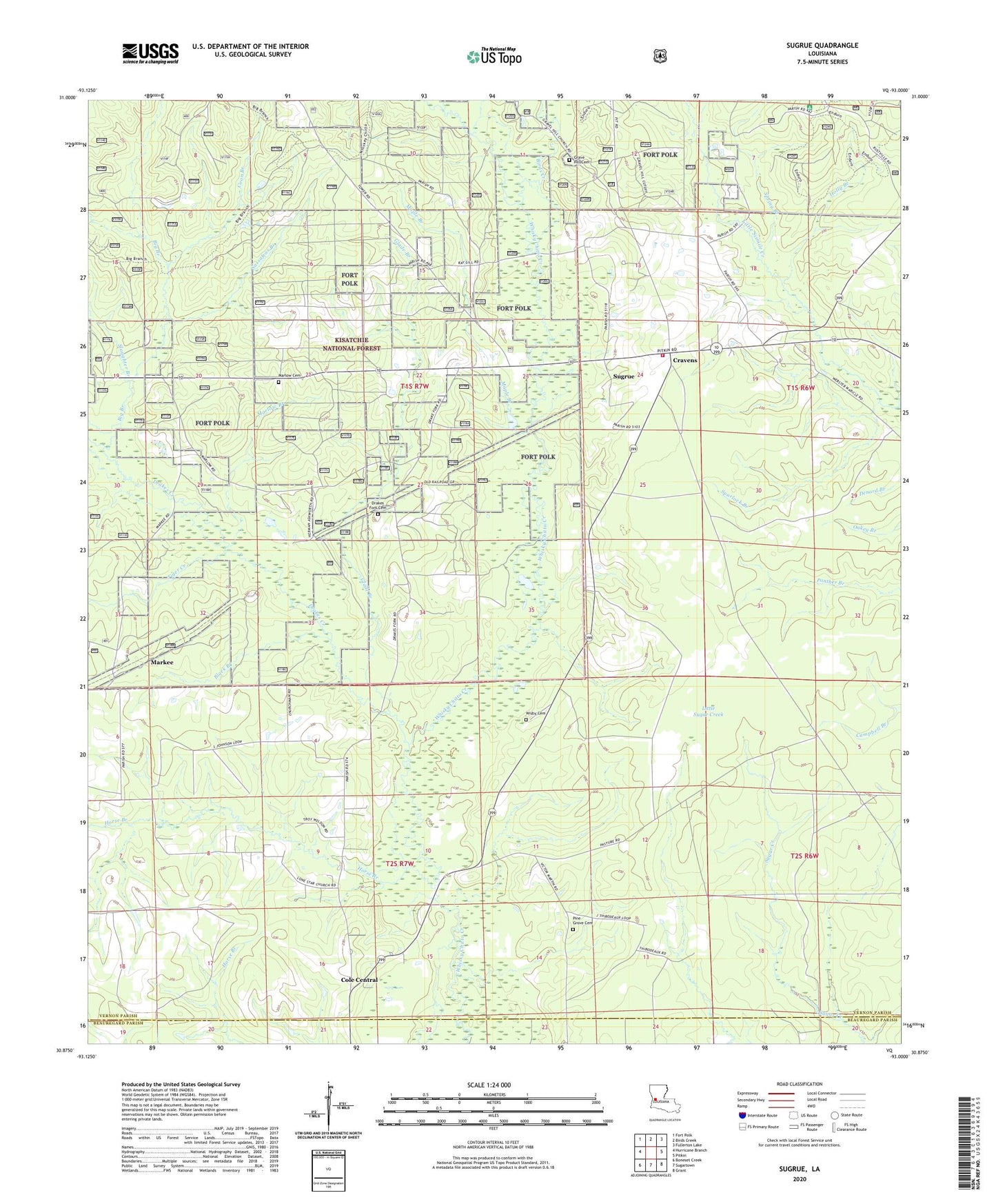
2020 topographic map quadrangle Sugrue in the state of Louisiana. Scale: 1:24000. Based on the newly updated USGS 7.5' US Topo map series, this map is in the following counties: Vernon, Beauregard. The map contains contour data, water features, and other items you are used to seeing on USGS maps, but also has updated roads and other features. This is the next generation of topographic maps. Printed on high-quality waterproof paper with UV fade-resistant inks.
Quads adjacent to this one:
West: Hurricane Branch
Northwest: Fort Polk
North: Birds Creek
Northeast: Fullerton Lake
East: Pitkin
Southeast: Grant
South: Sugartown
Southwest: Boneset Creek
Contains the following named places: Big Branch, Big Branch Trail, Birds Creek, Black Branch, Cole Central, Coon Branch, Cowpen Branch, Cravens, Cravens Volunteer Fire Department, Drakes Creek, Drakes Fork Cemetery, Fort Polk, Glade Branch, Glade Branch Church, Gravel Hill Cemetery, Gravel Hill Church, Holly Branch, Horse Branch, Lone Star Church, Louisiana Noname 62 Dam, Maple Branch, Markee, Marlow Branch, Marlow Cemetery, Marlow Church, Marlow Volunteer Fire Department, Pine Grove United Methodist Church, Sassafras Branch, Slaughter Branch, Spring Branch, Spurlock Branch, Sugrue, Talbert - Pierson Cemetery, Tiger Creek, Vernon Lookout Tower, Wisby Memorial Cemetery, Wisby Memorial Church