MyTopo
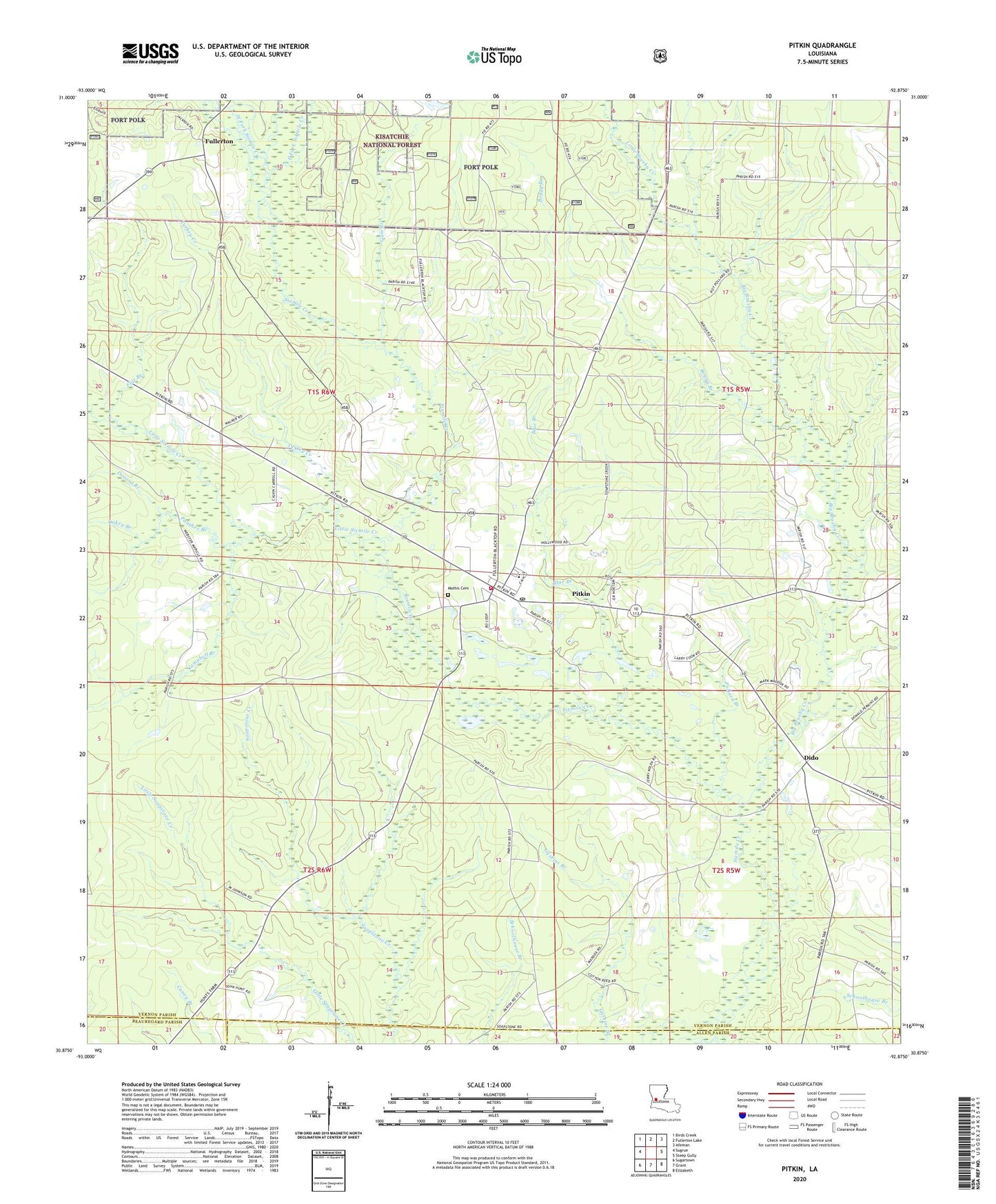
Pitkin Louisiana US Topo Map
Couldn't load pickup availability
Also explore the Pitkin Forest Service Topo of this same quad for updated USFS data
2024 topographic map quadrangle Pitkin in the state of Louisiana. Scale: 1:24000. Based on the newly updated USGS 7.5' US Topo map series, this map is in the following counties: Vernon, Allen, Beauregard. The map contains contour data, water features, and other items you are used to seeing on USGS maps, but also has updated roads and other features. This is the next generation of topographic maps. Printed on high-quality waterproof paper with UV fade-resistant inks.
Quads adjacent to this one:
West: Sugrue
Northwest: Birds Creek
North: Fullerton Lake
Northeast: Afeman
East: Steep Gully
Southeast: Elizabeth
South: Grant
Southwest: Sugartown
This map covers the same area as the classic USGS quad with code o30092h8.
Contains the following named places: Big Brushy Creek, Blue Branch, Boggy Branch, Campbell Branch, Denard Branch, Dido, East Fork Sixmile Creek, First Baptist Church, Flat Branch, Fullerton, Gum Branch, Little Brushy Creek, Little Sixmile Creek, Mathis Cemetery, Mount Olive Church, Nitram, Oakey Branch, Panther Branch, Pitkin, Pitkin Census Designated Place, Pitkin High School, Pitkin Lookout Tower, Pitkin Pentecostal Church, Pitkin Post Office, Pitkin Volunteer Fire Department, Pollard Branch, Simmons Mill Church, Turkey Creek, Ward Five, West Fork Sixmile Creek, ZIP Code: 70656