MyTopo
Venice Louisiana US Topo Map
Couldn't load pickup availability
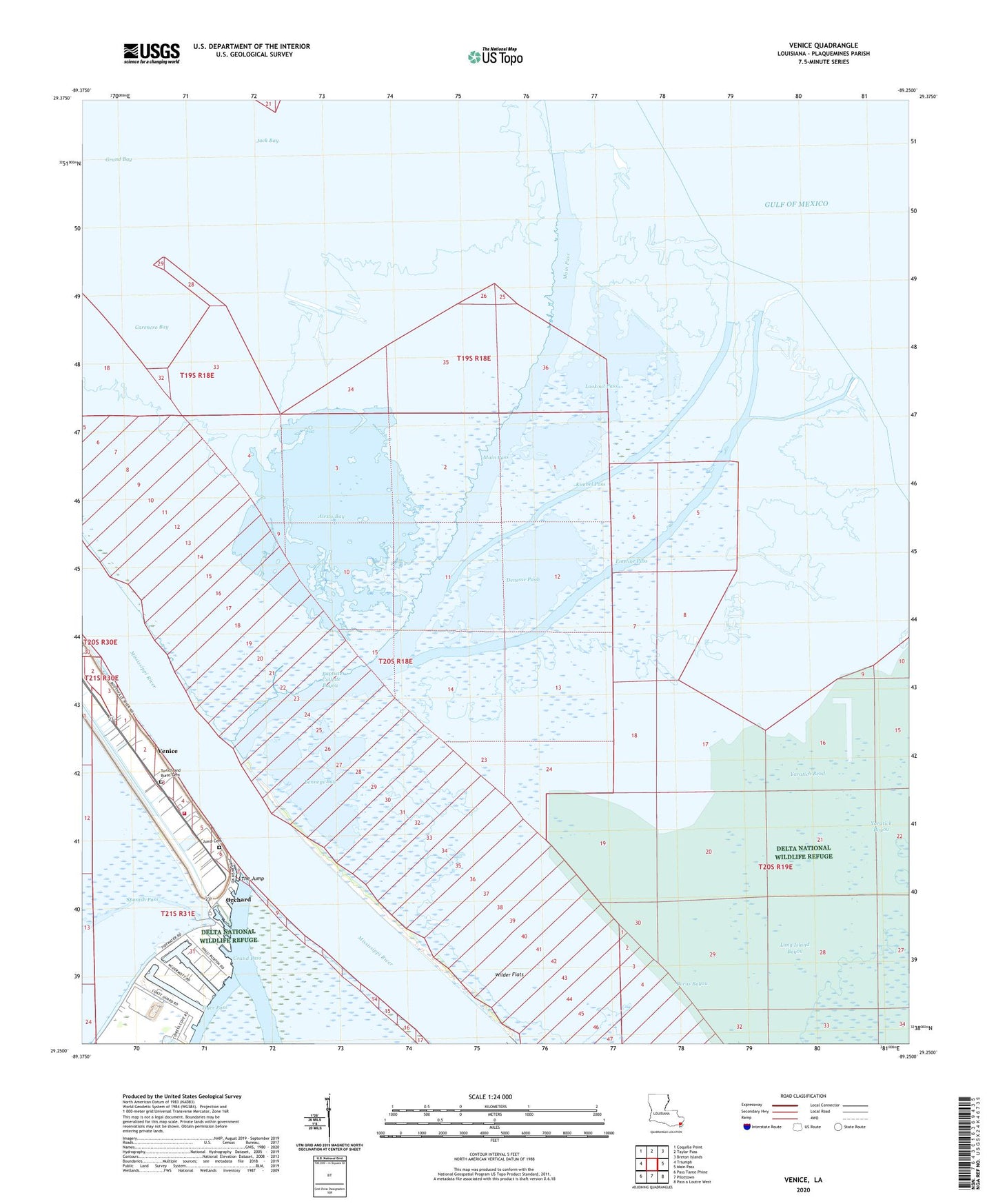
2025 topographic map quadrangle Venice in the state of Louisiana. Scale: 1:24000. Based on the newly updated USGS 7.5' US Topo map series, this map is in the following counties: Plaquemines. The map contains contour data, water features, and other items you are used to seeing on USGS maps, but also has updated roads and other features. This is the next generation of topographic maps. Printed on high-quality waterproof paper with UV fade-resistant inks.
Quads adjacent to this one:
West: Triumph
Northwest: Coquille Point
North: Taylor Pass
Northeast: Breton Islands
East: Main Pass
Southeast: Pass a Loutre West
South: Pilottown
Southwest: Pass Tante Phine
This map covers the same area as the classic USGS quad with code o29089c3.
Contains the following named places: Air Logistics Heliport, Alexis Bay, Baptiste Collette Bayou, Benneys Bay, Block 47 Oil and Gas Field, Buras Bayou, Carencro Bay, Chevron USA Incorporated Seaplane Base, Coast Guard Station Venice, Conoco Incorporated Venice Heliport, Cronin Mobile Home Park, Denesse Pass, Emeline Pass, Era Helicopters Venice Base Heliport, Full Gospel Church, Grand Bay, Grand Bay Oil Field, Grand Bay Receiving Station Heliport, Grand Bay Seaplane Base, Jack Bay, Kimbel Pass, Lookout Pass, Main Pass, Marathon Venice Heliport, Orchard, Phi Venice Heliport, Plaquemines Parish Fire District 5 Boothville Venice Fire Department, Shell Venice Terminal Heliport, The Jump, Venice, Venice Census Designated Place, Venice Post Office, Wilder Flats, Yaratich Bayou, Yaratich Bend