MyTopo
Vinton Louisiana US Topo Map
Couldn't load pickup availability
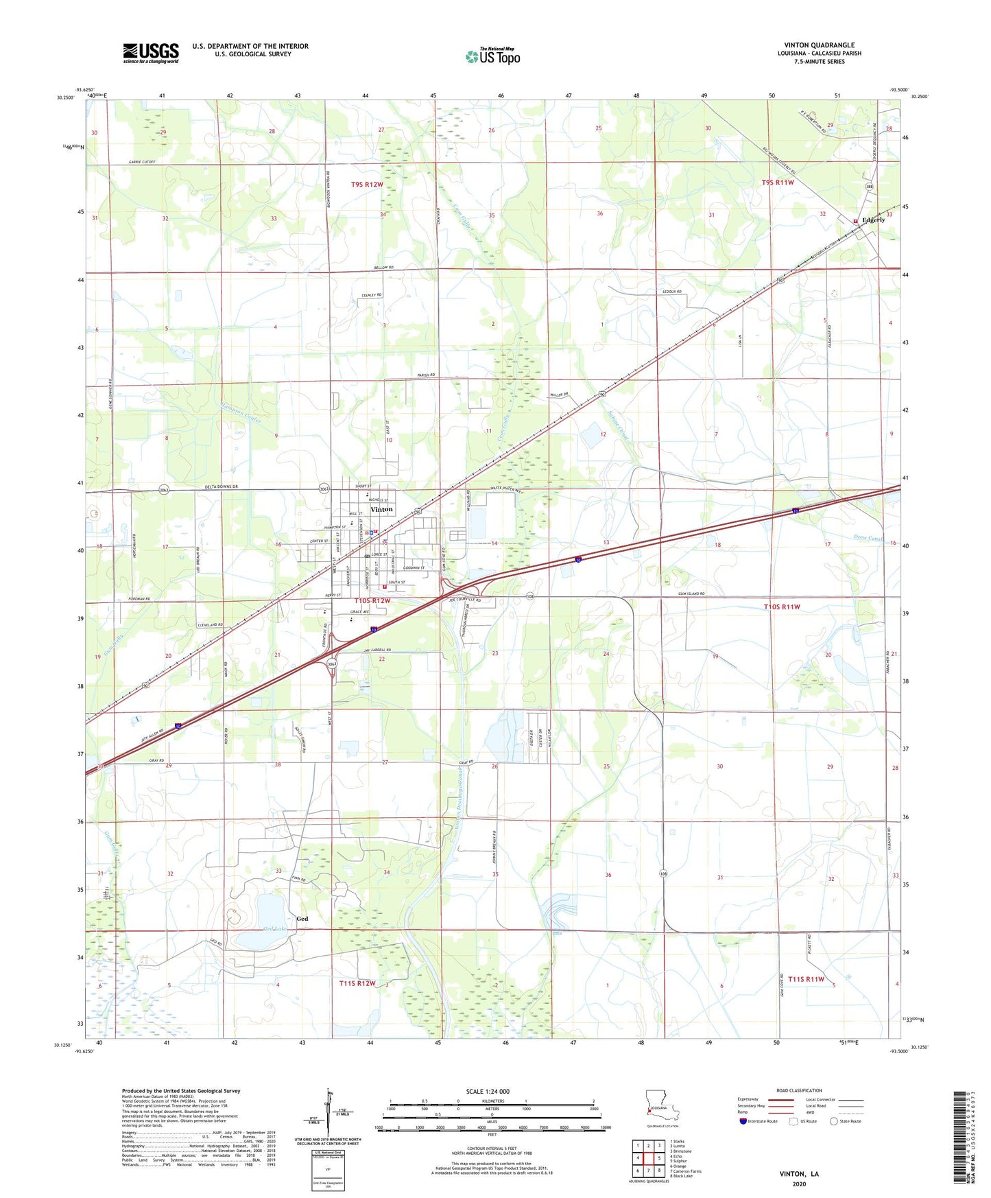
2020 topographic map quadrangle Vinton in the state of Louisiana. Scale: 1:24000. Based on the newly updated USGS 7.5' US Topo map series, this map is in the following counties: Calcasieu. The map contains contour data, water features, and other items you are used to seeing on USGS maps, but also has updated roads and other features. This is the next generation of topographic maps. Printed on high-quality waterproof paper with UV fade-resistant inks.
Quads adjacent to this one:
West: Echo
Northwest: Starks
North: Lunita
Northeast: Brimstone
East: Sulphur
Southeast: Black Lake
South: Cameron Farms
Southwest: Orange
Contains the following named places: Antioch Baptist Church, Calcasieu Multi - Handicapped Center, Calcasieu Parish Library Fontenot Memorial Branch, Calcasieu Parish Ward 7 District 1 Fire Department, Coon Gully, Delta Downs, Delta Downs Racetrack, Edgerly, First Baptist Church, First Pentecostal Church, Ged, Ged Lake, Ged Post Office, Glen Meadows Mobile Home Park, Gum Gully, Hampton Coulee, Horridge Street Church of God, Kingdom Hall of Jehovahs Witnesses, Morningstar Baptist Church, Parish Governing Authority District 12, Sabine Canal, Sabine Prairie, Saint James Baptist Church, Saint Josephs Church, Town of Vinton, Vinton, Vinton Calcasieu Parish Sheriff's Office, Vinton Elementary School, Vinton High School, Vinton Middle School, Vinton Oil Field, Vinton Police Department, Vinton Post Office, Vinton Southside Fire Station, Vinton United Methodist Church, Vinton Volunteer Fire Department Southside Station, Vinton Wastewater Treatment Facility, Ward Seven, ZIP Code: 70668