MyTopo
Winnsboro Louisiana US Topo Map
Couldn't load pickup availability
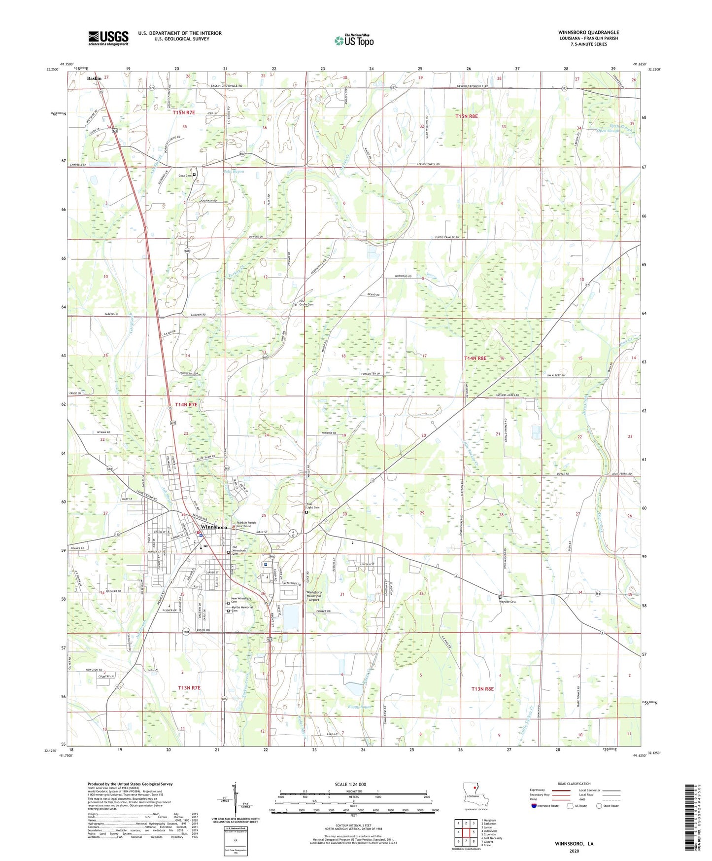
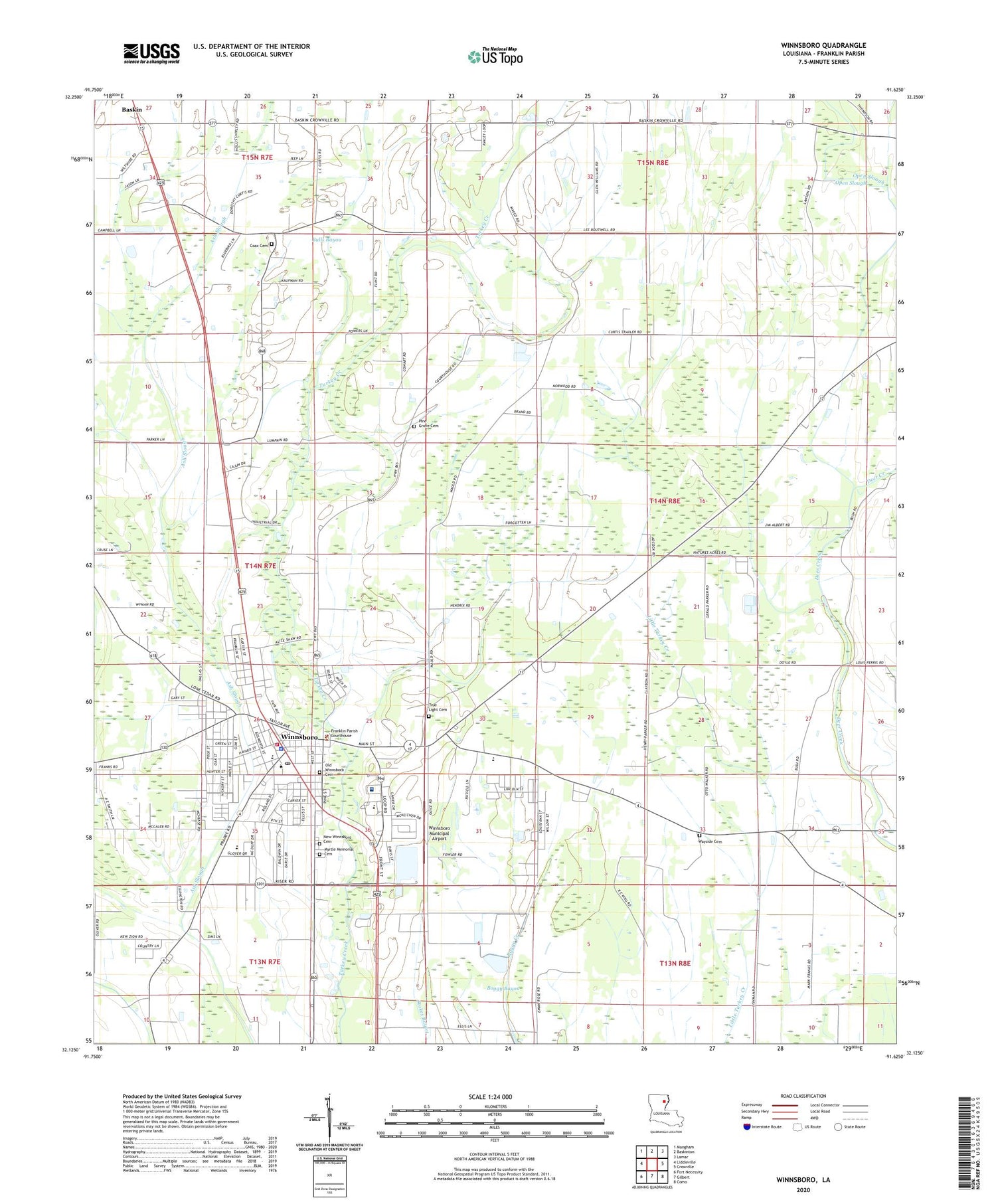
2020 topographic map quadrangle Winnsboro in the state of Louisiana. Scale: 1:24000. Based on the newly updated USGS 7.5' US Topo map series, this map is in the following counties: Franklin. The map contains contour data, water features, and other items you are used to seeing on USGS maps, but also has updated roads and other features. This is the next generation of topographic maps. Printed on high-quality waterproof paper with UV fade-resistant inks.
Quads adjacent to this one:
West: Liddieville
Northwest: Mangham
North: Baskinton
Northeast: Lamar
East: Crowville
Southeast: Como
South: Gilbert
Southwest: Fort Necessity
Contains the following named places: Ash Slough, Bell Union Church, Church of Christ, City of Winnsboro, Civitan Park, Coax Cemetery, Coax Church, Davis Park, Faith Tabernacle, First Baptist Church, First Church of the Nazarene, First United Methodist Church, First Zion Baptist Church, Fletcher Landing Strip, Franklin Academy School, Franklin Medical Center, Franklin Parish, Franklin Parish Courthouse, Franklin Parish High School, Franklin Parish Public Library, Franklin Parish Sheriff's Office, Freedom Bible Church, Horace G White Senior Learning Center School, Jackson Street Historic District, Jesus Name Home Mission Church, Kingdom Hall, Landis Memorial Park, Louisiana Noname 92 Dam, Louisiana Technical College Northeast Campus, Macon Ridge Agricultural Experiment Station, Myrtle Memorial Cemetery, New Winnsboro Cemetery, Old Winnsboro Cemetery, Open Slough, Parish Governing Authority District 5, Pine Grove Cemetery, Saint John Baptist Church, Saint Marys Catholic Church, Second Baptist Church, Shiloh Baptist Church, Taylor Bayou Church, Temple Baptist Church, Town Square Park, True Light Baptist Church, True Light Cemetery, True Light Church, True Light Church Gas Field, Twin Oaks County Club, Ward Seven, Wayside Cemetery, Wayside Church, West Winnsboro Recreational Park, Wildcat Stadium, Winnsboro, Winnsboro Assembly of God Church, Winnsboro City Hall, Winnsboro Commercial Historic District, Winnsboro Fire Department, Winnsboro Industrial park, Winnsboro Lower Elementary School, Winnsboro Municipal Airport, Winnsboro Pentecostal Church, Winnsboro Police Department, Winnsboro Post Office, Winnsboro Upper Elementary School, ZIP Code: 71295