MyTopo
Baskinton Louisiana US Topo Map
Couldn't load pickup availability
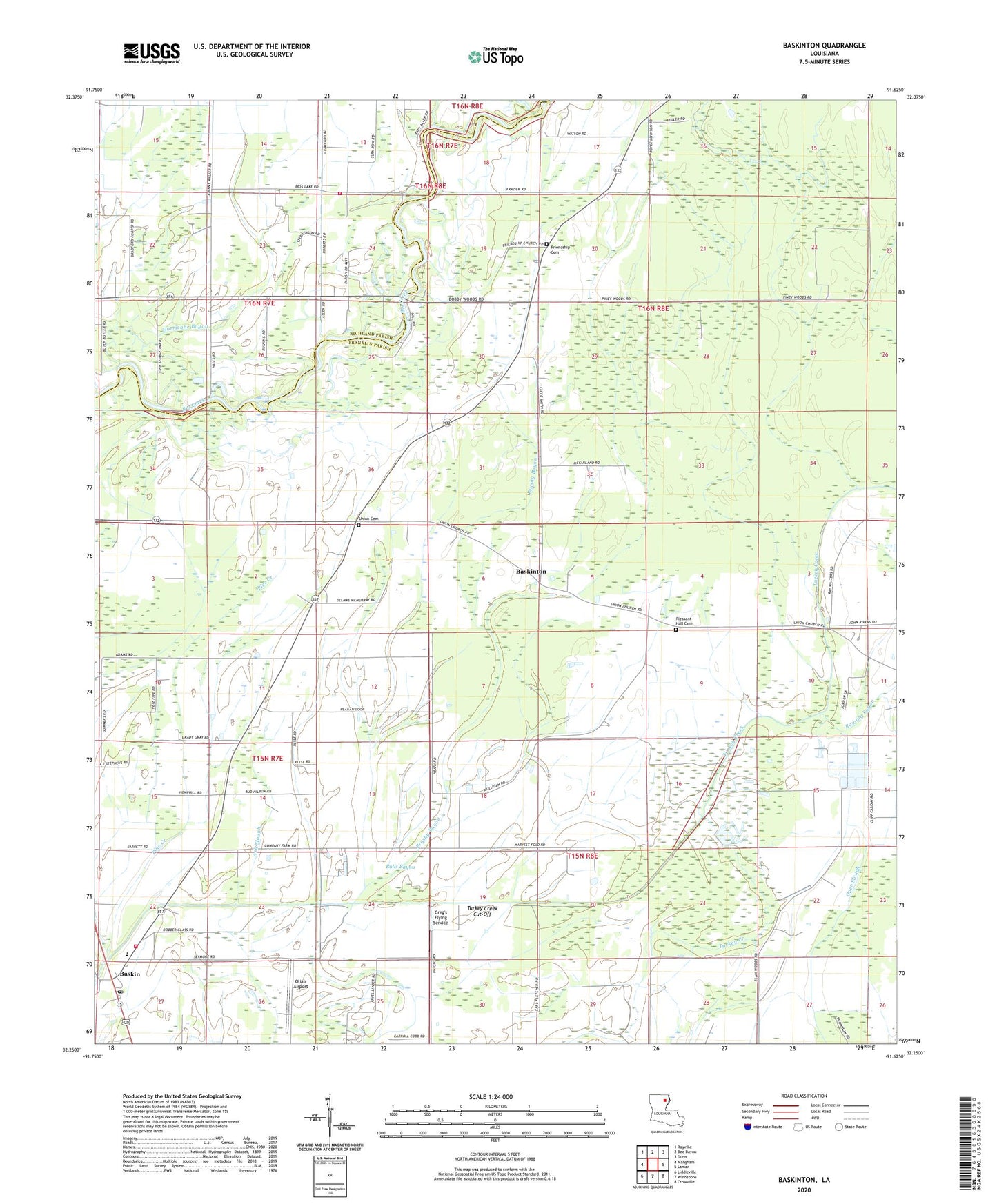
2024 topographic map quadrangle Baskinton in the state of Louisiana. Scale: 1:24000. Based on the newly updated USGS 7.5' US Topo map series, this map is in the following counties: Franklin, Richland. The map contains contour data, water features, and other items you are used to seeing on USGS maps, but also has updated roads and other features. This is the next generation of topographic maps. Printed on high-quality waterproof paper with UV fade-resistant inks.
Quads adjacent to this one:
West: Mangham
Northwest: Rayville
North: Bee Bayou
Northeast: Dunn
East: Lamar
Southeast: Crowville
South: Winnsboro
Southwest: Liddieville
This map covers the same area as the classic USGS quad with code o32091c6.
Contains the following named places: Archibald - Alto Fire Station, Baskin, Baskin Chapel, Baskin Post Office, Baskin School, Baskin Volunteer Fire Department, Baskinton, Baskinton Oil Field, Bethel Church, Brushy Bayou, Bulls Bayou, Church of Christ, Friendship Cemetery, Friendship Church, Greg's Flying Service, Hurricane Bayou, Oliair Airport, Parish Governing Authority District 6, Pine Creek, Pleasant Hall Baptist Church, Pleasant Hall Cemetery, Rowing Bayou, South Baskinton Oil Field, South Big Creek Oil Field, Turkey Creek Cut-Off, Union Cemetery, Union Church, Union Valley Church, Village of Baskin, Ward Six, West Baskinton Oil Field, ZIP Code: 71219