MyTopo
Woodworth West Louisiana US Topo Map
Couldn't load pickup availability
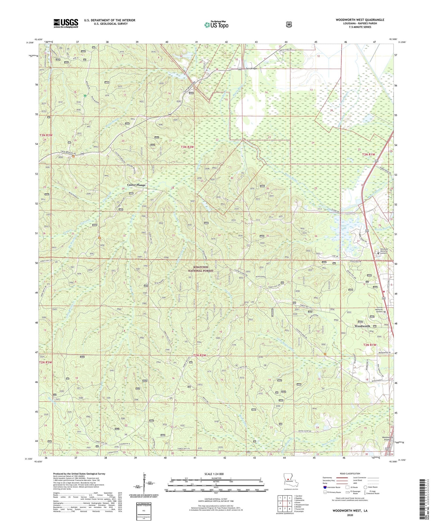
2020 topographic map quadrangle Woodworth West in the state of Louisiana. Scale: 1:24000. Based on the newly updated USGS 7.5' US Topo map series, this map is in the following counties: Rapides. The map contains contour data, water features, and other items you are used to seeing on USGS maps, but also has updated roads and other features. This is the next generation of topographic maps. Printed on high-quality waterproof paper with UV fade-resistant inks.
Quads adjacent to this one:
West: Elmer
Northwest: Gardner
North: Rapides
Northeast: Alexandria
East: Woodworth East
Southeast: Lecompte
South: Forest Hill
Southwest: Melder
Contains the following named places: Alexander Memorial Gardens, Bayou Boeuf Natural Research Area, Bayou Clear School, Bayou Hospital, Big Brushy Creek, Boggu Bayou, Castor Creek, Castor Creek Scenic Area, Castor Plunge, Claiborne Range, Clear Creek, Cypress Branch, Evangeline Camp, Grassy Bayou, Little Brushy Creek, Little Creek, Little Loving Creek, Long Branch, Lost Bayou, Lost Bayou School, Loving Creek, Magnolia Forest Walk, Magnolia Recreation Park, Middle Bayou, Oden Lake, Rapides Parish, Saint Mark Church, Sunrise Memorial Gardens, Town of Woodworth, Twin Bridges, Twin Bridges Church, Wild Azalea Trail, Woodworth Airport, Woodworth Lookout Tower, Woodworth Volunteer Fire Department, ZIP Code: 71485