MyTopo
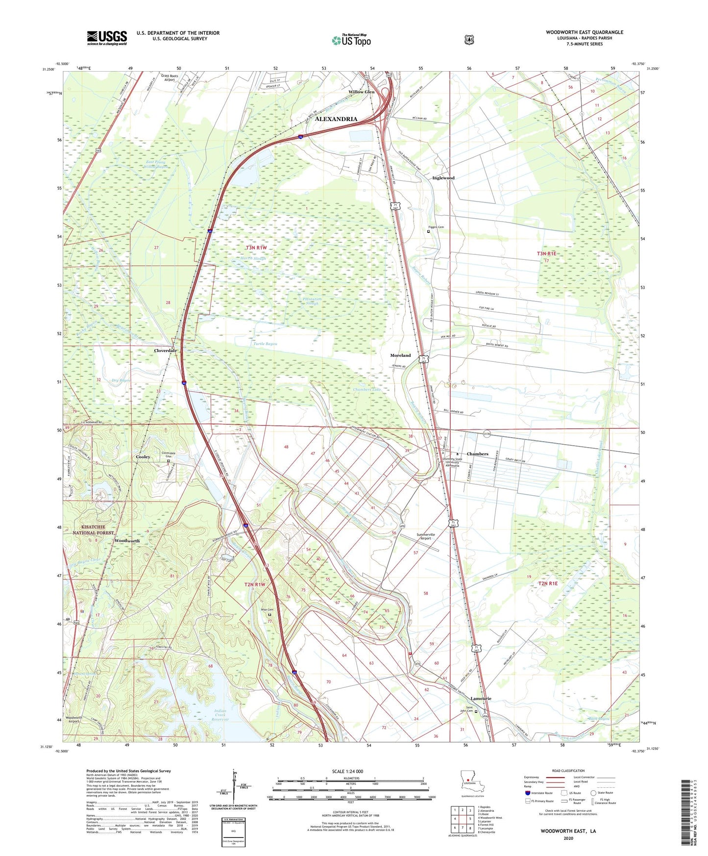
Woodworth East Louisiana US Topo Map
Couldn't load pickup availability
Also explore the Woodworth East Forest Service Topo of this same quad for updated USFS data
2024 topographic map quadrangle Woodworth East in the state of Louisiana. Scale: 1:24000. Based on the newly updated USGS 7.5' US Topo map series, this map is in the following counties: Rapides. The map contains contour data, water features, and other items you are used to seeing on USGS maps, but also has updated roads and other features. This is the next generation of topographic maps. Printed on high-quality waterproof paper with UV fade-resistant inks.
Quads adjacent to this one:
West: Woodworth West
Northwest: Rapides
North: Alexandria
Northeast: Libuse
East: Latanier
Southeast: Cheneyville
South: Lecompte
Southwest: Forest Hill
This map covers the same area as the classic USGS quad with code o31092b4.
Contains the following named places: Back Bayou, Bayou Clear, Bayou Robert, Bench Slough, Browns Spring, Chambers, Chambers Lake, Chatlin Lake Canal, Cloverdale, Cloverdale Cemetery, Cooley, Dry Bayou, East Prong Willow Bayou, Figgins Cemetery, Hard Times Plantation, Harris Slough, Hughes Bayou, Indian Creek Dam, Inglewood, Inglewood Plantation, Inglewood Plantation Historic District, Lamourie, Lamourie Baptist Church, Lamourie High School, Lamourie Ward Two, Lecompte Volunteer Fire Department Station 2, Little Bayou Clear, Louisiana State University Alexandria, Moreland, Oakland Baptist Church, Old Wise Cemetery, Parish Governing Authority District F, Pecan Bayou, Persimmon Bayou, Plantation Slough, Rocky Bayou, Saint John Baptist Church, Saint John Cemetery, Saint John Church, Second Union Baptist Church, Summerville Airport, Turpin Spur, Turtle Bayou, Willow Bayou, Willow Glen, Woodworth, Woodworth Police Department, Woodworth Post Office