MyTopo
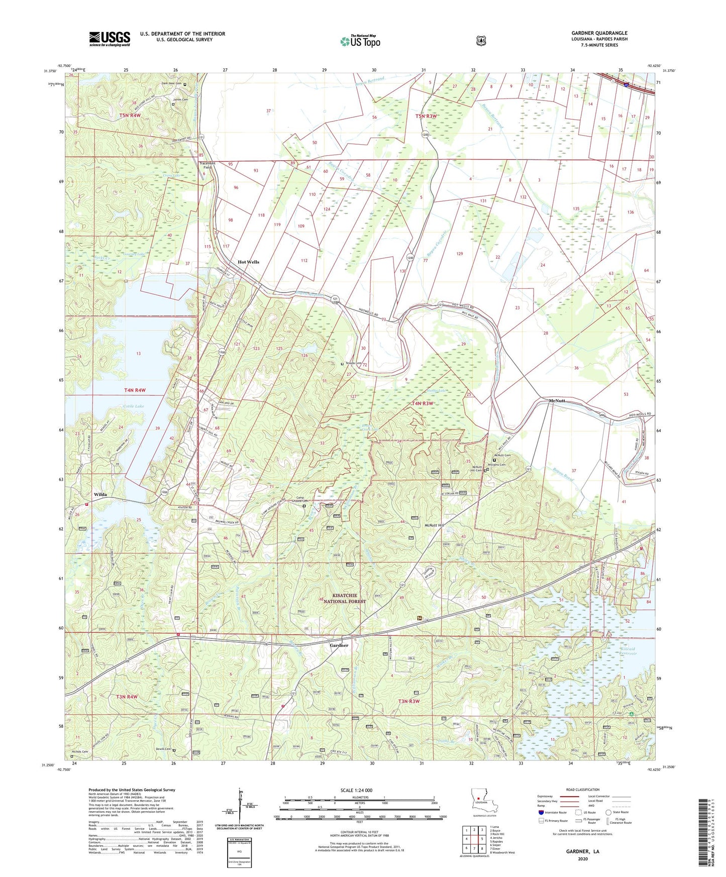
Gardner Louisiana US Topo Map
Couldn't load pickup availability
Also explore the Gardner Forest Service Topo of this same quad for updated USFS data
2024 topographic map quadrangle Gardner in the state of Louisiana. Scale: 1:24000. Based on the newly updated USGS 7.5' US Topo map series, this map is in the following counties: Rapides. The map contains contour data, water features, and other items you are used to seeing on USGS maps, but also has updated roads and other features. This is the next generation of topographic maps. Printed on high-quality waterproof paper with UV fade-resistant inks.
Quads adjacent to this one:
West: Jericho
Northwest: Lena
North: Boyce
Northeast: Rock Hill
East: Rapides
Southeast: Woodworth West
South: Elmer
Southwest: Sieper
This map covers the same area as the classic USGS quad with code o33092a4.
Contains the following named places: Alligator Slough, Bayou Cocodrie, Brown Creek, Brown Creek Lake, Burney Branch, Calvary Baptist Church, Camp Ground Cemetery, Collins School, Cotile Lake, Cotile Lake Dam, Cotile Volunteer Fire Department, Cotile Volunteer Fire Department Station 2, Crane, Crane Lake, Dark - Neal Cemetery, Dewill Cemetery, Dyer Creek, Eastern Charm School, Flag Lake, Gardner, Gardner Post Office, Gourney Lake, Hemphill Creek, Hemphill Star Church, Hot Wells, Hunter Lake, Indian Creek, Jacks Creek, James Cemetery, KBCE-FM (Boyce), Kincaid Recreation Area, Kincaid Reservoir, Laurel Hill Church, Laurel Hill School, Lehy Chapel, McNutt, McNutt Cemetery, McNutt Hill, McNutt Hill Cemetery, McNutt Rural Historic District, Milford, Mount Tramp Church, Nichols Cemetery, Oak Hill Volunteer Fire Department Station 5, Parish Governing Authority District E, Patterson Branch, Quadrate, Rapides Parish Fire District 2, Red Store Church, Second Evening Star Baptist Church, Sibley Branch, Texada Cemetery, Tracemont Field, Walker Branch, Whitley Branch, Wilda, Wilda Baptist Church, Williams Cemetery, Williamson Branch, Zion Church, ZIP Code: 71409