MyTopo
Zachary Louisiana US Topo Map
Couldn't load pickup availability
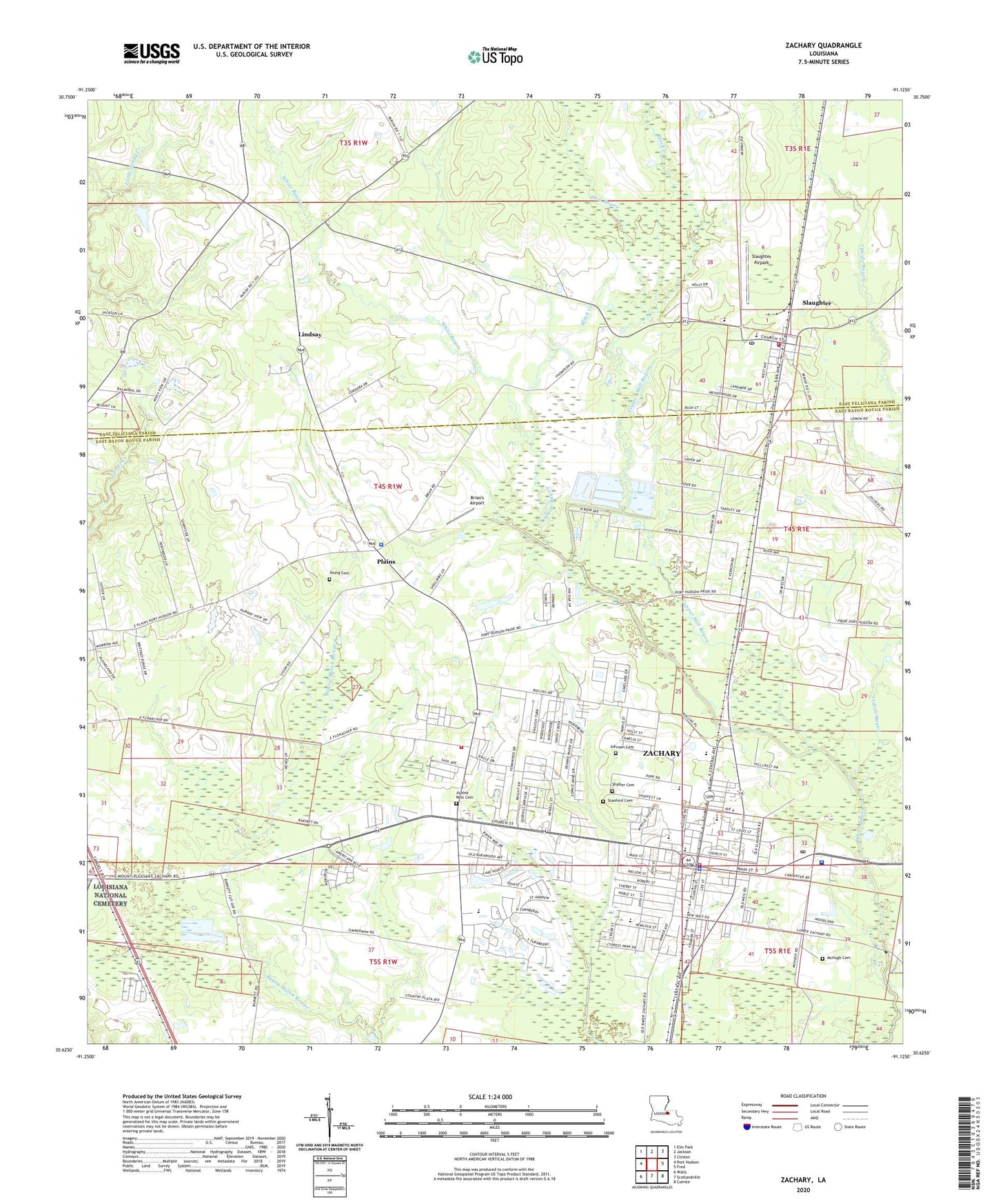
2024 topographic map quadrangle Zachary in the state of Louisiana. Scale: 1:24000. Based on the newly updated USGS 7.5' US Topo map series, this map is in the following counties: East Baton Rouge, East Feliciana. The map contains contour data, water features, and other items you are used to seeing on USGS maps, but also has updated roads and other features. This is the next generation of topographic maps. Printed on high-quality waterproof paper with UV fade-resistant inks.
Quads adjacent to this one:
West: Port Hudson
Northwest: Elm Park
North: Jackson
Northeast: Clinton
East: Fred
Southeast: Comite
South: Scotlandville
Southwest: Walls
This map covers the same area as the classic USGS quad with code o30091f2.
Contains the following named places: Alsen Oil Field, Ambrosia, Black Creek, Brian's Airport, Church of Christ, City of Zachary, Copper Mill Bayou, Copper Mill Elementary School, East Baton Rouge Parish Library Zachary Branch, East Baton Rouge Sheriff's Office - Zachary Plains, Ebenezer Church, First Baptist Church, First Baptist Preschool, First Presbyterian Church of Zachary, Goodhope Church, Grace Baptist Church, Hog Bayou, Indian Bayou, Jackson Chapel United Methodist Church, Jackson Road, Johnson Cemetery, Lane Regional Medical Center, Lane Rehabilitation Center, Lighthouse Church, Lindsay, Lion Park, Little Star Baptist Church, New Hope Baptist Church, New Pilgrim Baptist Church, New Providence Baptist Church, Northwestern Elementary School, Northwestern Middle School, Oakwood Village Adult Care Facility, Olive Grove Church, Open Door Fellowship Church, Parish Governing Authority District 4B, Peter Rock Baptist Church, Pilgrim Rest Church, Plains, Plains Presbyterian Church, Pleasant Grove Church, Poplar Springs Church, Saint John the Baptist Catholic Church, Saint Patricks Episcopal Church, Saint Patricks School, Shaffer Cemetery, Shaw - McHugh Cemetery, Slaughter, Slaughter Airpark, Slaughter Elementary School, Slaughter Police Department, Slaughter Post Office, Slaughter Volunteer Fire Department, Stanford Cemetery, Sweet Briar Mobile Home Park, Town of Slaughter, Trinity Christian Academy School, Union Antioch Baptist Church, Union Baptist Church, Young Family Cemetery, Zachary, Zachary Elementary School, Zachary Fellowship Church, Zachary Fire Department Station 81, Zachary Fire Rescue Station 82, Zachary High School, Zachary Historic Village, Zachary Manor Nursing and Rehabilitation Center, Zachary Police Department, Zachary Post Office, Zachary Presbyterian Church, Zachary Public Cemetery, Zachary United Methodist Church, Zachary Volunteer Fire / Rescue Station 80, ZIP Code: 70791