MyTopo
Elm Park Louisiana US Topo Map
Couldn't load pickup availability
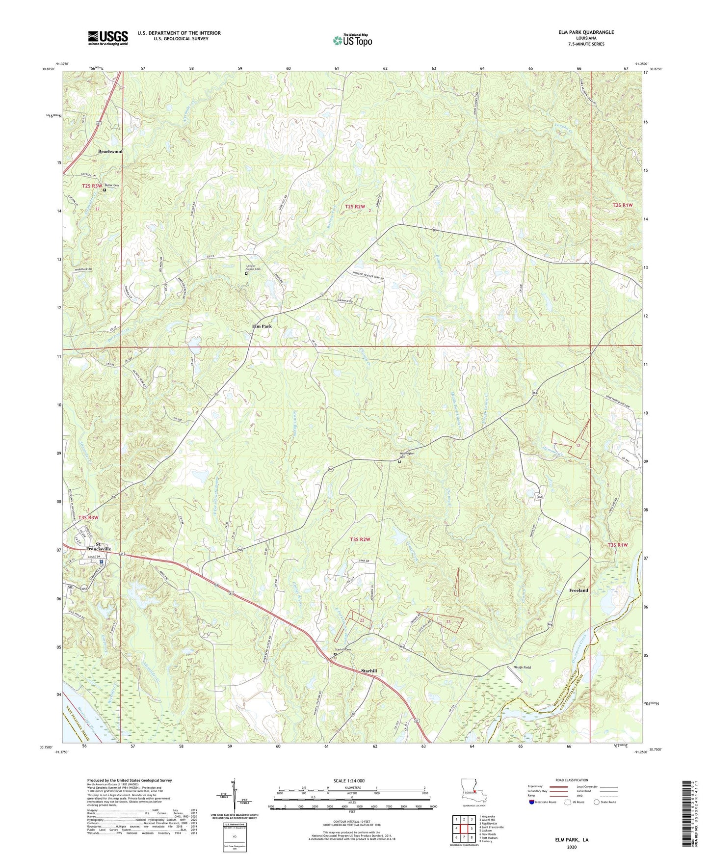
2024 topographic map quadrangle Elm Park in the state of Louisiana. Scale: 1:24000. Based on the newly updated USGS 7.5' US Topo map series, this map is in the following counties: West Feliciana, East Feliciana, Pointe Coupee. The map contains contour data, water features, and other items you are used to seeing on USGS maps, but also has updated roads and other features. This is the next generation of topographic maps. Printed on high-quality waterproof paper with UV fade-resistant inks.
Quads adjacent to this one:
West: Saint Francisville
Northwest: Weyanoke
North: Laurel Hill
Northeast: Rogillioville
East: Jackson
Southeast: Zachary
South: Port Hudson
Southwest: New Roads
This map covers the same area as the classic USGS quad with code o30091g3.
Contains the following named places: Ambrosia Plantation, Audubon State Historic Site, Barrow Fork, Beachwood, Butler Cemetery, Carney, Chaney Creek, Chaney Plantation, Cottage Plantation, District C, East Fork Caney Creek, Elm Park, Elm Park Church, Fairview Plantation, Faith Hope and Love Fellowship Center, Freeland, Gaspers Creek, Hamilton, Hammer Creek, Healing Place Church, Laurel Fork, Locust Grove Cemetery, Locust Grove Plantation, Locust Grove State Historic Site, Magnolia Church, Marydale Scout Camp, McKowen Church, Middle Fork Caney Creek, Mount Pilgrim Church, Nauga Field, Parish Governing Authority District 2, Raspberry Church, Riverbend Nuclear Plant, Rosale Plantation, Rosedown Church, Rosedown Plantation, Rosedown Plantation State Historic Site, Rosenwald School, Sage Hill Church, Saint Francisville Post Office, Starhill, Starhill Cemetery, Starhill Church, Troy Plantation, United Pentecostal Church, Ward Nine, Ward One, Ward Three, Ward Two, Washington Cemetery, West Feliciana Hospital, West Fork Grants Bayou, ZIP Code: 70775