MyTopo
Bailey Island Maine US Topo Map
Couldn't load pickup availability
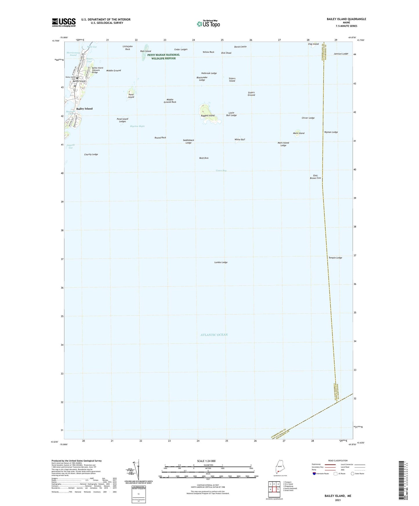
2024 topographic map quadrangle Bailey Island in the state of Maine. Scale: 1:24000. Based on the newly updated USGS 7.5' US Topo map series, this map is in the following counties: Cumberland, Sagadahoc. The map contains contour data, water features, and other items you are used to seeing on USGS maps, but also has updated roads and other features. This is the next generation of topographic maps. Printed on high-quality waterproof paper with UV fade-resistant inks.
Quads adjacent to this one:
West: South Harpswell
Northwest: Freeport
North: Orrs Island
Northeast: Phippsburg
East: Small Point
This map covers the same area as the classic USGS quad with code o43069f8.
Contains the following named places: Bailey Island, Bailey Island Cemetery, Bailey Island Cobwork Bridge, Bailey Island Post Office, Blacksnake Ledge, Bold Dick, Cedar Ledges, Charity Ledge, Chiver Ledge, David Castle, Dick Shoal, East Brown Cow, Holbrook Ledge, Jamison Ledge, Little Bull Ledge, Littlejohn Rock, Lumbo Ledge, Mackerel Cove Marina, Mark Island, Mark Island Ledge, Middle Ground, Middle Ground Rock, Pond Island, Pond Island Ledges, Ragged Island, Ram Island, Round Rock, Saddleback Ledge, Sisters Ground, Sisters Island, Temple Ledge, Town of Harpswell, Water Cove, White Bull, Wills Gut, WYFP-FM (Harpswell), Wyman Ledge, Yellow Rock, ZIP Code: 04003