
MyTopo
Bottle Lake Maine US Topo Map
Couldn't load pickup availability
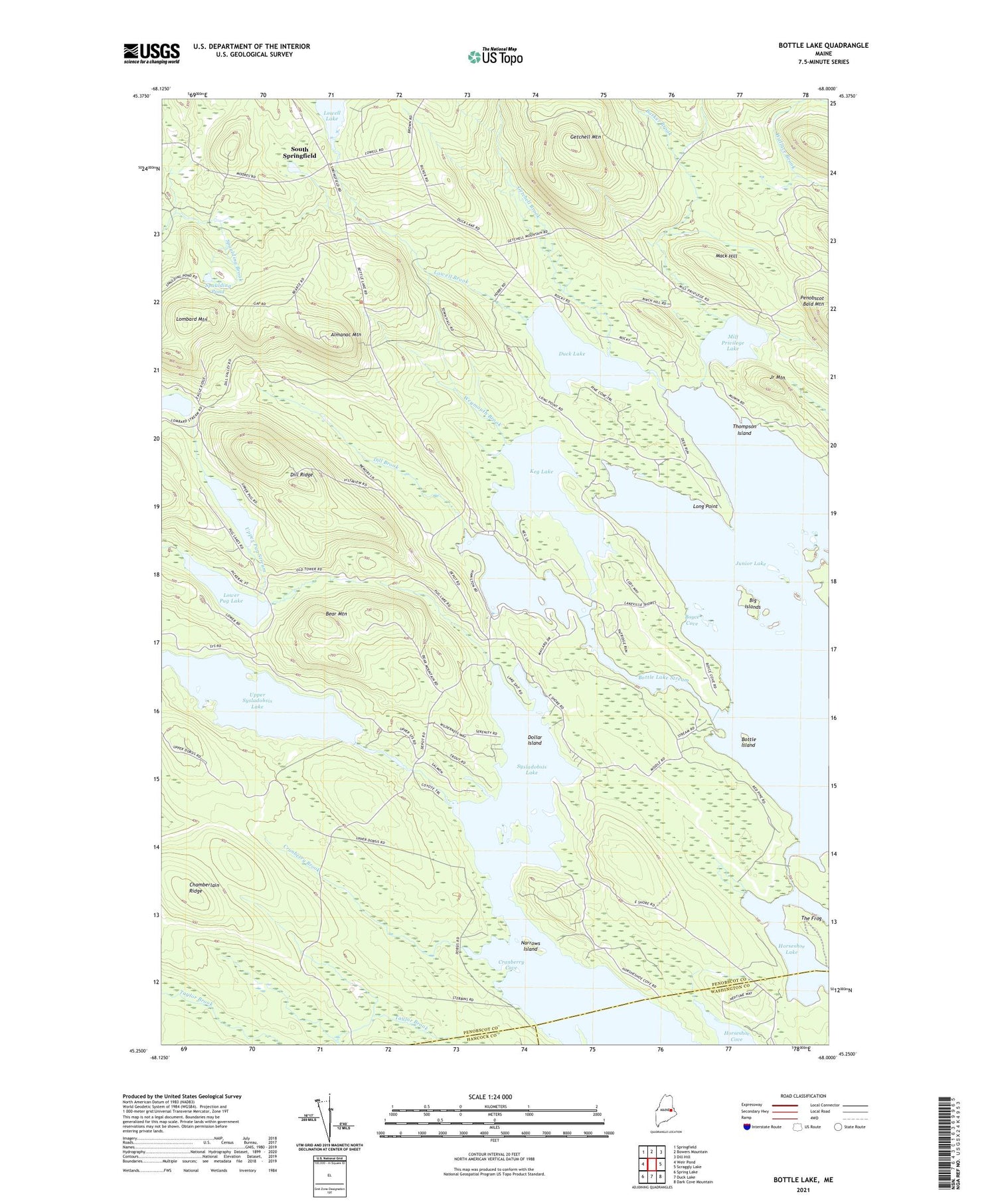
2021 topographic map quadrangle Bottle Lake in the state of Maine. Scale: 1:24000. Based on the newly updated USGS 7.5' US Topo map series, this map is in the following counties: Penobscot, Washington, Hancock. The map contains contour data, water features, and other items you are used to seeing on USGS maps, but also has updated roads and other features. This is the next generation of topographic maps. Printed on high-quality waterproof paper with UV fade-resistant inks.
Quads adjacent to this one:
West: Weir Pond
Northwest: Springfield
North: Bowers Mountain
Northeast: Dill Hill
East: Scraggly Lake
Southeast: Dark Cove Mountain
South: Duck Lake
Southwest: Spring Lake
Contains the following named places: Almanac Mountain, Almanac Mountain Lookout Tower, Barker Brook, Bayview Camp, Bear Mountain, Big Islands, Bottle Island, Bottle Lake, Bottle Lake Stream, Boyce Cove, Burnt Island, Chamberlain Ridge, Cranberry Brook, Cranberry Cove, Dill Brook, Dill Ridge, Dollar Island, Duck Lake, Getchell Brook, Getchell Mountain, Gowell School, Horseshoe Lake, Junior Lake, Junior Mountain, Keg Lake, Lombard Mountain, Long Point, Lowell Brook, Lowell Dam, Lowell Lake, Lower Pug Lake, Mack Hill, McKinney Point, McKinney School, Mill Privilege Lake, Narrows Island, Philip School, Pug Hole, South Springfield, Spaulding Pond, The Frog, Thompson Island, Town of Lakeville, Upper Pug Lake, Upper Pug Stream, Upper Sysladobsis Stream, Weymouth Brook


