MyTopo
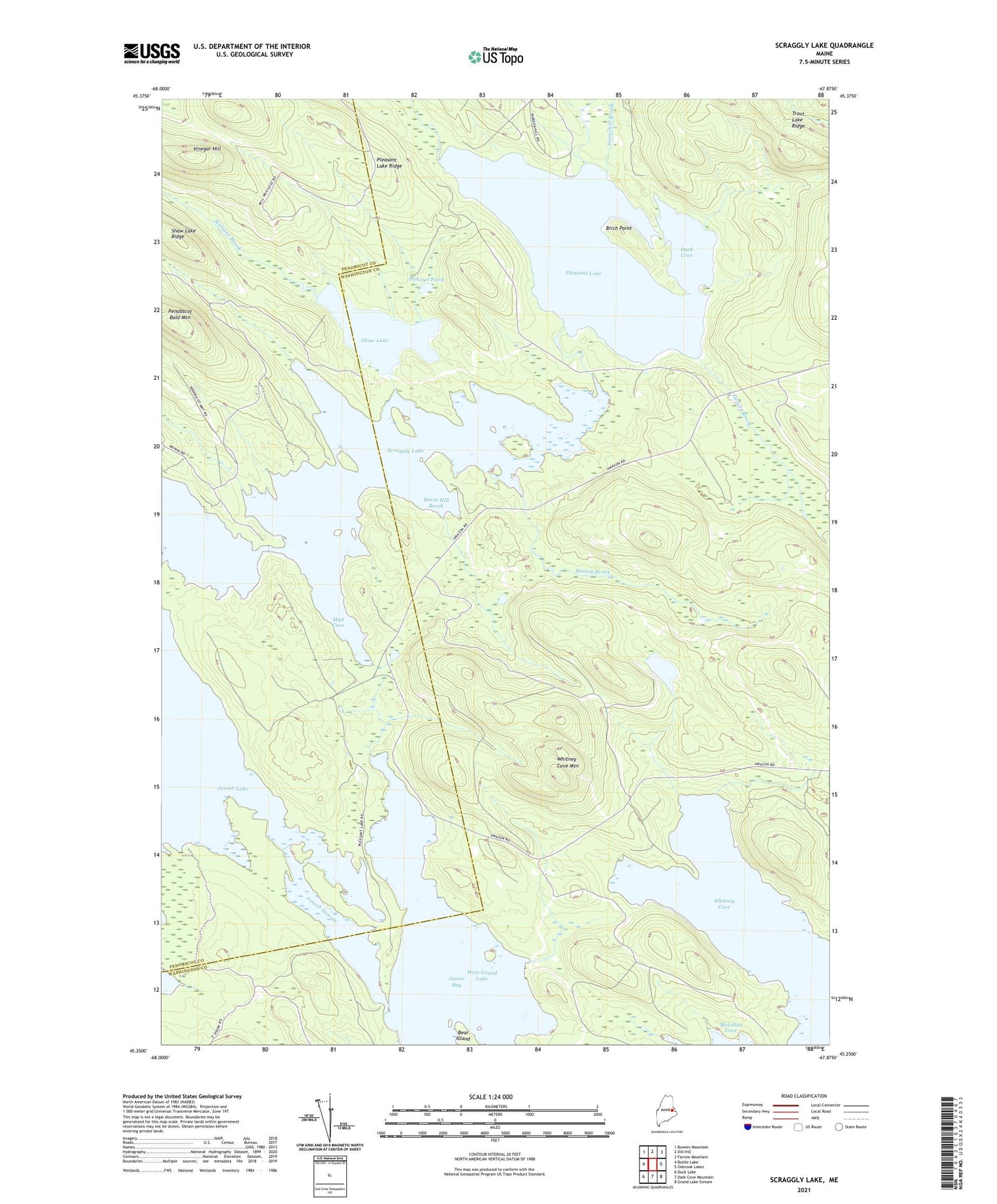
Scraggly Lake Maine US Topo Map
Couldn't load pickup availability
2024 topographic map quadrangle Scraggly Lake in the state of Maine. Scale: 1:24000. Based on the newly updated USGS 7.5' US Topo map series, this map is in the following counties: Washington, Penobscot. The map contains contour data, water features, and other items you are used to seeing on USGS maps, but also has updated roads and other features. This is the next generation of topographic maps. Printed on high-quality waterproof paper with UV fade-resistant inks.
Quads adjacent to this one:
West: Bottle Lake
Northwest: Bowers Mountain
North: Dill Hill
Northeast: Farrow Mountain
East: Oxbrook Lakes
Southeast: Grand Lake Stream
South: Dark Cove Mountain
Southwest: Duck Lake
This map covers the same area as the classic USGS quad with code o45067c8.
Contains the following named places: Birch Point, Dark Cove, Denver Brook, Horse Hill Brook, Horsehill Brook, Junior Bay, Junior Stream, Mud Cove, Norway Lake, Penobscot Bald Mountain, Pickerel Pond, Pleasant Lake, Pleasant Lake Ridge, Pork Barrel Lake, Pug Lake, Pukakon Township, Rainey Brook, Scraggly Lake, Shaw Lake, Shaw Lake Ridge, T6 R1 NBPP, Trout Lake Ridge, Unorganized Territory of Whitney, Vinegar Hill, Wallace Brook, Whitney Cove, Whitney Cove Mountain