MyTopo
Dark Cove Mountain Maine US Topo Map
Couldn't load pickup availability
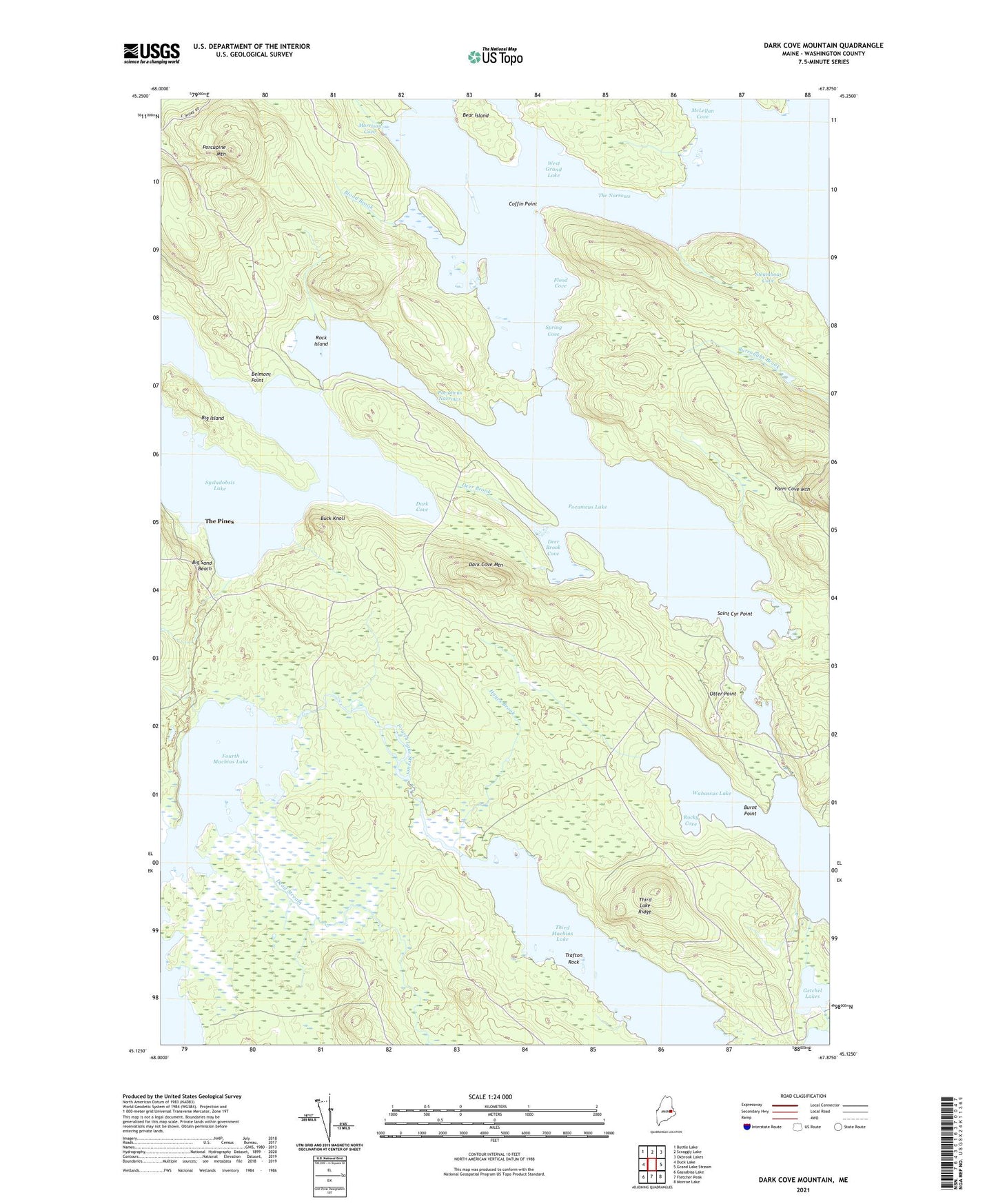
2024 topographic map quadrangle Dark Cove Mountain in the state of Maine. Scale: 1:24000. Based on the newly updated USGS 7.5' US Topo map series, this map is in the following counties: Washington. The map contains contour data, water features, and other items you are used to seeing on USGS maps, but also has updated roads and other features. This is the next generation of topographic maps. Printed on high-quality waterproof paper with UV fade-resistant inks.
Quads adjacent to this one:
West: Duck Lake
Northwest: Bottle Lake
North: Scraggly Lake
Northeast: Oxbrook Lakes
East: Grand Lake Stream
Southeast: Monroe Lake
South: Fletcher Peak
Southwest: Gassabias Lake
This map covers the same area as the classic USGS quad with code o45067b8.
Contains the following named places: Bear Island, Belmont Point, Big Island, Big Sand Beach, Blood Brook, Buck Knoll, Burnt Point, Coffin Point, Dark Cove, Dark Cove Mountain, Dead Stream, Deer Brook, Deer Brook Cove, Dennison Portage, Dobsis Dam, Elsemore Landing, Flood Cove, Fourth Lake Stream, Fourth Machias Lake, Getchel Lakes, Hayes Brook, Jumbo Landing, McLellan Cove, Morrison Cove, Otter Point, Pocumcus Lake, Pocumcus Narrows, Porcupine Mountain, Rock Island, Rocky Cove, Sakom Township, Spring Cove, St. Cyr Point, Steamboat Cove, The Birches, The Narrows, The Pines, Third Lake Ridge, Trafton Rock, Unknown Stream, Wabassus Lake