MyTopo
Dill Hill Maine US Topo Map
Couldn't load pickup availability
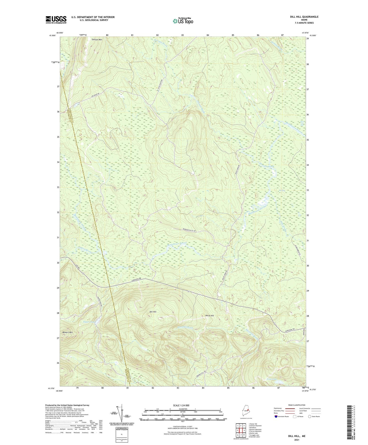
2024 topographic map quadrangle Dill Hill in the state of Maine. Scale: 1:24000. Based on the newly updated USGS 7.5' US Topo map series, this map is in the following counties: Washington, Penobscot. The map contains contour data, water features, and other items you are used to seeing on USGS maps, but also has updated roads and other features. This is the next generation of topographic maps. Printed on high-quality waterproof paper with UV fade-resistant inks.
Quads adjacent to this one:
West: Bowers Mountain
Northwest: Potter Hill
North: Stetson Mountain
Northeast: Brookton
East: Farrow Mountain
Southeast: Oxbrook Lakes
South: Scraggly Lake
Southwest: Bottle Lake
This map covers the same area as the classic USGS quad with code o45067d8.
Contains the following named places: Alder Brook, Big Bog, Black Cat Rips, Dill Hill, Dipper Pond, Horse Hill, Kossuth Township, Lindsey Brook, Middle Deadwater, Pleasant Brook, Tolman Deadwater, Trout Lake