MyTopo
Buckfield Maine US Topo Map
Couldn't load pickup availability
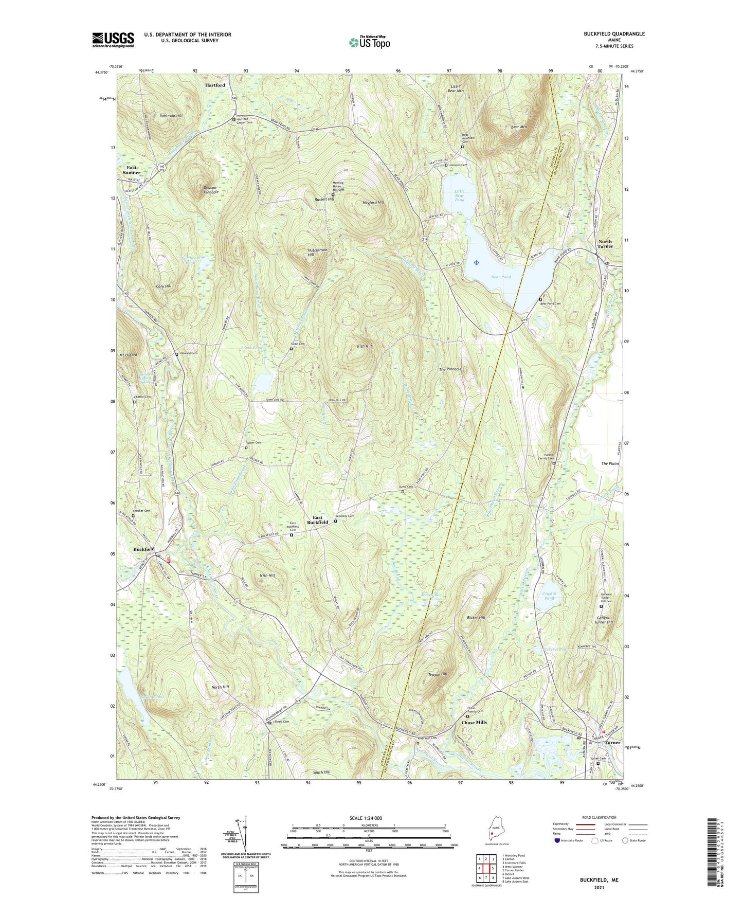
2021 topographic map quadrangle Buckfield in the state of Maine. Scale: 1:24000. Based on the newly updated USGS 7.5' US Topo map series, this map is in the following counties: Oxford, Androscoggin. The map contains contour data, water features, and other items you are used to seeing on USGS maps, but also has updated roads and other features. This is the next generation of topographic maps. Printed on high-quality waterproof paper with UV fade-resistant inks.
Quads adjacent to this one:
West: West Sumner
Northwest: Worthley Pond
North: Canton
Northeast: Livermore Falls
East: Turner Center
Southeast: Lake Auburn East
South: Lake Auburn West
Southwest: Oxford
Contains the following named places: Bear Mountain, Bear Mountain Cemetery, Bear Pond, Bear Pond Cemetery, Blanchard Stream, Bog Brook, Brush Shop Dam, Buckfield, Buckfield Community Church, Buckfield Fire Department, Buckfield Junior Senior High School, Buckfield Post Office, Buckfield Rescue Department, Bunganock Brook, Calvary Christian Academy, Cary Hill, Chaffin Cemetery, Chase Family Cemetery, Chase Mills, Cooper Seaplane Base, Crocker Cemetery, Crystal Pond, Deacon Pinnacle, Decoster Cemetery, Drew Brook, Drew Cemetery, East Branch Nezinscot River, East Buckfield, East Buckfield Cemetery, General Turner Hill, General Turner Hill Cemetery, Harlow Family Cemetery, Hartford, Hartford Center Cemetery, Hayford Brook, Hayford Hill, Howard Cemetery, Hutchinson Hill, Irish Hill, Jackson Cemetery, Jersey Bog, Little Bear Pond, Lively Brook, Lowell Cemetery, Martin Stream, Martin Stream Campsites, Meadow Brook, Meeting House Hill Cemetery, Mitchell Brook, Mount Oxford, Mount Oxford Spring, Nezinscot River Reservoir, North Hill, North Turner, North Turner Presbyterian Church, Northeast Pond, Old Mill Bulkhead Dam, Pickerel Pond, Ricker Hill, Riverside Cemetery, Robinson Hill, Russell Hill, South Pond, Swan Cemetery, Swan Pond, Swan Pond Brook, Teague Hill, The Pinnacle, Town of Buckfield, Turner, Turner Cemetery, Turner Census Designated Place, Turner Dam, Turner Post Office, Turner Village Church, Turner Volunteer Fire Department, Union Church, West Branch Nezinscot River, Zadoc Long Free Library, ZIP Code: 04220