MyTopo
Caribou Lake North Maine US Topo Map
Couldn't load pickup availability
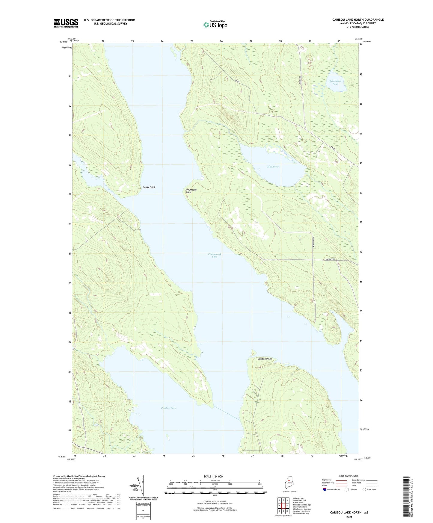
2024 topographic map quadrangle Caribou Lake North in the state of Maine. Scale: 1:24000. Based on the newly updated USGS 7.5' US Topo map series, this map is in the following counties: Piscataquis. The map contains contour data, water features, and other items you are used to seeing on USGS maps, but also has updated roads and other features. This is the next generation of topographic maps. Printed on high-quality waterproof paper with UV fade-resistant inks.
Quads adjacent to this one:
West: Pine Stream Flowage
Northwest: Chesuncook
North: Cuxabexis Lake
Northeast: Telos Brook
East: Harrington Lake
Southeast: Rainbow Lake West
South: Caribou Lake South
Southwest: Big Spencer Mountain
This map covers the same area as the classic USGS quad with code o45069h3.
Contains the following named places: Cardesa Point Campsite, Caribou Point, Chesuncook Lake, Fourmile Brook, Holmes Hole, Mauser Island Campsite, Mud Brook, Mud Pond, Otter Brook, Quaker Brook, Red Brook, Ripogenus Pond, Sandy Point, T3 R12 WELS, T4 R12 WELS, Weymouth Point