MyTopo
Cuxabexis Lake Maine US Topo Map
Couldn't load pickup availability
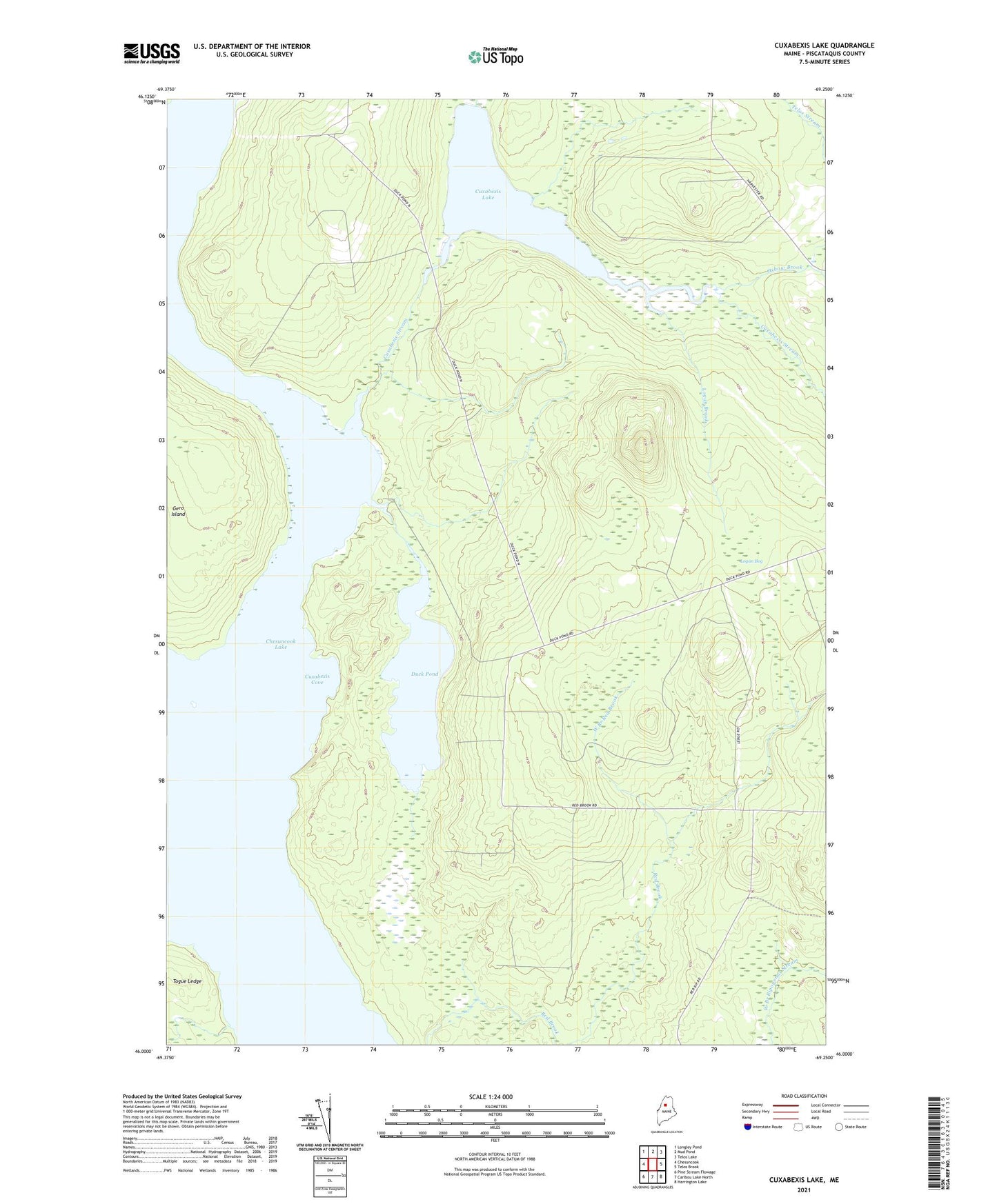
2024 topographic map quadrangle Cuxabexis Lake in the state of Maine. Scale: 1:24000. Based on the newly updated USGS 7.5' US Topo map series, this map is in the following counties: Piscataquis. The map contains contour data, water features, and other items you are used to seeing on USGS maps, but also has updated roads and other features. This is the next generation of topographic maps. Printed on high-quality waterproof paper with UV fade-resistant inks.
Quads adjacent to this one:
West: Chesuncook
Northwest: Longley Pond
North: Mud Pond
Northeast: Telos Lake
East: Telos Brook
Southeast: Harrington Lake
South: Caribou Lake North
Southwest: Pine Stream Flowage
This map covers the same area as the classic USGS quad with code o46069a3.
Contains the following named places: Cuxabexis Cove, Cuxabexis Lake, Cuxabexis Stream, Duck Pond, Logan Bog, Logan Brook, Moose Pond, Oxbow Brook, T5 R12 WELS, Togue Ledge, West Branch Red Brook