MyTopo
Cunliffe Lake Maine US Topo Map
Couldn't load pickup availability
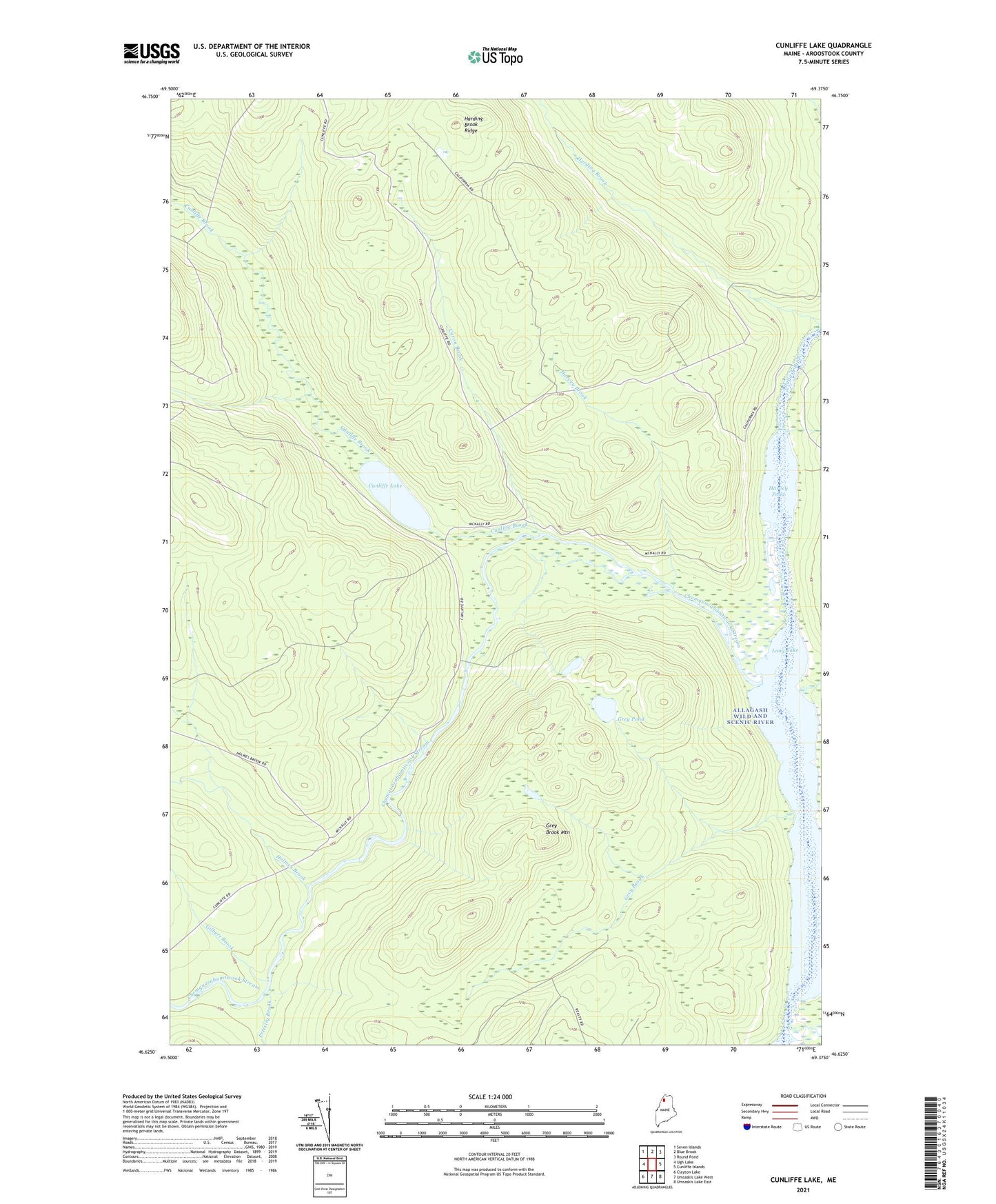
2024 topographic map quadrangle Cunliffe Lake in the state of Maine. Scale: 1:24000. Based on the newly updated USGS 7.5' US Topo map series, this map is in the following counties: Aroostook. The map contains contour data, water features, and other items you are used to seeing on USGS maps, but also has updated roads and other features. This is the next generation of topographic maps. Printed on high-quality waterproof paper with UV fade-resistant inks.
Quads adjacent to this one:
West: Ugh Lake
Northwest: Seven Islands
North: Blue Brook
Northeast: Round Pond
East: Cunliffe Islands
Southeast: Umsaskis Lake East
South: Umsaskis Lake West
Southwest: Clayton Lake
This map covers the same area as the classic USGS quad with code o46069f4.
Contains the following named places: Allagash Wild and Scenic River, Blanchette Camp, Caron Brook, Chemquasabamticook Stream, Cunliffe Brook, Cunliffe Lake, Gilbert Brook, Glazier Brook, Grey Brook, Grey Brook Mountain, Grey Pond, Harding Brook Ridge, Harvey Brook, Harvey Farm, Harvey Pond, Holmes Brook, Long Lake, Long Lake Dam, Priestly Brook, Shepherd Brook, T12 R13 WELS