MyTopo
Dixmont Maine US Topo Map
Couldn't load pickup availability
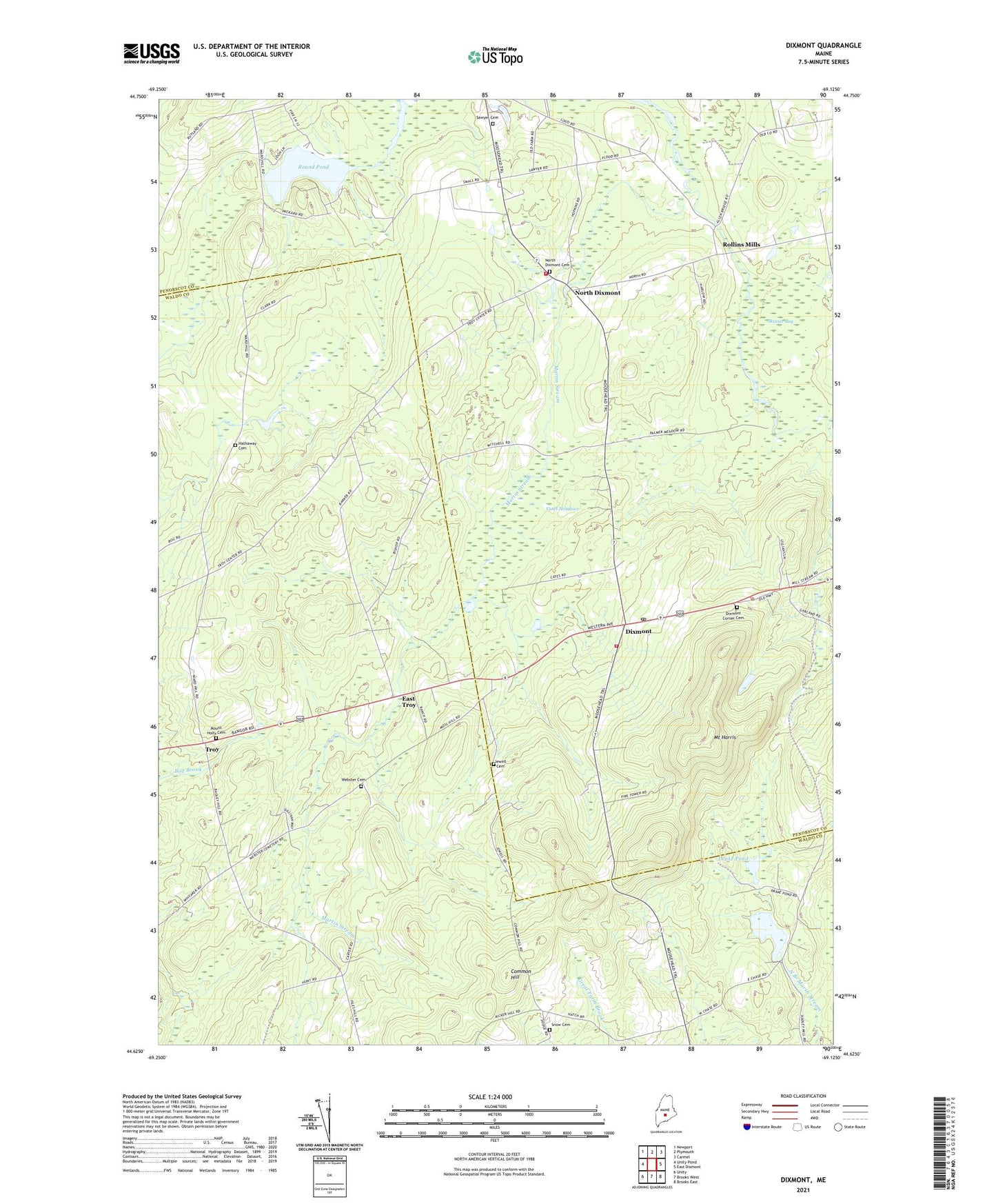
2021 topographic map quadrangle Dixmont in the state of Maine. Scale: 1:24000. Based on the newly updated USGS 7.5' US Topo map series, this map is in the following counties: Penobscot, Waldo. The map contains contour data, water features, and other items you are used to seeing on USGS maps, but also has updated roads and other features. This is the next generation of topographic maps. Printed on high-quality waterproof paper with UV fade-resistant inks.
Quads adjacent to this one:
West: Unity Pond
Northwest: Newport
North: Plymouth
Northeast: Carmel
East: East Dixmont
Southeast: Brooks East
South: Brooks West
Southwest: Unity
Contains the following named places: Cates Meadows, Common Hill, Dixmont, Dixmont Corner Cemetery, Dixmont Corner Church, Dixmont Post Office, Dixmont Volunteer Fire Department North Station, Dixmont Volunteer Main Fire Station, Drake Pond, East Troy, Garfield School, Hathaway Cemetery, Hows Corners, Huise Corners, Jewell Cemetery, Mount Harris, Mount Holly Cemetery, North Dixmont, North Dixmont Cemetery, Rogers Corners, Rollins Mills, Round Pond, Sawyer Cemetery, Skinner Bog, Town of Dixmont, Troy, Webster Cemetery, ZIP Code: 04932