MyTopo
Brooks West Maine US Topo Map
Couldn't load pickup availability
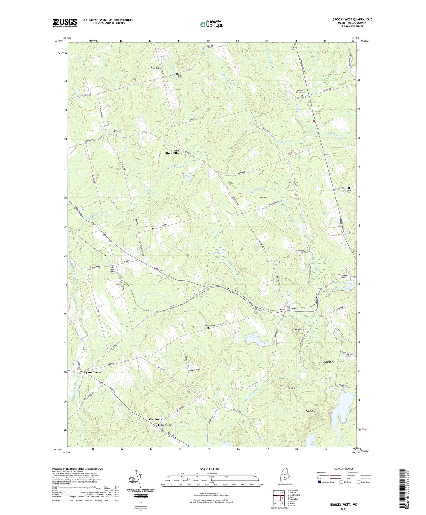
2024 topographic map quadrangle Brooks West in the state of Maine. Scale: 1:24000. Based on the newly updated USGS 7.5' US Topo map series, this map is in the following counties: Waldo. The map contains contour data, water features, and other items you are used to seeing on USGS maps, but also has updated roads and other features. This is the next generation of topographic maps. Printed on high-quality waterproof paper with UV fade-resistant inks.
Quads adjacent to this one:
West: Unity
Northwest: Unity Pond
North: Dixmont
Northeast: East Dixmont
East: Brooks East
Southeast: Belfast
South: Morrill
Southwest: Liberty
This map covers the same area as the classic USGS quad with code o44069e2.
Contains the following named places: Aborn Hill, Camp Paysock, Cates Cemetery, Center Cemetery, Center Church, Cole Cemetery, East Knox, East Knox Cemetery, East Thorndike, Files Hill, Halfmoon Pond, Hedgehog Hill, Jackson Corners, Jackson Fire Department, Knox Center, Knox Ledge Corner, Knox Station, Knox Station Cemetery, Lake Passagassawakeag, Leonard Cemetery, Meadow Brook, Morse Memorial Elementary School, Penny Brook, Pond Hill, Ray Corner, Skyscraper Hill, Stantial Bog, Stantial Brook, Stiles Cemetery, Taggett Hill, Town of Jackson, Town of Knox, Town of Thorndike, Walker Corner, Wing Brook, Wing Cemetery, ZIP Codes: 04921, 04986