MyTopo
Brooks East Maine US Topo Map
Couldn't load pickup availability
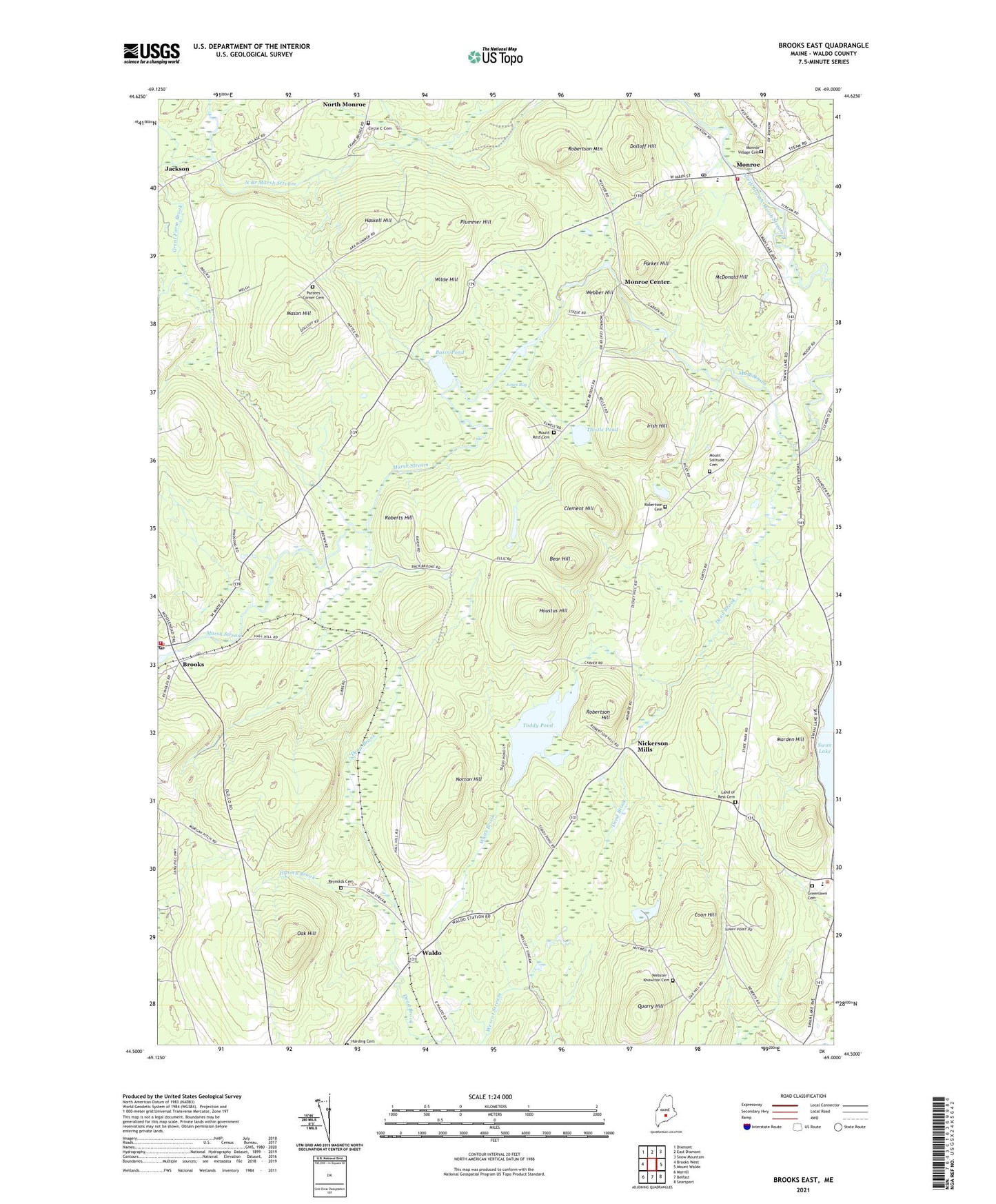
2024 topographic map quadrangle Brooks East in the state of Maine. Scale: 1:24000. Based on the newly updated USGS 7.5' US Topo map series, this map is in the following counties: Waldo. The map contains contour data, water features, and other items you are used to seeing on USGS maps, but also has updated roads and other features. This is the next generation of topographic maps. Printed on high-quality waterproof paper with UV fade-resistant inks.
Quads adjacent to this one:
West: Brooks West
Northwest: Dixmont
North: East Dixmont
Northeast: Snow Mountain
East: Mount Waldo
Southeast: Searsport
South: Belfast
Southwest: Morrill
This map covers the same area as the classic USGS quad with code o44069e1.
Contains the following named places: Basin Pond, Bear Hill, Brooks, Brooks Ambulance Service, Brooks Post Office, Brooks Volunteer Fire Department, Camp Fair Haven, Clark School, Clement Hill, Coon Hill, Dead Brook, Dolloff Hill, Dow School, Faith Church, Great Farm Brook, Greely School, Greenlawn Cemetery, Harding Cemetery, Haskell Hill, Houstus Hill, Hussey Brook, Irish Hill, Jackson, Jones Bog, Kermit Nickerson Elementary School, Land of Rest Cemetery, Marden Hill, Mason Hill, McDonald Hill, Monroe, Monroe Center, Monroe Community Library, Monroe Elementary School, Monroe Post Office, Monroe Volunteer Fire Station, Mount Rest Cemetery, Mount Solitude Cemetery, Nickerson Mills, North Monroe, Norton Hill, Oak Hill, Parker Hill, Pattee Corner, Plummer Hill, Quarry Hill, Reynolds Cemetery, Roberts Hill, Robertson Cemetery, Robertson Hill, Robertson Mountain, Thistle Pond, Toddy Pond, Town House Corners, Town of Brooks, Town of Monroe, Town of Swanville, Waldo, Webber Hill, Webster - Knowlton Cemetery, White Brook, Wilde Hill, ZIP Code: 04951